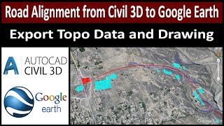
How to Export Coordinates (XYZ) from Google Earth to AutoCAD Civil 3D with Elevation

HTML-код
- Опубликовано: 8 фев 2025
- Global Mapper Download Link. getintopc.com/...
Google Earth Pro Download Link. getintopc.com/...
How to Export Coordinates (XYZ) from Google Earth to AutoCAD Civil 3D with Elevation
Google Earth se XYZ Kesy Autocad Civil 3d main import karain.
how to open KMl file in Global Mapper.
Google earth File kesy Global mapper main open karain.
Surveying Tech.
How to Export XYZ from Google Earth to AutoCAD Civil 3D.
#meatthezoo
#googleearth
#coordinates
#export
#surveying
#engineering
#xyz
#globalmapper
#autocadcivil3d
#Surveyingtech
#Surveying
#Land Survey
#Topographic Survey
#Levelling
Land Survey
Resection With Leica MS60
AutoCAD Civil 3D
Stake Out
Stake Out Arc/Reference Line
How To Export and Import Points In AutoCAD Civl 3d
Dwg
Horizontal Curve
AutoCAD Drawings
Surveying Intruduction
Total Station.
Leica Total Station
GPS, RTK.
Traverse
AutoCAD
AutoCAD Civil 3D
Pix4D Mapper
Cyclone
Surveying Tech.
#PakistanSurveyors
#UAESurveyors
#KSASurveyors
#ViralSurveyor
#Cyclone
#Surveying
#LeicaMultistation
#ResectionwithLeica
#AutoCAD
#AutoCADcivil3D
#SurveyEngineer
#LandSurvey
#LandSurveyors
#Surveyingtech
#SurveyingTech
Surveying Tech.
Land Survey
Surveying Intruduction
Total Station.
Leica Total Station
GPS, RTK.
Traverse
AutoCAD
AutoCAD Civil 3D
Pix4D Mapper
Cyclone
Surveying Tech.


![I.N "HALLUCINATION" | [Stray Kids : SKZ-PLAYER]](http://i.ytimg.com/vi/n5B5q1Hwt_U/mqdefault.jpg)


Good Information about Google earth
ماشاءاللہ
very good information
Good knowledge
Thanks 😊
Ustaad-e-Mohtaram❤️❤️❤️
Thanks Qamar shahzad. 😊
Great 💗
Thanks
Mashallah
Thanks 😊
Mashallah 💖
Thanks 😊 for support.
Thanks
Sir elevation mai bht zada difference ata hai is trha..
Yes, aisa he hai but yeh data ap sirf study or and report k lye use kr skty ho. Construction k lye to pher apko proper traverse aur survey karni hoge.