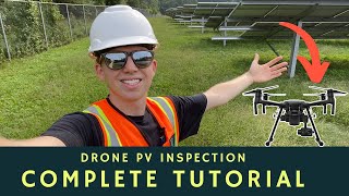
Drone Solar Farm Inspection Reveals $21,423.27 in Revenue Loss!

HTML-код
- Опубликовано: 14 июн 2024
- Claim Your FREE GUIDEBOOK to Maintaining Solar Assets with Drones 👇
bit.ly/3V3LI4P
In this video, we will be inspecting a 7.5MW solar farm with 30,195 panels using thermal drone technology. We will walk you through the purpose of this photovoltaic (PV) inspection, the drone equipment we are using, and how we set up our flight planning software. Throughout the data capture, we will discuss how traditional inspection methods like I-V Curve tracing and handheld thermal imagers differ from thermal drone inspections. What would take a few weeks in the past now takes just a few days.
Once the solar inspection is completed, we review and explain the anomalies found during the inspection like cell hot spots, cracked modules, and shading. With the onsite solar inspection completed, we’ll head back to the office and explain the post-processing software features. For this solar inspection, we used Raptor Maps AI machine learning tools, which produces a detailed final report. Next, we walk through the final output of our processed data including the issues identified by Raptor Maps reports and how we concluded the inspection revealed $21,423.27 in lost revenue. Through the reporting these issues can now be corrected.
#Drone #Inspection #Solar
►Resources
How to Inspect a Solar Farm with a Drone Tutorial - • How to Inspect a Solar...
The Ultimate ROI Guide For Infrared Drone Solar Inspections - bit.ly/3EzhrlP
►Equipment Used in this Video
Solar Irradiance Meter - amzn.to/3CbWomP
►Our Must-Have Drone Equipment Checklist
✅ Budget Friendly Ground Control Points (GCPs) - bit.ly/3nAT2pH
✅ Most Reliable SD Card for Drone Mapping - bit.ly/3lZOhWn
✅ Heavy Duty Landing Pad - bit.ly/3zt1hXA
✅ Collapsable Orange Safety Cones - bit.ly/40Tr2fp
✅ OSHA Certified Safety Vest -bit.ly/3KsycSt
✅ Wind Speed Anemometer Gauge - bit.ly/3ZCaYO5
✅ Best Flight Planning Tablet - bit.ly/40Dci4q
✅ Handheld VHF Airband Transceiver - bit.ly/40AyLPP
►About The Drone Life
The Drone Life is an industry-leading UAS service provider that provides turnkey aerial data solutions nationwide. We proudly specialize in the industrial, environmental, renewable, and construction industries. Our team consists of highly experienced, dependable, and licensed drone professionals that are committed to safety, quality, and customer success.
Website - thedronelifenj.com
LinkedIn - / the-drone-life-nj
Instagram - / thedronelifenj
Facebook - / thedronelifenj
TikTok - / thedronelifenj
►Chapters
0:00 Purpose of Inspection
1:03 Drone Equipment
3:27 Flight Planning
4:47 Traditional Methods
6:02 Flying the Site
7:57 Reviewing Anomalies
10:09 Reporting Software
14:53 Resources  Наука
Наука


Claim Your FREE GUIDEBOOK to Maintaining Solar Assets with Drones 👇
bit.ly/3V3LI4P
I love the amount of detailed info in your videos! Super informative. I'd love to see you do a video on the business end of things, how much you charge, different packages you offer,, and how you seek out clients.
Stay Safe, work hard play hard
Another great video with amazing detail. Thank you for the insight.
Great info. This is an outstandingly good insight into how the done image acquisition and post acquisition processes combine to deliver an exceptionally high quality deliverable and insight for the client.
It's great to see different ways that drones can be used. I'm from NJ. Been flying freestyle for little over a year. But want to get into the camera side of it. Lot to learn.
Nice work very impressive
Great Video. I learned a lot. I’m working toward training for inspections in the New Orleans area. These are fantastic resources.
I really like what you are doing... keep up the good work..
Super informative. Thanks. What Mission planner do you normally use?
Very informative video..seems fairly easy yet has a great report with the software app used.🙂
Great video Jon!
Good afternoon, I'm Brazilian. I found your video on inspection of solar plants very interesting.
Great content bro 👏
Awesome video!
I like your display. Huge. What NITS does it have and which one is it?
Perfect, informative video! I have a question regarding data processing. Which of the three levels of Raptor Maps inspections have you used in this project; Overview, Standard, or Comprehensive? What criteria does usually affect the choice of one of these inspection levels. Thank you in advance.
Man what a great video. I’m getting solar in January and trying to get my level 1 thermal first quarter of the year. Still trying to figure out which drone I’m going to get but I think I would be too disappointed in the magic 3t
Gotta fix that revenue loss. Well done!
I would like to see pics of all of the problems associated with solar panels. If there is such a video I have not run across it. Thanks for doing this.
atomonous! sorry had to say it
great video!
What's the rough cost for the processing of images and providing required reports for this project charged by the Raptor Maps?
Hi my name is Robert and I am an operator of a DJI M3T drone In your video you describe an interactive map that intrigued me My question is "under what conditions " can I put this map on my drone
Thanks Rob Czech Republic
Does the property owners own the tree line?
Would it be feasible to top the trees causing the shading issues?
Granted the tree lines, do provide a wind barrier and some protection from other anomalies.
I curve tracing is the only way to do it right although super labor intensive. Luckily some newer inverters have built in Iv curve tracing built in making thermal scans not as critical. Pulling modules for warranty is also alot of work
One more column on the report, Location map next to photos. This is very interesting business. I Would like to get into.
I’m from south jersey and just launched my own llc and 1 of the services I’d like to offer is solar panel readings. Mostly on home to start, wouldn’t mind a solar farm down the road. What kinda cost are associated with the software company and is it a windows based or Mac based platform?
How much did you charge? Just curious as to how long it would take to pay for that expensive drone. How much did it cost you to do this,, including the software analysis.. You can email me the charge answer. Your videos are very informative. Thanks,
is the reporting software commercially available?
Please can I have information about thermo camera we can used with depth between 5-10 cm under ground.
So I worked with company of Mine action .
We need make survey to find the items in different depth
What's the average price of Raptors Maps for such things ?
I’m from the UK and thinking about starting up in this field. What would you typically charge for something like that and how did you get into it?
The flight is NOT autonomous. Its Automatic. There is a huge difference in the context of UAV flying.
P.S.
Love your content!!
I reached out to Raptor Maps and they said that they were unwilling to work with me and that they only work with the solar farms themselves. Are you essentially providing the UAV services to the farm owner and utilizing their license with Raptor Maps to generate the report?
what's the minimum amount on the solar meter does it need to be?
How much was a service like you performed cost?
Is the M30T thermal camera good enough for this job?
What thermal camera did you use?
13:38, how do you get the map that contains string ID, the string geometry, and each string's exact location? Do you have to manually predefine all these and upload into Raptor Maps? Or are they recognized by the software automatically?
I am curious about this as well
how much are you spending on this software? IO see that it helps you out a lot, But at what costs?
An ounce of prevention, regular drone survey is required on these farms. Difficult to convince these folks, they are too concerned about costs.
Your landing-pad is too small. I'd want less grit near something that expensive. Amazing either way.
Hey mate, is there any way I can reach you out? cheers.
Would a mavik 3T work for this kind of work? Is there a minimum type of thermal sensor you need to do this kind of work?
he's using Mavic 30T for this work, if u see the specifications beetwen 30t and 3t they have exactly the same thermal camera. 30t have more time flight, diferents atachments and specifications, but, if u see the T camera specifications they are exactly the same... so yup, u can take that photos.
@@MauRolsky he's actually using the Matrice 300.
@@DIYProjects88 You could fly this entire site in under 25 mintues with a Mavic 3T. I flew 100MW in a single day with the 3T...the days of using big drones with maximum photo invertvals of 1.5 seconds are long over
What's the cost of the Raptor report?
if u go to the raptor maps chat box, they fastly gonna tell u, they have 3 different point to take in considerer at the time of calculate the report value.
I am starting with a DJI MAVIC 3 Thermal, would you be kind to send me out your check list for flight? =) please....
So I initially was going to get out of content creation mode and get into the commercial side of things but then came to a hard stop. I don’t want to spend $6500 on the M2EA and the Phantom 4 V2+ is $2000 for outdated technology. So what do you recommend? Photogrammetry and orthomosaics greatly benefit from the PV2+ mechanical shutter, and the Air 2/2S operate super slow for drone deploy… and the Mavic 3 doesn’t support waypoints or lichi. Man I’m super upside down on what to get. Thoughts?
You have to spend money to make money. You are talking about a very small investment to have a great ROI.
What did you end up doing?
@@speedbird7976 I have decided to wait until DJI fixes there GPS issue (hopefully June) and will most likely buying the Mavic 3. But I think the Mavic 3 with the zoom lens will be great for Inspections and I will give that a try. Yes it doesn’t have thermal capabilities but that will come later down the road once I can start actually making money.
@@speedbird7976 I bought Sensefly eBee X platform and a DJI 300.
For an entry level here's my take...you can but the Phantom 4 V2 (that's if you find) and get one of the PPK Kits that use the Emlid GNSS Receiver (Reach M2). Also get a GNSS Base Station (RS2 or a modification using the Reach M2 and a LORA Radio). The Phantom 4 V2 is old technology but it's still the best entry apart from it's RTK version. The Mavics are good but their Electronic Shutter systems may not be the best for mapping solutions. Have a great one.
6 cents per kWh surely, not 0.06 cents.
Turn the music down!!!
imo you're talking way too fats and tripping over your own words but solid video
Thanks! Talking about solar inspections gets quite exciting!
@@thedronelife speaking slower can help a lot of non-native English speakers like me
@@thedronelife by the way.. thanks for sharing you knowledge
Excelente conteúdo