Это видео недоступно.
Сожалеем об этом.
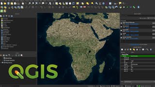
Download very high-resolution georeferenced satellite images in QGIS

HTML-код
- Опубликовано: 15 авг 2024
- High-resolution satellite images refer to satellite imagery with a high level of detail and clarity. These images are captured by satellites orbiting the Earth and can provide detailed views of the Earth's surface. High-resolution satellite images typically have pixel sizes ranging from a few centimeters to several meters.
Georeferenced satellite images are satellite images that have been processed and adjusted to match specific geographic coordinates on the Earth's surface. This georeferencing process involves assigning a spatial reference system to the satellite image so that it aligns accurately with real-world locations.
_______________
using the QGIS plugins you'll be able to download High-resolution georeferenced images, in this tutorial we've discussed and shown how to download high-resolution georeferenced images in QGIS using one of the powerful plugins in this software.
____________________________________________________________
- QGIS Comprehensive Tutorial for Beginner's - QGIS Full Course
✅ • QGIS Comprehensive Tut...
- Sentinel Hub QGIS Plugin - Download Copernicus Satellite imagery (Sentinel 1/2/3/5) in QGIS
✅ • Sentinel Hub QGIS Plug...
- ArcGIS Desktop Complete Beginner's Tutorial - ArcGIS full course
✅ • ArcGIS Desktop Complet...
- Download DEMs in QGIS using the open topography plugin (API Key access) for a specified extent
✅ • Download DEMs in QGIS ...
- Creating a web map using qgis2web Plugin in QGIS
✅ • Creating a web map usi...
____________________________________________________________
🔴 Check it out:
- Like & Share the video with others:
✅ • Download very high-res...
_ _ _ _ _ _ _ _ _ _ _ _ _ _ _ _ _ _ _ _ _ _
- Subscribe to our channel :
✅ / @rsgis6997
=========================================================
#QGIS #GIS #Image #HighResolutionimages #georeferenced


Excelente sabes de mapas base que sean actualizados y que se puedan visualizar dentro de QGIS o tal vez se pueda descargar la imagen de otro medio con una buena resolución pero actualizada
hola buen tiempo
Sí, las imágenes del sitio web de Copernicus están actualizadas y son apropiadas
Download Sentinel1/2/3/5 Images from Copernicus Data Space Ecosystem (Latest Update)
ruclips.net/video/GTIzFRc6cWg/видео.htmlsi=jmT8hdRViowGUKHh
👍👍👍
🌹🌹🌹