Drawing the horizontal projection of the subsurface features from a radar visual in the Snap program, I mean, how do I convert it from this format to the gpr format, and which programs do I need?
Is this DEM workable in HEC-HMS ? Or need for any process before exporting to HEC-HMS? “Note: I download from same site but unfortunately couldn’t define terrain date in HEC-HMS by using this DEM, so any advice ?
I have not delt with HECHMS before. You may need to check (and change) the DEM format that works with HEC and also pay attention to the coordinate system.


Drawing the horizontal projection of the subsurface features from a radar visual in the Snap program, I mean, how do I convert it from this format to the gpr format, and which programs do I need?
Sorry. I have not done this before.
thanks.for teaching.but what is the problem of it .after download is completed and added to arc gis the DEM was not visible.
Thanks. Try to use Zoom to layer.
i mean that just after i Downloaded and extracted the zipped file and added to Arc GIS software the folder is empty.what is the reason for this?
@@fekadugemeda2707You need to extract the zipped folder. If you have done that and still have the issue, try to download your data again.
Is this DEM workable in HEC-HMS ? Or need for any process before exporting to HEC-HMS? “Note: I download from same site but unfortunately couldn’t define terrain date in HEC-HMS by using this DEM, so any advice ?
I have not delt with HECHMS before. You may need to check (and change) the DEM format that works with HEC and also pay attention to the coordinate system.
I'm looking for 5meter DEM or less paid or not where can i find?
It depends on the country you're in. I think Lidar data would be good for your needs.
@@ziadabdeldayem6884 north-eastern Bulgaria i find only 30m
Hello i could not find the hi-res files whenever i place any polygon in the map.. why?
.
how to download an image of the year 2023
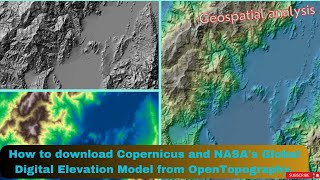
Is the DEM georefrenced? Please reply.
Yes.
@@ziadabdeldayem6884 Thank you.
very very informative video but your tune is very low
Thanks
Does this model need to fill?
Hi Aya. I have not checked that. But if it requires filling, you can interpolate to estimate the missing values.
thank for your information