🎯 Key Takeaways for quick navigation: 00:00 🌍 Remote sensing basics and image classification will be discussed in this lecture. 02:54 🌐 Remote sensing relies on the electromagnetic spectrum, including visible and infrared wavelengths. 05:27 📷 Remote sensing uses sensors, which are like cameras, to measure radiation in specific wavelength bands. 07:03 📊 Sensor data is converted into digital numbers, creating raster images with brightness values. 09:08 🛰️ Landsat satellites have multiple bands to capture reflectance in various parts of the electromagnetic spectrum. 13:45 🔵 Combining different bands in remote sensing software creates various types of color composites for visualization. 18:43 🌿 Band combinations and indices help highlight specific features and phenomena in remote sensing imagery. 23:12 🌱 NDVI (Normalized Difference Vegetation Index) is a commonly used index in remote sensing that ranges from -1 to 1, indicating the presence and health of vegetation. 24:05 📊 NDVI is calculated by comparing the reflectance in the near-infrared (NIR) and red bands, emphasizing differences in vegetation health and density. 26:21 💧 Other indices, like NWI (Normalized Difference Water Index) and MSAVI (Modified Soil Adjusted Vegetation Index), are used to assess water and soil characteristics in remote sensing.
Hello, I followed your video on remote sensing basics and image classification in the context of GIS with great interest. I find your explanations particularly clear and instructive. While watching this video, a question came to mind: do you think it would be possible to find a thesis topic with a physics emphasis that could be applied in the field of GIS, especially in the context of processing images obtained through remote sensing, or even in remote sensing itself? Although I understand that currently mathematics play a crucial role in many GIS researches, I am convinced that physical principles could also offer interesting perspectives. For example, applying the laws of physics to model light-matter interactions in satellite images, or using advanced physical concepts to improve image classification algorithms. The integration of physical models into geographic information systems for a better understanding of environmental phenomena, or even the use of concepts from quantum physics (qbits - cub sats .....)/statistical physics for innovative applications in the field of geomatics? I would be very interested in your thoughts on this topic. Do you think there are opportunities to further explore this intersection between physics and GIS in the context of academic research, with possible opportunities to conduct experiments in a laboratory, for example, to improve acquisition methods (such as LIDAR)? Thank you again for the time you devote to sharing your knowledge and experience on your RUclips channel. Best regards, AOUINATOU OUSSAMA


Well explained. This was such a great help
Thank you!!!
Well explained and interesting to hear.
So clear and well explained. Thank you 🤓
🎯 Key Takeaways for quick navigation:
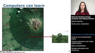
00:00 🌍 Remote sensing basics and image classification will be discussed in this lecture.
02:54 🌐 Remote sensing relies on the electromagnetic spectrum, including visible and infrared wavelengths.
05:27 📷 Remote sensing uses sensors, which are like cameras, to measure radiation in specific wavelength bands.
07:03 📊 Sensor data is converted into digital numbers, creating raster images with brightness values.
09:08 🛰️ Landsat satellites have multiple bands to capture reflectance in various parts of the electromagnetic spectrum.
13:45 🔵 Combining different bands in remote sensing software creates various types of color composites for visualization.
18:43 🌿 Band combinations and indices help highlight specific features and phenomena in remote sensing imagery.
23:12 🌱 NDVI (Normalized Difference Vegetation Index) is a commonly used index in remote sensing that ranges from -1 to 1, indicating the presence and health of vegetation.
24:05 📊 NDVI is calculated by comparing the reflectance in the near-infrared (NIR) and red bands, emphasizing differences in vegetation health and density.
26:21 💧 Other indices, like NWI (Normalized Difference Water Index) and MSAVI (Modified Soil Adjusted Vegetation Index), are used to assess water and soil characteristics in remote sensing.
Amazingly explained! Thank you 😊
This was a great help, thank you!
Well explained, thank you
thanks for your support. Well explained.
Very well explained. Big THANKS
Thank you so much!
Amazing ❤
nice presentation. thanks
Hello,
I followed your video on remote sensing basics and image classification in the context of GIS with great interest. I find your explanations particularly clear and instructive.
While watching this video, a question came to mind: do you think it would be possible to find a thesis topic with a physics emphasis that could be applied in the field of GIS, especially in the context of processing images obtained through remote sensing, or even in remote sensing itself?
Although I understand that currently mathematics play a crucial role in many GIS researches, I am convinced that physical principles could also offer interesting perspectives. For example, applying the laws of physics to model light-matter interactions in satellite images, or using advanced physical concepts to improve image classification algorithms. The integration of physical models into geographic information systems for a better understanding of environmental phenomena, or even the use of concepts from quantum physics (qbits - cub sats .....)/statistical physics for innovative applications in the field of geomatics?
I would be very interested in your thoughts on this topic. Do you think there are opportunities to further explore this intersection between physics and GIS in the context of academic research, with possible opportunities to conduct experiments in a laboratory, for example, to improve acquisition methods (such as LIDAR)?
Thank you again for the time you devote to sharing your knowledge and experience on your RUclips channel.
Best regards,
AOUINATOU OUSSAMA
Thank you 🙏🏽