ICON 2.5 km resolution simulation of Atmosphere and Ocean
HTML-код
- Опубликовано: 21 окт 2024
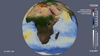
- This animation shows the first coupled ICON 2.5 km atmosphere-ocean simulation performed on DKRZ's new Levante supercomputer in a collaboration between the Max-Planck-Institute for Meteorology (MPI-M), the German Climate Computing Center (DKRZ) with vendor support by Atos.
Clouds are computed from vertically integrated cloud ice and cloud water. Ocean currents are displayed with a range between 0 and 1 m/s.
The diurnal cycle is shown by switching between day and night time views of Earth based on solar radiation. These images are provided by NASA via visibleearth.n... . It reflects in features like clouds over the rain forests building up during day time and collapsing in afternoon rainfall events (rain not shown).
Over the oceans, we can observe different cloud decks traveling in different directions. The ocean currents show the strong tropical currents that are only minimally affected by the rotation of Earth, and detailed Western Boundary Currents with their eddying extensions that cross the basins. While the ocean currents may seem like a snapshot image, they simply change so much slower than the clouds, that they seem static to the viewer.
While in the tropics, much of the weather is dominated by the diurnal cycle, in the mid-latitudes, the westerlies move the weather around the globe.
Enabling these high-resolution simulations contributes to various funded projects, such as the EU H2020 Projects ESiWACE2 and nextGEMS, but requires more long-term financial support provided by institutional funding.


Dejar ya de dar por ahi....