Hello Greg, This was a perfect video. The only proviso is that it was not actually videoed on the live working area on the site but it was sufficient to relay the message of the brilliant working magic of the great Leica TS15. I am glad you mentioned in this video that you can stake out using the drawing points on the Controller or the normal setting by doing it manually as a normal Total Station. I am learning to use TS15 or TS16 on the Robotic mode and thus everything you are showing is brilliant. It is the uploading and downloading of the survey data which is the crunch bit you have to explain in a clear crystal method you have used up to now. On Video No.12 you did not show how you downloaded the surveyed data onto the laptop via the Cad software. I will be grateful if you would kindly show this in your next video. Super video.
Hi Asim! Please see last video (uploaded today) when I am taking information from the instrument to the CAD, in previous 2 from 'know how' for engineer's I am showing also how to create a job and how to bring the data to the instrumetn, hope it will help :)
Hey we have the same name :) I'm just about to start a job where I will need to apply these techniques, so I have been working through all of your videos. Many thanks for the content.
Hello Mr.Greg! Thanks for beneficial videos. Autodesk Civil 3D and Leica Geo Office is commonly used in my country. I wonder which software programs are used in office in UK
Having your own EDM is a good idea, especially now as there is quite a lot of offers for engineers with own equipment. I do not survey accurately the corners, but I would probably try to 'shoot' just the corner, or if possible send someone to hold the target there. For me 2 points on each face close to corner (giving me two lines) is well enough to find the corner position.
Yes I suspected that, its frustrating as in trying to lose the staff holder, I'm losing the accuracy of precise building footprint, and actually have to survey it twice. i.e once to laser the corner and second time to get a level on the same corner. I can already do that with GPS (separate kit) so don't need a robotic at all to achieve this. So wondering if there's any point getting a robotic if its making me less efficient and survey every corner twice, just use my old TS06 to laser everything and GPS a foot out from the corner after
Depends what you will need a robotic for really, if you can do you job with TS06 and you have one, then there is no point in spending so much money.BTW I love TS06 :), but for works I am currently doing robotic makes life really easy.
Thanks for reply. I'm freelance with own kit doing topo green field sites and some setting out. A lot of measured building surveys too for architects. Do very little site engineer work. Might keep my pennies for equipment failure disasters for the moment
THANK YOU VERY MUCH , i was thinking to buy a online course , but i change my mind , your course is very complex , i am interested if you can explain how to rotate a drawing , how to identify your CONTROL POINTS , YOUR station , when you go first day in a new site as a setting out engineer
Hi El Fugitivo! I will bo covering local grid soon and rotating the drawings too. When you start on new site they typically provide you with targets info :)
Dear Mr Greg, I am a construction Engineer in Malta. Is it possible to contact you privately via email please? I would like to ask you some questions if possible. Thank you Aaron
Hello, great videos! Just wondering can TS 15 do AutoStake like shown here: ruclips.net/video/1cdi5HKbXJk/видео.html and also can you do grid scans with EDM? Thankyou!! Keep it up!
Hi Blaz! It can, but I never used it before. EDM can survey for you as well, but it all depends what apps you have as there are a lot for Viva software, unfortunately you have to pay extra for these.


Great work mate . Expecting more videoes. Great explanation
More to come!
Thank you, it was a good tutorial
Happy you liked it 👍👍
Your videos are treasure for beginners. Thank you for the hard work.
Glad you like them! Happy to help 👍👍
These series of videos is really great , its easy to understand and surly will help me in my new job . Thank You Greg
Glad to hear that Mohammed! Thanks for comment :)
Excellent...I feel we need a new Series Greg hahaha one with the ts16 lol
There is a couple of vids with TS16 and iCON as well 💪
Great stuff! I love what you’re doing for people who are new to engineering like myself!👏🏽
Thank you! Glad to hear it!
Hello Greg,
This was a perfect video.
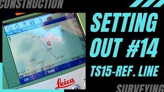
The only proviso is that it was not actually videoed on the live working area on the site but it was sufficient to relay the message of the brilliant working magic of the great Leica TS15.
I am glad you mentioned in this video that you can stake out using the drawing points on the Controller or the normal setting by doing it manually as a normal Total Station.
I am learning to use TS15 or TS16 on the Robotic mode and thus everything you are showing is brilliant.
It is the uploading and downloading of the survey data which is the crunch bit you have to explain in a clear crystal method you have used up to now.
On Video No.12 you did not show how you downloaded the surveyed data onto the laptop via the Cad software.
I will be grateful if you would kindly show this in your next video.
Super video.
Hi Asim! Please see last video (uploaded today) when I am taking information from the instrument to the CAD, in previous 2 from 'know how' for engineer's I am showing also how to create a job and how to bring the data to the instrumetn, hope it will help :)
Keep going mate you are amazing
Thanks Hussein! Happy you like it!
Nice lesion
Thank you Gezim!
THANK YOU FROM GERMANY
Hi Claudia! Happy to be seen in Germany :)
It’s really helpful video, thanks
Thanks Emre!
cool bring more
thanks Omar :)
Hey we have the same name :) I'm just about to start a job where I will need to apply these techniques, so I have been working through all of your videos. Many thanks for the content.
Very happy I could help, wish you all the best in a new role and any questions let me know :)
@@SITENG Do you have any resources on how to change between grid systems? I can't find any guides on the internet
@@user-ej5mr9th1i Do you mean create the local grid?
If so, I will be showing this on my channel, so stay patient :)
good videos pal
Thank you Jamie!
Thanks
Welcome !!
Great video! Does the TS15 have a reflectorless laser built in?
Yeah, you can use reflectorless option
Hello Mr.Greg! Thanks for beneficial videos.
Autodesk Civil 3D and Leica Geo Office is commonly used in my country. I wonder which software programs are used in office in UK
Hi Sami! Thanks, If it's work on site, Autocad 2D is well enough, if design Autocad & Revit mostly.
Hi, How do you stake radius out please with a leica ts15
Have a look on my arc video: ruclips.net/video/YtfPwt8trU8/видео.html
Hope it helps :)
I am thinking of buying the ts15 for survey work and setting out. How do you accurately survey building corners?
Having your own EDM is a good idea, especially now as there is quite a lot of offers for engineers with own equipment. I do not survey accurately the corners, but I would probably try to 'shoot' just the corner, or if possible send someone to hold the target there. For me 2 points on each face close to corner (giving me two lines) is well enough to find the corner position.
Yes I suspected that, its frustrating as in trying to lose the staff holder, I'm losing the accuracy of precise building footprint, and actually have to survey it twice. i.e once to laser the corner and second time to get a level on the same corner. I can already do that with GPS (separate kit) so don't need a robotic at all to achieve this. So wondering if there's any point getting a robotic if its making me less efficient and survey every corner twice, just use my old TS06 to laser everything and GPS a foot out from the corner after
Depends what you will need a robotic for really, if you can do you job with TS06 and you have one, then there is no point in spending so much money.BTW I love TS06 :), but for works I am currently doing robotic makes life really easy.
Thanks for reply. I'm freelance with own kit doing topo green field sites and some setting out. A lot of measured building surveys too for architects. Do very little site engineer work. Might keep my pennies for equipment failure disasters for the moment
THANK YOU VERY MUCH , i was thinking to buy a online course , but i change my mind , your course is very complex , i am interested if you can explain how to rotate a drawing , how to identify your CONTROL POINTS , YOUR station , when you go first day in a new site as a setting out engineer
Hi El Fugitivo! I will bo covering local grid soon and rotating the drawings too. When you start on new site they typically provide you with targets info :)
İ have question about Leica CS15.
I am all ears 😁
Leica scrin not work?
@@nizamibabayev4737 check the settings, maybe you have touchscreen off
Dear Mr Greg, I am a construction Engineer in Malta. Is it possible to contact you privately via email please? I would like to ask you some questions if possible. Thank you Aaron
Hi Aaron! Please contact me on Instagram.
I don't have Instagram
Do you have Facebook?
@@noraam46 there is a link on main YT page
Hi Greg,
I have sent you a message on your Facebook page. Thank you
Leicas own system is so cumbersome and user unfriendly. I prefer GeoPad. Much much better.
Hi Segen! Never used that, but Leica is not that bad :) I really like it
Hello, great videos! Just wondering can TS 15 do AutoStake like shown here: ruclips.net/video/1cdi5HKbXJk/видео.html and also can you do grid scans with EDM? Thankyou!! Keep it up!
Hi Blaz! It can, but I never used it before. EDM can survey for you as well, but it all depends what apps you have as there are a lot for Viva software, unfortunately you have to pay extra for these.
Leica Viva sucks. CS20 captivate is the best
Come on, it's not that bad Ionut.
Thanks
👍👍