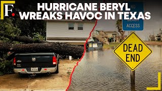
[Saturday] Beryl Restrengthening; Landfall in Texas Expected Monday

HTML-код
- Опубликовано: 5 июл 2024
- Website: www.tropicaltidbits.com/
If you value what I do, you can support my work here: www.tropicaltidbits.com/support/
Follow my X/Twitter for more frequent updates: x.com/TropicalTidbits
Please note that these posts do NOT necessarily reflect the official forecasts of the National Hurricane Center (NHC), and should not be interpreted as such. While tropical storms exist in the Atlantic, official NHC information is available at www.hurricanes.gov. Please refer to the NHC when making decisions, and heed the advisories and evacuation statements of your local National Weather Service Office and emergency management officials.
Dr. Levi Cowan creates videos and blogs pertaining to tropical cyclones, primarily hurricanes in the Atlantic Ocean. Posts occasionally concern other, non-tropical weather events around the world. Dr. Cowan has a Ph.D. in meteorology from Florida State University.  Наука
Наука


the mic quality is fine mate no need to apologize all we care about is that you willingly take time from your trip to give us your feedback for the storm, and that we thank you for 🙏
Literally the only noticeable difference is the mouse clicks in the background as he draws on-screen, very minor issue if one at all!
Some of his videos have had birds chirping in the background. I kept pausing thinking the bird’s outside my house were freaking out. But besides that being a little distracting, he’s always been understandable which is what is important lol
dont worry about audio quality, we are here for superior forecast quality
Yes we're going to read them tarot cards in order to predict the hurricane .
Yes very true!
Mic is fine. You are fine. Thank you always for the expertise.
Thank you for your videos. I just started watching you these past couple of weeks and I can’t believe I didn’t find your videos sooner! Keep up the good work 😊
Love to hear that - thank you :)
Im so glad you found this channel-- TT has been a huge help over the last few years. Pertinent information, right to the point. As someone who lives on the gulf coast i really appreciate it. ✌️
@@Tropical-Tidbits been watching since Irma in 2017, always enjoy your video formats, keep it up! :D
I'm in southeast Texas Houston Texas area wish me luck 🤞 🙏 please 🙏 🫂 @@Tropical-Tidbits
One of the best features of Doc Cowan's report format, is he doesn't bother showing his not-ugly mug in a headshot throughout the video, as do so so many other web-weather guys. I find this very respectful of his viewers because others that do the talking head thing don't seem to realize it is a) annoying b) distracting c) a poor use of the limited screen display. Doc C is not self serving, and only interested in presenting useful, not useless, information. In a potentially life threatening event, we appreciate this genuine respect of and his interest to the viewers. Thanks Doc !!
I agree 100%. I prefer the voice only with no face on screen, not only for weather channels but also for true crime type channels. If your voice is good and unique i dont want to know what you look like-ruins the mystery. And to your point, most people are viewing on a phone with a limited screen so it is not useful to the viewer to have your face taking up valuable real estate!
Also I love how he gets right to the point and none of the usual “hit the like button and subscribe” nor does he blather on incessantly before getting to the information. Straight to the meat of it.
@@janesmith7331 yes! Pertinent information, right to the point. Love it
@@janesmith7331 Yes I do appreciate this kindness that he just gets right into it "like a dog on point" as we say down here in Alabama, with now self-serving promotions or pleas etc. That's another reason why I wait with baited breath for every video report Doc posts
If you don’t like talking heads don’t watch them but that’s their format and what they like to do.
Thank you, Dr. Cowan for the heads-up for Texas & your analysis is always easy to understand. Great job even while you're traveling!
Don't apologize for helping on your vacation. Thank you.
Thank you, voice is great!!
Dr. Levi Cowan for president 2024! Your insights are immeasurably helpful, and your understanding of the weather phenomenon of the hurricane is priceless. Thanks for your learned expertise!
really appreciate you taking the time while traveling to do these.
You do an amazing job…..No audio issues. Thank you very much.
Always appreciate your thorough updates. Thanks
Irma 2017 is when I started to watch your videos. Thank you!
One of the best forecasts ever , explained very thoroughly , but not talking down to us or over simplifying.
Beryl already has a center of circulation and she is moving into a less hostile environment. Once the hurricane hits a hot deep upwelling in the ocean with minimal wind shear , she will intensify rapidly. Texas could see a Cat 3 hurricane or higher. Thank you for the updates.
Wishcasting…
Thank you. I'm in Kleberg county, this is the best info I've been able to find all day.
Thanks for all your great work, Dr. Cowan! You are very appreciated!
I appreciate your factual forecast with no drama, thanks. Been a user of TTB website for last couple years
Your audio sounds just fine; some of the wishcasters I used to watch back in the day could only dream of sounding this clear. 😂
I always turn to your site in times of winter weather forecasting and of course for the tropics as well. I live in a land-locked state far from the coast but we get the remnants often; always good to remain weather aware for as large a zone as possible so nothing surprises you!
Yay corpus christi needs water ! Thank goodness 🙏.. we been in water restrictions for 5 years !
Thanks for taking time out to do another update!
Thank you Dr. Cowan for excellent updates! Watching closely from Rockport, Texas and getting out of harms way. Beryl is forecast to come in very near the location that Hurricane Harvey landed. San Antonio Bay / Matagorda / Calhoun County is 30 miles northeast of the city of Rockport and is adjacent to the Aransas National Wildlife Refuge. Harvey blew up from a tropical depression to Cat 4 in less than 42 hours. 🙏🙏🙏
Storm looks really healthy i expect cat 3 on landfall
Agreed, with rapid strengthening a Cat 2 or stronger at landfall seems more probable. Also see a continued shift in the model tracks to the East, meaning more time for the storm to be over open (& very warm) water. As a broad comment it seems when water temperatures are extremely warm models tend to underestimate the capacity for tropical systems to strengthen. It's very interesting that with tremendous amount of data gathered on tropical storms how difficult they are to forecast. A few days back many models predicted the storm would track much farther west and south into Mexico. Will be curious to revisit our our predictions Eric in the next few days .
I’ll take the under. So far it’s struggling to get its act back together. Due to the shear it has not stacked back up yet. It’s been running above average in terms of strength but the current model guidance is only low end Cat 1 so reaching Cat 2 is questionable but it could get there. Tomorrow will let us know, it will either already be a Cat 1 working towards a 2 or still be just a TS. Right now all the strong winds are NE of the center so it hasn’t wrapped up. Pressure actually went up not down during the last recon flight.
Thanks for the update Levi.
Good morning Levi
Thank you for all you do.
God bless you 🙏❤
Just the info I was looking for at this point. Thank you. Safe travels!
If a hurricane cools the water, does that effect make it less likely to have higher intensity systems during the rest of the season specifically around its track?
This can happen over a narrow area, but only persists for a week or two before the cold wake warms up again. It typically takes a special coincidence for a 2nd storm to be hindered by the first one's cold wake.
Only for a short period of time. Don’t forget that Rita tracked over some of the same water that Katrina became a Cat 5 on but Rita became the strongest Gulf of Mexico hurricane on record.
@@Tropical-Tidbits thanks for the explanation
Another excellent discussion !! THANK YOU !!
Sound is fine and we so appreciate your expert analysis (plus your delivery is so much easier on the ears than that met student with the hyper “weather man” voice.)
Thanks for the updates!!
You're the absolute best. Thanks doc
Thank you. 🌿
Watching from Barbados 🇧🇧
Fantastic reporting.
Ok..thank you Levi
Thanks for the update!
Thank you for the updates!
Thanks Levi! 💜🌀
Thanks Levi!
Love your content!
Gratitude is a must ♥️ thanks always for your update 🇯🇲❤️💛💚
Those of us in central Texas are, shall we say...concerned.😏
Thank you! God bless you
Thank you!
Thanks, Doc!
Hopefully the intensification won’t be like Harvey 😢
The sheer cerated by the upper low to the West also veers Beryl a bit more to the North. I bet on a Cat2 between Corpus Christi and Port Aransas.
Thank you.
Beryl is not done yet !!!!!
I really hope they retire the name after this. I'm getting teased a lot.
Best coverage I’ve seen. Awesome explanation of the atmospheric phenomena affecting the storm’s strength and direction. I like seeing comparisons between previous forecasts and current storm composition.
Also, hello from Matagorda County!
Sounds great doc
mic quality is great!! ROCK ON!!
Thanks Sir.👍👍
Watch out for the rain Louisiana, we need it though.
Thanks doc!
My lawn is being watered right now. From South east Texas
Very informative. Thanks from Port Isabel Tx.
Thank you Batman
I have a bad feeling… don’t ask why
That is quite possibility one of the best laptop mics ive heard in my life lol
Thanks. What is this HASP B modeling you refer to. Even though on the runs you mention European (ECMWF I think) and of course GFS. How come it's pretty rare for these tropical systems to just fall apart after traveling over various land masses. Yet tornados often fall apart easily after interaction with large structures or terrain on the ground.
Inertia. Compare physics of hurricane vs tornado
thanks brotha levi
Thank you
Beryl doesn't quit. I like his style.
Im in NW Harris county so I'm all in on watching this storm over the next day.
is there a one-time donation option to support your work?
Why do meteorologists refuse to tell us what the ceiling is on a storm? If I’m in the path, I want to know if there’s even a modest possibility it could come in far stronger than forecast. What’s to prevent Beryl from going through RI again and stop it from being a major hurricane at landfall? It already went from TD to Cat 4 in less than two days once. Not a single meteorologist told us that was even a possibility, it’s important information that you need to get out.
As someone who used to talk to you on the wunderground days, please help the industry figure out their messaging on this. I had family members get absolutely blindsided in Michael because y’all didn’t get the message out that Michael could go through RI. All us enthusiast knew it was a possibility, the professionals did too, but the public didn’t.
Mainstream media is VERY bad at this!!! This is why I go to RUclips for the forecast bc watching mainstream u will be a sitting duck
Yes sir, you are spot on sir. And same with 2020 Sally which at last minute took a hard right WHILE UNEXPECTEDLY STRENGTHENING. Even without the track divergence, if folks down on the AL FL panhandle had heard messaging it could have a stronger top-end, they would have not been caught flatfooted.
It’s simple actually. If they mention high end forecasts, that’s all people will talk about. Then when it doesn’t end up that bad they will say that the meteorologists overhyped the storm. Then people will stop listening and the situation will be even worse. If you want to listen to worst-case-scenario people, you can find them all over RUclips. If you want an honest analysis of the most probable outcome, then you have already found what you are looking for.
I have heard many forecasters say it could strengthen up.
They are not great at predicting the intensity of a storm so I think they are more cautious. I would expect that if it's already showing signs of organizing that it would be a major hurricane. They predicted Beryl to only be a Cat 2 at the windward Islands. It was a Cat 5.
tbh your laptop's mic is pretty good
Do you think my Monday 7am flight out of Houston will be affected? Headed to Tampa hopefully.
@@kappc2014 I think it will be affected Monday morning is supposed to the worst time of the storm in Houston
Yeah... probably not happening
Looking like Corpus will be on the south side of the storm, thank god. Been on the north side many a times and it's always so much worse.
The way it looks makes me wonder if one of these could ever split in two after going over a land mass or there's probably not enough fuel or they will always combine into one because of physics.
You know like it would be crazy if the part on north that looks split off became it's own Hurricane or tropical storm and now there were two back to back!
I’m concerned about rapid intensification. Seems to happen to us on the gulf coast lately.
Will it hit Corpus Christi bad brotha?
I'm very very glad Beryl didn't have this convection hit last night and the storm did weaken to 1001 MB or you would be talking cat # on a Texas landfall. My other Dr. friend Reed Timmer is headed for Texas Dr. Cowan hehe he never stops chasing.
I certainly wish we (Central Maine) had the expertise demonstrated in your forecasts. We have to deal with an AI or computer generated forecast map that changes every 30 minutes, not much time to deal with severe weather.
Brownsville
Go Noles!
Let's go beryl!
🔥🔥🧐
They cloud seeding like MF
I'd like to get the additional updates, but I don't have a TwiX account. Do you also post on Truth Social? Thanks.
Im still predicting Louisiana
Realy abuse realy crime not lie i wander if the president didnt know this always beyond the kaw
Fake news
You’re not being forced to do anything dog
Thank you.