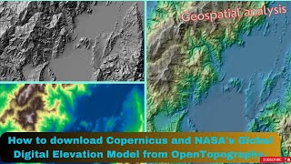
Download SRTM 30m Digital Elevation Models for Free

HTML-код
- Опубликовано: 26 май 2015
- Learn how easy it is to search and download freely available Shuttle Radar Topographic Mission (SRTM) DEMs, that were collected in February 2000 in a special joint mission on-board STS-99, using X and C band interferometric techniques. The US Government recently relaxed the distribution restrictions on the data, making 30m (1 Arc second) DEMs available.


Simple, fast, efficient and very useful. Thanks a lot!
Thank you very much! Greetings from Peru
Thank you!!!!
That was so good.
thank you
thank you.. very usefull
Excellent
Great information, in that page can I download land use and land cover?
Thank you
Obrigada!
I'm trying to get the SRTM of a smaller area like the property of a building. Does anyone know if I can get this?
Thankss
Gracias por interesante fuente de información. A pesar de mi precario ingles esta muy explicado por la calidad de las imágenes.
Saludos desde la patagonia
Sorry to be so offtopic but does anyone know of a trick to get back into an Instagram account?
I stupidly lost the login password. I appreciate any tips you can give me.
@Harold Uriel Instablaster :)
@Alijah Rudy I really appreciate your reply. I got to the site on google and im trying it out atm.
Seems to take a while so I will reply here later with my results.
@Alijah Rudy It did the trick and I actually got access to my account again. I am so happy!
Thanks so much you saved my ass :D
@Harold Uriel Happy to help :D
thank you so much for the information I downloaded but I face with a problem in the cell size is shown in degree, not by meter. my model needs the cell size by the meter, not by degree. is there any other websites that shown in the meter? if you have the address and share it with me it will help me a lot
Sir what will be the procedure to join both dem tile??
How could I turn that into a CAD file, for drawing contour lines?
After selecting coordinates datasets while I view the results it's showing no results found can you tell any solution for this please!
Why do we select the SRTM Global and not the other SRTMs? (this is for a class assignmnet so could you please revert asap)
Mainly, because it's the highest resolution available. 1 Arc Second = 30 meters
lta.cr.usgs.gov/SRTM1Arc
pls link focus program
30-minute DEM?
I follow every step but cannot download
Nice video, but if one has to download a large part of the world you get like 10000 squares =/
Thank you !!!!