
- Видео 45
- Просмотров 393 422
Jesse Buyungo
Добавлен 6 июн 2017
This channel provides you with tricks, tutorials about Gis, Remote sensing, spatial data analysis and data science.
Semi-Automatic Object Based Image Analysis in QGIS || Part 2
In this video, I show you how to use QGIS software to perform semi-automatic OBIA. This includes slicing imagery, performing segmentation and classification.
Link to download python file for image slicing.
👇👇👇👇👇👇👇👇👇👇👇
drive.google.com/uc?export=download&id=1tk17fyFxbzPNL-Z1c8ERuGnDHChHazvz
enjoy
Link to download python file for image slicing.
👇👇👇👇👇👇👇👇👇👇👇
drive.google.com/uc?export=download&id=1tk17fyFxbzPNL-Z1c8ERuGnDHChHazvz
enjoy
Просмотров: 571
Видео
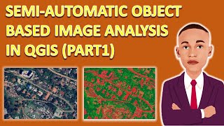

Semi-Automatic Object Based Image Analysis in QGIS || Part 1
Просмотров 1 тыс.4 месяца назад
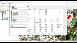
In this video, I show you how to configure your QGIS software to perform semi-automatic OBIA. This includes installing the dependencies and the map segmentation plugin. Enjoy Unofficial Windows Binaries for Python Extension Packages python libraries 👇👇👇👇👇👇👇👇👇👇👇 www.lfd.uci.edu/~gohlke/pythonlibs/ QGIS Map Segmentation GitHub 👇👇👇👇👇👇👇👇👇👇👇👇👇 github.com/sirebellum/qgis-segmentation

How to Download Super High Resolution Imagery in QGIS
Просмотров 3,4 тыс.5 месяцев назад
This video is your one-stop guide to downloading stunningly detailed satellite and aerial imagery straight into QGIS Whether you're a seasoned geospatial analyst or just starting out, this tutorial will equip you with the knowledge to: Install and configure the MapTiler plugin Explore a vast library of high-resolution imagery providers Search and zoom to your desired location Customize download...

Supervised classification in QGIS || A complete Tutorial || 100%
Просмотров 24 тыс.2 года назад
Supervised classification is based on the idea that a user can select sample pixels in an image that are representative of specific classes and then direct the image processing software to use these training sites as references for the classification of all other pixels in the image. In this tutorial, I demonstrate how to carry out supervised classification in QGIS. Enjoy
Accuracy Assesment In Quantum GIS || A complete Tutorial
Просмотров 7 тыс.2 года назад
This is a tutorial about the accuracy assessment of a land cover classification using the Semi-Automatic Classification Plugin (SCP) for QGIS. Enjoy

Converting Landsat 8 DN to Top of Atmosphere Reflectance and Radiance ||A QGIS tutorial!!
Просмотров 6 тыс.2 года назад
In this wonderful tutorial, I show you how you can quickly compute Top of atmosphere reflectance and radiance Values easily and quickly in QGIS using the RS&GIS Plugin. Enjoy this tutorial!!!!!

Calculating Land surface temperature using Landsat 8 Imagery || QGIS Tutorial
Просмотров 14 тыс.2 года назад
In this wonderful tutorial, I show you how you can quickly and easily compute and derive Land surface temperature Values using QGIS RS&GIS Plugin. Enjoy this tutorial!!!!!

How to create shapefiles in ArcGIS
Просмотров 5792 года назад
In this video, I show and demonstrate how to create point, lines, and polygon shapefiles in ArcGIS Software from scratch. Enjoy this tutorial

How to create automatic dimensions in AutoCAD || A lisp Application
Просмотров 14 тыс.2 года назад
In this video, I show you how you can automatically dimension all the segments on a polyline using an AutoCAD using an Auto Lisp. Kindly subscribe to this channel please. Click the link below to download the AutoLisp Application bit.ly/3gKMWwP
How to Export AutoCAD Coordinates for Polyline to MS Excel Spreadsheet || Auto Lisp
Просмотров 27 тыс.2 года назад
In this video, I show you how you can automatically export polyline coordinates from AutoCAD to excel spreadsheets using an Auto Lisp. Kindly subscribe to this channel please. Click the link below to download the AutoLisp Application bit.ly/3zuPF4x
How to Auto Increment AutoCAD Text Labels
Просмотров 10 тыс.2 года назад
In this video, I show you how you can automatically label points, stations within AutoCAD using an Auto Lisp. Kindly subscribe to this channel please. Click the link below to download the AutoLisp Application bit.ly/3Dt62Bb
How to Create a Beautiful Hillshade in QGIS
Просмотров 30 тыс.2 года назад
The Hillshade tool obtains the hypothetical illumination of a surface by determining illumination values for each cell in a raster. A hillshade is used to create a beautiful understanding of the terrain of a given area. In this video, I show you how to create a beautiful hillshade, I have used an SRTM DEM 30m resolution file. Enjoy!!!!
Animated African Coronavirus map: How the Covid-19 outbreak has spread around the Africa so far.
Просмотров 1343 года назад
Here is an updated map of the spread of the coronavirus In African Countries from January 2020 to Date.
Object-based Image classification in QGIS || OBIA !! || A complete Tutorial
Просмотров 73 тыс.3 года назад
Object-based image analysis (OBIA) involves pixels first being grouped into objects based on either spectral similarity or an external variable such as ownership, soil or geological unit.An Object Based Image Analysis (OBIA) approach to image classification segments an image into homogenous spectral regions. This differs from standard image analysis methods that classify each pixel in isolation...
How to download and install Ofeo Tool Box (OTB 7.3.0) in QGIS!!
Просмотров 21 тыс.3 года назад
Orfeo ToolBox (OTB) is an open-source project for state-of-the-art remote sensing In this video, I show you how to download, install and configure the OTB Plugin in quantum GIS.
QGIS How to label individual sides of polygon || Dimensions In QGIS
Просмотров 13 тыс.3 года назад
QGIS How to label individual sides of polygon || Dimensions In QGIS
How to import spreadsheet data into QGIS
Просмотров 1,1 тыс.3 года назад
How to import spreadsheet data into QGIS
Digitization in QGIS || A complete tutorial!!
Просмотров 1,2 тыс.3 года назад
Digitization in QGIS || A complete tutorial!!
Qgis Raster sampling tutorial || Random sampling|| systematic sampling || A complete tutorial!!!
Просмотров 2 тыс.3 года назад
Qgis Raster sampling tutorial || Random sampling|| systematic sampling || A complete tutorial!!!
How to create, add and edit shape files in Qgis. || A beginner's tutorial
Просмотров 2,3 тыс.3 года назад
How to create, add and edit shape files in Qgis. || A beginner's tutorial
How to georeference images in Qgis || A complete tutorial!!
Просмотров 12 тыс.3 года назад
How to georeference images in Qgis || A complete tutorial!!
Envi supervised classification tutorial || Maximum Likelihood Classifier
Просмотров 1,7 тыс.3 года назад
Envi supervised classification tutorial || Maximum Likelihood Classifier
How to create an RGB composite In envi
Просмотров 3,2 тыс.3 года назад
How to create an RGB composite In envi
Classification Of Remote Sensing data || Part 1 || Supervised Classification.
Просмотров 2,5 тыс.3 года назад
Classification Of Remote Sensing data || Part 1 || Supervised Classification.
What is remote sensing?? || Introduction to remote Sensing
Просмотров 6 тыс.3 года назад
What is remote sensing?? || Introduction to remote Sensing
Autocad 2025: Use Bconvert command then select a simple circle and convert all of them in blocks, now you can use DataeXtraction command to get x,y,z coordinates
Hello! Great video! Which satellite image is this? Its prett high resolution!
When I am trying to add Landsat bands it is asking me about ENVI Header info. What to fill in Sample, Lines and Band?
I got error message: >> For Land Surface Temperature: :-( Error: Traceback (most recent call last): File "C:\Users/Francis_Otia/AppData/Roaming/QGIS/QGIS3\profiles\default/python/plugins\NITK_RS-GIS_17\RSGIS_M.py", line 2134, in run lst_cal_w_del(num) File "C:\Users/Francis_Otia/AppData/Roaming/QGIS/QGIS3\profiles\default/python/plugins\NITK_RS-GIS_17\RSGIS_M.py", line 1821, in lst_cal_w_del ndvi_cal(num) File "C:\Users/Francis_Otia/AppData/Roaming/QGIS/QGIS3\profiles\default/python/plugins\NITK_RS-GIS_17\RSGIS_M.py", line 1755, in ndvi_cal output_extras[num][0] = (output_re[num][n_info[1]] - output_re[num][r_info[1]]) / ( ~~~~~~~~~~~~~~~~~~~~~~~~~~^~~~~~~~~~~~~~~~~~~~~~~~~~~ TypeError: unsupported operand type(s) for -: 'list' and 'list' Process stopped in between ! You are good to go again.
For QGIS 3.34, before following these steps, you need to go to 'Plugins', select 'ALL' and search for 'OrfeoToolbox provider', once it shows, check the box near it and close the Plugins window. This solves the problem of OTB not appearing in the settings --> processing.
Wonder full sir , thanks
Thank you so much 🙏... I've been looking for this for long time now
This video deserves more likes and comments! Thank you soooo much!
Thank you so much for posting this tutorial! You have a great series. Very helpful and great energy!
Good
but how do I select date of the satellite image to capture?
Super Video
Te amo mi rey. Sos un Genio!!!! Mis aplausos para Usted!!!!
Hello, sir. My problem is that when I export separate map pieces from the world map, such as Bing Satellite, for example, if I have a small country map, it gets blurred. This is because it requires a lot of zooming compared to larger countries, and I can't change the zoom specifically for it since i don't want to mess with the spacing when adding it back to my video editor for map animation. Is there any workaround to make it very high quality?
At a country level, the resolution has to be low, try exporting Small areas
I have tried to make map. But there shows 2 legends. Is there any way to show only one band data on legend?
Yes please, there is a way
VERY HELPFUL YOU MADE ME GAIN A LOT OF TIME THANK YOU
Thank you so much.
Very succinctly presented. Thank you sir
My pleasure
it doesnt generate the folder..
Have you followed the steps? One by one?
Thank you
You're welcome
👍👍
Thanks!!
Ya no está disponible el sitio para descargar las librerías 😥
Sorry, I have just seen this comment. I will look for the updated path and update ASAP
how can i extract "Z" value of polylines
Hello Jesse, thanks for creating such a valuable tutorial on OBIC. It's been incredibly helpful. I was wondering if you could kindly share the raster image you used.
Wow, this is a Pléiades satellite image taken in Kampala CBD, Uganda
@@jessebuyungo Thanks. I could not find it on EarthExplorer. I wonder if you still have that image.
It's a commercial satellite image. So you have to buy it at a cost
In my project. At the Classification menu section has a 'select at least one signature' notification, and then so what should I do?
Could you share a screenshot of the error please?
Doesnt work i think vexp command already exist on my lap , if you can upload the lisp file i can change the command
I can't get what you are saying please
if I use polygons instead of points for the training sample it the classification goin to be more accurate?
We. Are not using points actually, we are selecting points which we later use to select our polygons
@@jessebuyungo got it!! in your opinion what model is the most accurate? Im trying em all but it seems that linear and polinomial are the better ones
...I can't say that there is an accurate model, different model will be accurate depending on the given situation, maybe the landscape, the samples, the satellite imagery etc.....
@@jessebuyungo I undestand, another thing, im trying to do the segmentation with a landsat but it doesnt work, the output is just a big polygon that cover the study area. Do I need to change some settings for landsat? I tried to resample at10 meters but It doesnt work
Can I give you a tutorial for that at a discounted price?
This is very useful for me thank you so much.
You are welcome!
I'm trying to do this with a multiband image but I can't find this option, what version of Qgis and the SCP plug-in were you using?
What's your QGIS version?
Wonderful 🙏🏽🙏🏽
Thank you 🙌
thx just what i needed
Very clear from start to finish.
Thank you so Richard. Thank you for my coffee tooo
Hey, thanks for the tutorial! Though I was wondering, is there any way to draw on top of the hillshade and still have the shade visible on the drawn polygon? Thanks in advance :)
Yes please,.once you play with the transparency of the polygon layer
I got this to work but the measurements were way off.. like 1/3 real life.. not sure what went wrong..
Have you tried to check your coordinate system. Metric Measurements work with projected crs other than geographical ones
hello, I face some struggle during the "VectorClassifier". The shp is missing at the end. I can find it nowhere and even I try to run it on temporary file, it doesn't show up either. Thanks in advance
@jessybuyungo I need your help
Hello chief, what does it say after classification?, does it give an error?
@@jessebuyungo hello, so basically the algorithm work perfectly but I can't find the output. Plus there's no error message after running the "vectorclassifier". I just don't understand why it's missing. I choose the file for the results and everything but it's still missing
I can't understand the problem, maybe we can arrange an online meet and you take me through and I can guide you where you are going wrong
@@jessebuyungo ohh really, thanks in advance.
Great video. What a nice surprise to hear a UG his expert explaining a specific issue that I needed to relearn. Greetings to KLA! and long live the GIS Working Group!!! I learned everything I know from Martin K. you remember him?
Thank you so much @ashiola for the shout out🙏🙏
can you explain why u use autocad and not shp in the last, i didnt see my file output any help pls ?
Hi there, am sorry, but I haven't used AutoCAD in this tutorial, Incase you are facing challenges, I can take you through under a private arrangement please
@@jessebuyungo I once again tried all the steps at the final classification stage to open the output shp file, I cannot find it despite the message specifying that the document has been classified, can you review this on your side maybe there was an error
Ohhh sorry chief. Try checking in the directory you saved it
Very well explained🎉 thanks
Thank you 🙏
how do i increase the dimension line location from the polyline
Try setting it in the dimensions style before you use the lisp command
After collecting all of the training data, I was unable to run the classification. I got messages saying "error: process failed", "SCP: multiprocess: error classification", and "SCP: covariance matrix". Are you familiar with these errors?
Not so please, could you need a personal tutorial?
Thank you so much, sir, it was really helpful!
Glad it helped!
beautiful my friend, new sub :)
Thanks for the sub!
hello. i made the classified image. when i use the 'identify features' option and click on any pixel, then i get the pixel value as i assigned and i get the lat-lon of that point. but i cannot find any attribute table or anything that lists up all the lats and lons as an array. so basically i am trying to use the pixel values from this file and change another files values at the same lat-lon point. how can i get the lat-lon of all the points of my classified image?
identify features works on vector not raster data, so it will give you the features in your vector layer
I was following full process why showed classification errors? After declaring classifier
could you please share a screenshot of the error
Does not work
it does, check again how you are doing it
Awesome!
Thanks!
Dear Mr. Buyungo, is it possible to combine the two rasters into one which delivers the same visual effect and if yes, how? I just can't find a way in QGIS. thanks in advance.
Not really
In my qgis,3.28, it takes a lot of time why?
REALY??
heey brother l need your help. Isent you an email concerning this topic
please resend the email I have failed to identify it , I am sorry I haven't replied, yet.
@@jessebuyungo l managed to figure it out.thank you Jesse