
- Видео 36
- Просмотров 61 746
GeoScience Lab
Добавлен 4 дек 2015
I am a GIS & RS Expert and a Passionate Teacher.
I am open to be hired for Geoinformatics and Spatial Analysis based Projects, so if you need support regarding your GIS and Remote Sensing based project, please contact me in the below provided Email Address or WhatsApp Number.
WhatsApp: +8801867788436
Email: geospatialnavigators@gmail.com
I am open to be hired for Geoinformatics and Spatial Analysis based Projects, so if you need support regarding your GIS and Remote Sensing based project, please contact me in the below provided Email Address or WhatsApp Number.
WhatsApp: +8801867788436
Email: geospatialnavigators@gmail.com
Google Earth Engine for Beginners | Global Building Footprint Data | ArcGIS Pro | ArcMap
Google Earth Engine is not complicated at all. Please follow the steps of the video to acquire any satellite data you want. Search for your preferred data in the Google Earth Engine (GEE) Data Catalogue, open the data in GEE code editor, clip the according to your region of interest. Finally, fetch the data to your Google Drive. Simple! Isn't it?
#googleearthengine #building #buildingfootprint #gisdata #arcgispro #gis #arcgistutorial #arcmap #arcgis #buildingshapefile #buildingfootprintdata #freebuildingfootprintdata #googleearthenginetutorial #GEEforbeginners #easygoogleearth engine
_____________________________________________________________________
Hotspot Analysis: ruclips.net/video/4Qf...
Просмотров: 582
Видео


Hotspot Analysis in ArcGIS Pro
Просмотров 1,6 тыс.5 месяцев назад
Hotspot analysis is a powerful tool used to identify areas with a high concentration of events or features. Imagine you’re looking at a map where certain locations have more activity than others-like crimes in a city or wildlife sightings in a forest. Hotspot analysis helps you pinpoint these "hot" areas where things are happening more often than expected. #hotspot #hotspotanalysis #arcgispro #...

Georeferencing in 5 Minutes in ArcGIS | ArcMap
Просмотров 7 тыс.11 месяцев назад
From Beginner to Master of Georeferencing in 5 minutes in ArcMap. Georeferencing is a process used in geographic information systems (GIS) and cartography to assign real-world geographic coordinates (latitude and longitude) to spatial data that does not originally have such coordinates. It involves aligning or "referencing" data to specific locations on the Earth's surface, allowing it to be ac...

URBAN HEAT ISLAND (UHI) with ArcGIS from Land Surface Temperature (LST)
Просмотров 3,2 тыс.Год назад
An urban heat island (UHI) is an urban area that is significantly warmer than its surrounding rural areas due to human activities. UHI index helps to comprehend the temperature gradient/change among urban spaces where high UHII denotes high temperature gradient or a high UHI effect. UHI analysis is performed to learn about the effects of urban infrastructure or Grey Infrastructure on Local Atmo...
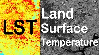
Land Surface Temperature (LST) from Landsat 8/9 with ArcGIS | ArcMap
Просмотров 5 тыс.Год назад
Land Surface Temperature or LST is a measurement of how hot the land is to the touch. It differs from air temperature because land heats and cools more quickly than air. LST is an essential environmental parameter that has several uses in meteorology, climatology, agriculture, urban planning, and environmental monitoring. Remote sensing instruments, such as thermal infrared sensors aboard satel...

Image Classification in ArcGIS (Unsupervised) | Landsat 8 and 9 Image
Просмотров 1,1 тыс.Год назад
A Landsat 8 and 9 Satellite Images can be easily and automatically classified according to the corresponding land use in ArcGIS very easily. In this video, Unsupervised Image Classification Process is explained in the simplest way. #landsat #imageclassification #arcgis #imageclasses #unsupervisedclassification #remotesensing #remosensingtechniques Geodatabase Design: ruclips.net/video/9QA61yn6U...

Geodatabase Designing in ArcGIS for Beginners | Domain Creation | Easiest and Detail Tutorial
Просмотров 1 тыс.Год назад
The geodatabase is the native data structure for ArcGIS and is the primary data format used for editing and data management. Attribute Domain Creation is an easy method to assign certain range of spatial data from a dropdown window to the Attribute Table of ArcGIS. In this video, Geodatabase Designing and Attribute Domain Creation Process is explained in the simplest way. #geodatabase #geodatab...

Image Classification in ArcGIS (Supervised) | Landsat Image
Просмотров 5 тыс.Год назад
A Landsat 8 Image can be classified according to the corresponding land use in ArcGIS very easily. In this video, Supervised Image Classification Process is explained in the simplest way. #landsat #imageclassification #arcgis #imageclasses #supervisedclassification Channel Intro: ruclips.net/video/p1eVkgwyol4/видео.html NDMI: ruclips.net/video/hHUzsJkSFIY/видео.html Area from Classified Image: ...

GIS (Geographic Information Systems) | The Science of Where | Muhammad Al Amin
Просмотров 469Год назад
I am open to be hired for Geoinformatics and Spatial Analysis based Projects, so if you need support regarding your GIS and Remote Sensing based project, please contact me in the below provided Email Address or WhatsApp Number. WhatsApp: 8801874646773 Email: md.alamin.geo.du@gmail.com GIS, or Geographic Information Systems, are computer-based tools used to store, visualize, analyze, and interpr...
Excel to ArcGIS Conversion | Joining Spatial Data from Excel with Attribute Table in ArcGIS
Просмотров 348Год назад
Any kind of Excel Data can be joined with the Attribute Table of and ArcGIS feature or shapefile. This process can also be regarded as Excel to ArcGIS Conversion. In this video, Excel to ArcGIS Conversion Process is explained in the simplest way. #dataconversion #exceltoarcgis #arcgis #exceldata #arcmap NDMI: ruclips.net/video/hHUzsJkSFIY/видео.html Area from Classified Image: ruclips.net/video...
NDMI in ArcGIS | Moisture Index Map in ArcGIS
Просмотров 460Год назад
The Normalized Difference Moisture Index (NDMI) is a numerical indicator to identify the Vegetation Moisture Content of a certain area. The map is simply inversive to the map of Bare Soil Index (BSI). In this video, NDMI is calculated in ArcGIS raster calculator from Landsat 8 & 9 in the simplest way. #arcmap #gis #remotesensing #ndvi #arcgis Area from Classified Image: ruclips.net/video/0Iok7c...
Area Calculation from Image in ArcGIS | Vegetation Map Area Calculation | Image Classification
Просмотров 279Год назад
Calculating area of similar attributes from Image in ArcGIS is a very easy and Simple process. #arcmap #gis #shapefile #area #arcgis NDVI: ruclips.net/video/yNPpyKCXAjE/видео.html BSI (Bare Soil Index) Calculation: ruclips.net/video/b7WVjczF5n8/видео.html Area and Perimeter in ArcGIS: ruclips.net/video/41t2Xt4XcRk/видео.html Digitizing in Google Earth Pro: ruclips.net/video/Iv3PXh7U53Y/видео.ht...
NDVI in ArcGIS | Vegetation Map in ArcGIS
Просмотров 689Год назад
The Normalized Difference Vegetation Index (NDVI) is a numerical indicator that uses the red and near-infrared spectral bands. With the help of NDVI, we can understand the amount of vegetation coverage of a certain area. You can create vegetation map from NDVI according to your study area. In this video, NDVI is calculated in ArcGIS raster calculator from Landsat 8 & 9 in the simplest way. #arc...
BSI (Bare Soil Index) Calculation in ArcGIS From Landsat 8 & 9 | BSI Map
Просмотров 1,3 тыс.Год назад
Bare Soil Index (BSI) is a numerical indicator that combines blue, red, near infrared and short wave infrared spectral bands to capture soil variations. With the help of BSI, we can understand the amount of bare soil present in a certain area. In this video, BSI is calculated in ArcGIS raster calculator from Landsat 8 & 9 in the simplest way. #BSI #gis #modelbuilder #landsat #baresoilindex BSI ...
Stream Order Map from DEM in Model Builder of ArcGIS
Просмотров 513Год назад
Stream ordering is a method of assigning a numeric order to links in a stream network. Stream Order analysis is a crucial part of hydrological analysis. In this video, Stream Order Analysis is explained in the simplest way. #stream #argis #gis #modelbuilder #modelbuilding #modelbuildingtips Area and Perimeter in ArcGIS: ruclips.net/video/41t2Xt4XcRk/видео.html Digitizing in Google Earth Pro: ru...
Calculate Area and Perimeter of Polygons in ArcGIS | Merge Polygons | Area of a Country or Zone
Просмотров 414Год назад
Calculate Area and Perimeter of Polygons in ArcGIS | Merge Polygons | Area of a Country or Zone
Digitizing in Google Earth Pro in 5 Minutes | KML to Shapefile in ArcGIS
Просмотров 2,3 тыс.Год назад
Digitizing in Google Earth Pro in 5 Minutes | KML to Shapefile in ArcGIS
INTERPOLATION by KRIGING in ArcGIS | Map Creation as Image | ArcMap
Просмотров 2,4 тыс.Год назад
INTERPOLATION by KRIGING in ArcGIS | Map Creation as Image | ArcMap
Zero to Hero of Digitizing in ArcMap | Geodatabase Design | ArcGIS Easy Tutorial
Просмотров 7 тыс.Год назад
Zero to Hero of Digitizing in ArcMap | Geodatabase Design | ArcGIS Easy Tutorial
Georeferencing Downloaded Image (Map) in ArcGIS For Digitizing | Scanned Map | ArcMap | GIS TUTORIAL
Просмотров 8 тыс.Год назад
Georeferencing Downloaded Image (Map) in ArcGIS For Digitizing | Scanned Map | ArcMap | GIS TUTORIAL
Georeference and Project Image in ArcGIS | Download Image from Google Earth | ArcMap | GIS TUTORIAL
Просмотров 1,4 тыс.Год назад
Georeference and Project Image in ArcGIS | Download Image from Google Earth | ArcMap | GIS TUTORIAL
বাফার দ্রবনের pH নির্ণয় । pH OF BUFFER SOLUTION | HSC CHEMISTRY | BOARD QUESTION | BAN & ENG VERSION
Просмотров 1,1 тыс.2 года назад
বাফার দ্রবনের pH নির্ণয় । pH OF BUFFER SOLUTION | HSC CHEMISTRY | BOARD QUESTION | BAN & ENG VERSION
PH OF STRONG ACID | শক্তিশালী এসিডের PH নির্ণয়। HSC CHEMISTRY | BOARD QUESTION | BANG & ENG VERSION
Просмотров 2412 года назад
PH OF STRONG ACID | শক্তিশালী এসিডের PH নির্ণয়। HSC CHEMISTRY | BOARD QUESTION | BANG & ENG VERSION
PH OF WEAK ACID | দুর্বল এসিডের PH নির্ণয়। HSC CHEMISTRY | BOARD QUESTION | BANGLA & ENGLISH VERSION
Просмотров 5312 года назад
PH OF WEAK ACID | দুর্বল এসিডের PH নির্ণয়। HSC CHEMISTRY | BOARD QUESTION | BANGLA & ENGLISH VERSION
তড়িৎ বিভব | তড়িৎ প্রাবল্য | ELECTRIC POTENTIAL & INTENSITY | স্থির তড়িৎ | HSC PHYSICS 2ND PAPER
Просмотров 1,2 тыс.2 года назад
তড়িৎ বিভব | তড়িৎ প্রাবল্য | ELECTRIC POTENTIAL & INTENSITY | স্থির তড়িৎ | HSC PHYSICS 2ND PAPER
WORKDONE BY PUMP | পাম্প দ্বারা কৃতকাজ । HSC PHYSICS | BOARD QUESTION SOLVE | ENG. and BANG. VERSION
Просмотров 4002 года назад
WORKDONE BY PUMP | পাম্প দ্বারা কৃতকাজ । HSC PHYSICS | BOARD QUESTION SOLVE | ENG. and BANG. VERSION
BUFFER SOLUTION | বাফার দ্রবণ । HSC CHEMISTRY | Board Question Solution | BANGLA and ENGLISH VERSION
Просмотров 1,1 тыс.2 года назад
BUFFER SOLUTION | বাফার দ্রবণ । HSC CHEMISTRY | Board Question Solution | BANGLA and ENGLISH VERSION
will you provide me Link for the software to download ?
Please can you send me the text flie with the 5 steps? thanks
@@kareniacordova571 send an email here please md.alamin.geo.du@gmail.com
how do we take off the polygon features we have created on map after everything
Tahank you vai. Ami coastal land kibabe extract korbo?? Z value ta koi pabo?
did you use C2L1 or C2L2 data
@@oboipapi867 C2L1
It is helpful for beginners. Please share document containing the formula and descriptions
btw i have to make erosion map with base map raster Erosivity Erodibility,Land conservation,Soil type and than i times that data raster with raster calculator tools after that i have to use zonal statistic as table but the result show are is 0,0.....and my map is 20ha.....i dont know what to do this is my last project and tommorow is the test ahkkkk
@@FaizPutrapratama make sure that your raster datasets are projected correctly (use the UTM zone that corresponds to your study area, search it on google).
Thank you so much via
@@AminulsLifestyle You are welcome!
You may use the BTM projection system because Bangladesh is divided between UTM zones 45N and 46N. Thanks for the great video.
@@Geospatial. Thank you for your valuable suggestion! I will follow it!
Great job. So, can i have a reference for this formula please?
@@mamadoutraore77 doi.org/10.3390/cli10010003
It's a helpful and beginner friendly video to whom are learning Remote sensing
@@Md.HabibullahMasbah Thank you for the appreciation.
Sir meri topographic sheet arcmap me jo folder connect h usme show nhi ho rhi jbki mne vha save kar rakhi h
Thanks ❤
i had to mosaic two satellite images for my study area, can i still compute LST, if yes then which satellite image ML or Al should i use?
@@longkiriterang3534 Yes, You can do that definitely. If both the images are from Landsat 8, then the whole process and the values involved in the process are the same.
why am i getting high number on the lst value/temperature?
Kindly make sure to use the "Landsat Collection 2 level-1" data set. Otherwise it will show an error.
@@geosciencelab Sir thank you for creating this video. Sir, my LST is showing very high values with L2 data. However, the Level 1 data is giving correct results. Can I calculate LST from Level 2 data ? What is the process for that ? Moreover, Is it ok to use Level 1 Data for LST and Level 2 data to show the association of LULC with LST in the same paper? As Level 2 data is considered as good for LULC classification.
Tnx eto sundor kore bujanur jonno 😊
@@mdsadi3294 You are welcome!
I was looking for this types video for my study area map making.. Thank you so much
@@ummayhumayra6750 Great to know that you found it helpful, Welcome!
Good Content!
Thanks a lot!
Thank you, very helpful!
Welcome my friend!
Thanks for the tutorial. Does the correction value for TOA using LandSat-8 apply to LandSat-9? I can't find that "-0.29" in Landsat-9 calibration document.
@@victoriaoyekan Thank you for your comment and sorry for replying late. In my knowledge, there is no correction value required for landsat 9 band 10 image because one of the major stray light issues that landsat 8 had, have been solved in landsat 9.
may i know the source of the UHI index formula?
@@leone2527 Yes, You can do it by using the raster calculator tool
@@leone2527 This is the source: doi.org/10.3390/cli10010003
Are the calculation formulas for Landsat5 and Landsat7 the same as in the video?
@@lanlanhia Actually, for 5 and 7, formulas are different. Follow this: drive.google.com/file/d/17ad5RZfX8IAyvlqlDZ0gO2WQF8nyFlCz/view?usp=drivesdk
@@geosciencelab Thank you!
Important one, thanks!
You're welcome!
Thank you for the video. Great job! However, in my case, the color representation of the urban heat island does not correspond to the urban areas. To put it more clearly, the colors would be more accurate if inverted, but the values would still be incorrect. What should I do? Thank you.
Brother, I calculate stack profile but it is not showing in the display? how to solve?
Sorry for replying late, there was an unrest situation going on in my country, there might be an issue with your software, you can try to create it in ArcGIS pro. Also, try to restart your software and try again, it should work, Thank you
thanks a lot❤
@@lowbudgettravelerbd most welcome!!
great video
@@lowbudgettravelerbd Thanks a lot!
hey could you please send me the word really need it, thanks good video anyway
Kindly, see the description of the video
Make a tutorial on prediction of future LST map.... Please
@@diywithfabiha I will, soon, In sha Allah
@@geosciencelab thank you
Thank you vaiiii
Welcome!!
well explained...really informative video ...keep it up
Thank you so much!
Sir kindly make some more videos of Google earth pro
@@aqsariaz995 okay! Will try to upload soon
@@geosciencelab ok sir
Thank you for sharing a nice video on image analysis. How can I download and follow remotely.
Sorry for the late reply! Here is the free dataset to follow: bit.ly/3N8KIr8 Actually I had already provided it in the description of the video while uploading it.
Title is misleading. This is only for LS8 imagery ans not 9
Thank you for your comment! I actually meant that the process and steps are the same for landsat 8 and landsat 9. Nevertheless the constant values will be different for landsat 9 images and I also mentioned how we can obtain the constant values from the metadata Text file, so that one can fetch the values for landsat 9 as well and follow the same steps.
Great
Thanks!
Big fan vai big fan
🤣 Thanks!
Onekta easily vabe bujlam
Nice to hear that!
Vaia tapgotibidda r ekta video cai
In sha Allah you will get it soon!
I love your explanation Sir
I am delighted to hear that! Thanks
The shape is like face
To be more specific, You can say it looks like a clown! haha!
iwas having challenges with my classification tool and luckily you mentioned ticking the spatial analyst section and it worked like a charm
I'm really happy to hear that!! Do let me know in comments if you face any other problems
God bless you
Hello Sir! Are these annual precipitation data? I mean the annual average rainfall data..?
Yes, they are. but the accuracy of the data was not assessed. I only used it for tutorial purpose.
Great!
Thanks!!!
Good ..keep it up...I love Bangladesh
Thanks a lot for your appreciation 🤍🤍
Wow!!
Thanks!!
Thank you
You are most welcome!
Thank you very much <3 😍
You are most Welcome!
Superb as made so easy. How can ArcGis application be downloaded free. Share a link if possible, please.
Thank you! I will upload a video on the topic soon, keep connected with my channel!
Pls Upload video on 3d maps
Okay sure, Soon!
Excellent!
Thanks!