Really enjoy your fun/interesting/great (list goes on..) cartography videos. In fact, when sending rounding-up e-mails to students in the ArcGIS Pro classes we regularly host (ESRI Prom and Apew courses) I always include the link to your RUclips channel :) Pleas keep up the good work 👍
Welp, I thought my UC map gallery submission was finished.... until I watched this!! Thinking about adding a simplistic inset AOI map using that cool "World from Space" projection and the Moriarty linework, which by the way is sweeeet. At work, my coworkers and I call your amazing cartographic ideas "Nelson Specials", lol! They are always a huge source of inspiration for us. Thank you so much man! Hope you have a relaxing memorial day weekend.
That was excellent I guess the reason to not make the globe a real 3D is to have that transparent frame on top of the other 2D map. Another great tutorial, your tutorials on ArcGis design are the most highquality and enjoyable.
Hi John, Please help me, I can't reproduce your global map. when I use the global background rectangle and change its width to 80 pt, the corners get rounded (not squares like your video), and when i change the coordinate system to spatial view the rectangle layer doesn't cover the hole globe close to the north pole. Do you have an idea of how can I avoid the rounded corners???
ah, this is because the 80 pt wide outline is centered over the edge of the polygon. you want the line to render on the inside of the polygon. to do this, apply a negative offset of half the line's width. So your 80 pt line would have an offset of -40. You can find the offset option in the symbology panel just under the width setting. you can see that in the video but i forgot to mention it with words. sorry for the inconvenience!
@@JohnNelsonMaps Hello again John, unfortunately, the solution you suggest still doesn't work for me. Although I watched another one of your videos and it helped me find a way to make it printable. Thank you very much for your videos!, I just discovered them recently but they are great. You are very good and talented at this.
Hi professor, I would be thankful if you tell me how I can solve geographic transformation error when I want to use the world from space for projection.
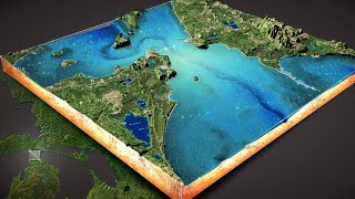
Enjoyed every second. One request, could you please make a video on the whole project? The shaded relief map looks interesting and I want to see how you made it. Thank you.
This is a great approach for a beautiful inset! Thanks John! Any tips on how to achieve this without weird wrap of the Global Background layer when visualizing the mid-Pacific? I work in Hawaii, and shifting the lat/long of center of the background layer results in awkward visuals associated [presumably] with the dateline. Thanks!
ohhh, this can be a challenge. In this case consider not using the global background layer and instead draw a circle graphic in your layout (in the layout's "insert" tab, there is a section called "graphics and text"). you can style a circle the same way you would a geographic layer. i wish i thought of this for the video!
@@JohnNelsonMaps ohhhhmygosh. i've just been banging my head on this problem for hours - setting and resetting the map projection, reprojecting the feature classes, redrawing the global rectangle - and then i thought "maybe i should scroll down and look in the comments". so, wish i thought of that 3 hours ago but at least you saved me! thanks, for all of your very beautiful techniques!
I create a polygon for the global background and symbolize as shown, and that all seems to work fine. However, when I reproject the map to the "World From Space" coordinate system, I don't get a nice "globe" like you see here. There is always some kind of "top of a Dairy Queen ice cream cone twist" up near Alaska / northwest Canada. It appears that my frame isn't sized correctly, as I played around with the size and shape of the rectangle and that seemed to make somewhat of a difference, however, I'm never able to get rid of this and have a nice "globe" like you do. Strange. Anyway, thank you for the inspiration and for showing us how you did this. I appreciate you taking the time to share your knowledge and experience.
ah, sorry for this Craig! i run into that too, depending on the projection and perspective. i'm told it's because deep in the projection engine some amount of generalization is happening and nodes are dropped, so it gets choppy. bummer. but you can download the global background layer here, and just use it right on your computer and it will work perfectly: esriis-my.sharepoint.com/:u:/g/personal/john8409_esri_com/EcrNVzNF7zpBv7AeC1k8b_wBa4kScve9z0xBHvioZtJNrw
@@JohnNelsonMaps Hey John thank you so much for your reply - have been watching a number of your videos and saw how you use the global background - awesome work! Can't tell you enough how much I appreciate your tutorials!


Really enjoy your fun/interesting/great (list goes on..) cartography videos. In fact, when sending rounding-up e-mails to students in the ArcGIS Pro classes we regularly host (ESRI Prom and Apew courses) I always include the link to your RUclips channel :) Pleas keep up the good work 👍
Wow thanks!
Love, love, love this! Thanks John! As a novice, you're continuing to blow my mind.
wow! thanks Angela!
I just used this in one of my map in my bachelor thesis and the opponents of the thesis were excited! Thank you!
well allright!
Welp, I thought my UC map gallery submission was finished.... until I watched this!! Thinking about adding a simplistic inset AOI map using that cool "World from Space" projection and the Moriarty linework, which by the way is sweeeet. At work, my coworkers and I call your amazing cartographic ideas "Nelson Specials", lol! They are always a huge source of inspiration for us. Thank you so much man! Hope you have a relaxing memorial day weekend.
Oh wow what an honor! Thanks much for the kind words!
Thank you John! This was one of the coolest things I have learned in cartography. Just amazing!
Wonderful! Thanks Elham!
That was excellent I guess the reason to not make the globe a real 3D is to have that transparent frame on top of the other 2D map. Another great tutorial, your tutorials on ArcGis design are the most highquality and enjoyable.
thanks Edgar!
Hi John, Please help me, I can't reproduce your global map. when I use the global background rectangle and change its width to 80 pt, the corners get rounded (not squares like your video), and when i change the coordinate system to spatial view the rectangle layer doesn't cover the hole globe close to the north pole. Do you have an idea of how can I avoid the rounded corners???
ah, this is because the 80 pt wide outline is centered over the edge of the polygon. you want the line to render on the inside of the polygon. to do this, apply a negative offset of half the line's width. So your 80 pt line would have an offset of -40. You can find the offset option in the symbology panel just under the width setting. you can see that in the video but i forgot to mention it with words. sorry for the inconvenience!
@@JohnNelsonMaps Hello again John, unfortunately, the solution you suggest still doesn't work for me. Although I watched another one of your videos and it helped me find a way to make it printable. Thank you very much for your videos!, I just discovered them recently but they are great. You are very good and talented at this.
@@juandelmonte4186 oh good, glad to hear you found a solution! all the best to you and your work, and thank you for the kind words!
aaaaah I love your videos! Thank you!
Thanks!
Hi professor, I would be thankful if you tell me how I can solve geographic transformation error when I want to use the world from space for projection.
I have noticed that too. I will ask and get back with you
Enjoyed every second. One request, could you please make a video on the whole project? The shaded relief map looks interesting and I want to see how you made it. Thank you.
Thank you! Here is a detailed how-to: ruclips.net/p/PLPjPOZQjCWEkNDgdYkdchVXutrGO2L9s-&si=gxncNsoJ-AebxFb5
Hi Nelson. Shall we rework on 6:22. this beautiful map of slovenia
go Slovenia!
This is a great approach for a beautiful inset! Thanks John! Any tips on how to achieve this without weird wrap of the Global Background layer when visualizing the mid-Pacific? I work in Hawaii, and shifting the lat/long of center of the background layer results in awkward visuals associated [presumably] with the dateline. Thanks!
ohhh, this can be a challenge. In this case consider not using the global background layer and instead draw a circle graphic in your layout (in the layout's "insert" tab, there is a section called "graphics and text"). you can style a circle the same way you would a geographic layer. i wish i thought of this for the video!
@@JohnNelsonMaps ohhhhmygosh. i've just been banging my head on this problem for hours - setting and resetting the map projection, reprojecting the feature classes, redrawing the global rectangle - and then i thought "maybe i should scroll down and look in the comments". so, wish i thought of that 3 hours ago but at least you saved me!
thanks, for all of your very beautiful techniques!
Dear sir, how to get the world from space coordinate system?
this one is available in the list of coordinate systems in the map properties dialog.
you are the best!
Very nice tips!
I create a polygon for the global background and symbolize as shown, and that all seems to work fine. However, when I reproject the map to the "World From Space" coordinate system, I don't get a nice "globe" like you see here. There is always some kind of "top of a Dairy Queen ice cream cone twist" up near Alaska / northwest Canada. It appears that my frame isn't sized correctly, as I played around with the size and shape of the rectangle and that seemed to make somewhat of a difference, however, I'm never able to get rid of this and have a nice "globe" like you do. Strange.
Anyway, thank you for the inspiration and for showing us how you did this. I appreciate you taking the time to share your knowledge and experience.
ah, sorry for this Craig! i run into that too, depending on the projection and perspective. i'm told it's because deep in the projection engine some amount of generalization is happening and nodes are dropped, so it gets choppy. bummer. but you can download the global background layer here, and just use it right on your computer and it will work perfectly: esriis-my.sharepoint.com/:u:/g/personal/john8409_esri_com/EcrNVzNF7zpBv7AeC1k8b_wBa4kScve9z0xBHvioZtJNrw
@@JohnNelsonMaps Hey John thank you so much for your reply - have been watching a number of your videos and saw how you use the global background - awesome work! Can't tell you enough how much I appreciate your tutorials!
@@CraigH999 ah, that's fantastic to hear, thanks Craig!
@@JohnNelsonMaps Hi John, even using this shapefile the globe doesn't get a circular shape. Do you know why?
@@juandelmonte4186 try a negative offset of half the line's width. so -40.
Genius!
Hey thanks!
Clap clap clap!