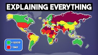
Discover the world through maps

HTML-код
- Опубликовано: 28 авг 2024
- Discover the world through maps: amzn.to/47qEGtS
Join us on a fascinating exploration in our latest video, "Understanding the Map of Earth: A Comprehensive Guide."
From the intricate art of cartography to the diverse geographical features that mark our planet, this video offers an in-depth look at world maps.
Learn about different map projections, the importance of geographical accuracy, and how maps have evolved over time.
Whether you're a geography enthusiast or just curious about our world, this guide is perfect for expanding your global knowledge.


![Oasis - Oasis Live '25 [Official Trailer]](http://i.ytimg.com/vi/gol_JnuEtKM/mqdefault.jpg)


Discover the world through maps: amzn.to/47qEGtS
Do you explain to people that the Earth is round and it is impossible to translate a sphere into a 2D map? I thought it was obvious.
I forgot that people are idiots 🤦🏼
@@Gruby2T A guy in the video surely believes that the 2D map represents it's actual size.
@@tomasgogashvily5350 Because if the map is flat, the earth is also flat.🤯
Africa is about 7500 and Russia about 8000, so your numbers are incorrect, your argument that the size is not accurate is true.
Still doesn't change the fact that there are 49 million kangaroos in Australia and 3.5 million people in Uruguay. wich means that if the kangaroos decided to invade Uruguay , each person would have to fight 14 kangaroos.......
Wow, how original. Did you come up with that yourself?
The population of India is 1.5 billion+
so as per you Australia has 49 million kangaroo, let me enlighten you, an average person pee around
1L to 2L a day, considering this fact that u said about kangaroo and Uruguay if 1.5billion Indians just pee in Australia then there would be a tsunami that would stop your 49 million kangaroo and drown them😂
bro i'm out 😂
I think I could take out at least 2 kangos before I ascend to Valhalla.
It's something I often ponder about too
Because "Every 60 seconds in Africa, a minute passes."
Dude really? It's the same here!
@anisaiki-do4vq Bwaaahahahaha, you obviously didn´t get mine. Believe me, I absolutely got it and thought the funnniest way to react is by mimicing one of those stereotypical users with, lets say limited knowledge about everything outseide their glorious country, commenting every so often.
@@alexanderkupke920no, only in Africa. Every 60 seconds a minute passes
Here in India every 60 mins an hour passes
😊
I'm really happy for this man finally discovering maps aren't to scale.
I’ve seen this argument so many times before by people who know nothing about maps. Let me break it down. (Im speaking from 6 years of nautical navigation experience).
What you’re looking at is the Mercator projection. A common map style that is used for air and sea navigation. It takes every line of latitude and longitude and makes them the same distance apart from one another *regardless of location*. This in turn makes the land masses that are further towards the north and south poles stretch out. This map style is important so aircraft pilots and sea navigators can plot a course from point A to point B using the shortest distance possible since every LAT/LONG spacing is equivalent. As you can see when he changes to a map that scales countries to their actual size. The land masses near the equator did not change.
Nobody is saying Greenland is that big. You’re just looking at the wrong projection.
Thank you for the lesson, I didn't know it had to do with air and sea navigation. Very interesting makes sense now.
Still, we could have been given both variations, however we were not. So it leads us to the question why. Is there nefarious intent. If so , fvck you. The truth will come out and this will change.
All those years at school to learn that crap 😂😂😂😂
Come I teach you how to do farming business bro
@@startexercisingtoday no problem. Glad you were receptive!
@@mlcmlc4301 I’m good on that bub.
This dude is giving “I’m 14, just smoked weed and this is deep” vibes as a 47 year old
Is he lying?
@@soumi1984 He is lying..
for example Russian trans-Siberian railway (that goes only from Moscow to Vladivostok and NOT from one side of Russia to another) is 8300 km long so the whole length of Russia can not possible be 6000 km as he says 🤷♂️
@@splifstar85good check on google map
The dude’s a Billionaire… His name is Saygan Yalcin…
@@splifstar85lol is it a straight line genius 😂
They DID tell us in school... you didnt pay attention 😂
Hahaha exactly😂 dramatic music in The background makes this more hilarious😂😂😂😂😂😂
Alot of people say don't go to school when they don't listen to there teacher lessons, but most schools don't teach this
White man education, remember that.
yes probably also left midsence like in this video
Which shool huh? , 😅
Actually, in the Netherlands, we are told this and that the distortion comes from trying to put spherical information on a flat plane. So the greater the distance from the equator, the bigger the distortion.
White people will believe anything that makes themselves look superior 😂😂😂
I don't know what school you went to but as a scandinavian our teacher showed us a globe and explained why Scandinavia look so big.
Why bro?
Yeah, why bro, don't leave us guessing...
Let me tell you something!
Explain bro why left us hanging?
He doesnt remember why, thats why he doesnt explain it. Dont you guys understand😢
"This is the real map" *proceeds to put random new oceans between country borders
Not oceans he just separated some countries to show how large Africa is…..
@@zi3416 No its so that the countries are on the correct location on this flat projection. Its impossible to project a globe map on a flat recangular plane without distortion in either size or location
Similar to the orange peel map.
Yes, the "Impossibility Theorem" in cartography.
Russia was still wider than Africa
I thought you could travel through Europe with car, but according to this guy traveling through Europe you need a boat.
Floating car 🚙
You are retarded my friend
😂
It's because it needs to be a globe so that the countries stick together with their true size
@@amarrevolver4452globe........
Well, they taught you at school, but obviously you weren't paying attention in class.
You've been told in school, you just weren't paying attention.
When you reach full grown adulthood and have never seen a globe
this guy is a Billionare, he can buy ur whole family, hes way smarter than everybody u know little bitch
Globes are for the immature children who are too afraid to do some serious research 🤦🏻♂️
Have you? Other than cgi and pictures 😂
@@melvin8929 My reply was erased. If those who believe in flat earth are so silly then why the heavy censorship? 🤐
@@melvin8929oohh a random flat earther appears 😂😂
this guy's gonna flip when he realizes he can turn his underwear inside out for another day of use.
😮 bro thanks!!
Stop, that's nasty. You seriously do that?
That’s gross
Just get more pairs
Just wanted to thank you, but then I've seen you wrote "another day" of use. Nah, bro, it's for another week of use.
Thats a mud butt
It isn't wrong, it just a projection of a curved surface onto a flat surface. In school you would have seen a globe, with all the surfaces in correct proportion.
Buddy didnt listen enough to know the difference between the ship and cargo map versus the actual map, everybody who listened for 3 mins in class already knew it was a boating map
We have been told this in school. Aside from the 2D-Maps in your Atlas Book, there are World Maps printed on Globes. Spherical Maps of the world. The distortion you are showing is a result of mapping a 3D sphere onto a 2D-Sheet. On the Globus, the Sperical Map, you have the sizes of countries right. People who do not pay attention in school miss some details appearently.
It's fine intentionally. Make a long story short, it's white supremacy. No more and no less.
You took the words right out of my mouth!
It seems to me that Americans don't go to school to learn such obvious things. Their whole system seems to teach violence and greed only.
this is correct... this guy wasn't paying attention or he's a woke Biznitch with an agenda
@@deVeaux3962 How does mapping a 3D world onto a 2D medium distort in that particular way? I really am curious.
The distinction between the Mercator projection and the true scales represented by the globe were the first damn mention in my 6th grade geography class.
But why do that though. And the fact that it’s taught in 6th grade doesn’t make it right. On the contrary. There is no excuse for doing that. And maybe he did not attend 6th grade in the US. Other countries do not necessarily teach this and so imagine how much easier it is for the plunder of resources we observe in Africa. Makes so much more sense.
@@cbm2770bcoz u cant directly put the Sphere object into the flat 2D object
They love teaching things that don't make sense. They also teach that boys can be girls and girls can be boys if they believe it hard enough...
Because you cannot project surface of the sphere to a flat plain, maintaining distances and angles.
@@cbm2770 Then figure out a better way to project a 3 Dimensional sphere onto a 2 dimensional plane, smartass. On a projection like this, landmasses in the middle will be smaller and in the corners they will get bigger. This has nothing to do with colonialism, wtf
No wonder many people think Africa is one country.
Imagine trying to educate, while not knowing how maps work.
We were told this in school that,
that particular map was distorted because we were not able to see a flat map on a globe. You just weren’t paying attention.
What projection map is being in text or paper map then? This would be a distortion of facts if mapmakers were using the Mercator projection instead of the Peters.
*proceeds to shrink africa specifically by 'accident'*
@@ayouberrazki5602 found another person who wasn't paying attention during geography class
@@ayouberrazki5602It's not really that Africa was shrunk, it's that other countries were 'blown up'.
@@roejogan2693you can put everything to scale
Bro just discovered a 2D distortion of a 3D object. Someone get this guy a middle school diploma quick
Your middle school told you that and you believed it smh
@@Mynewhandle420distortion is true, it's just that they don't teach that countries are actually different sizes to what the map looks like
@@wafflemangaming282in the US we were taught this in elementary, then the federal government got involved in indoctrinating our kids instead of educating them, and here we are. A dude on RUclips who, apparently, is as dumb as a box of cow dung. 🤷♂️🤷♂️
Yes they do
I'm stupider now for reading your response I can't believe it's highlighted
Btw the guy takling is a multi billionaire called Saygin Yalcin
This was is taught in schools. Clearly, you either didn't go to one or weren't paying attention. This map is specifically for marine navigation.
The reason is simple: the world map was first made during colonization of the world. And they made some larger and some smaller to keep the idea of a big empire alive.. even though they were small compared to the countrys they wanted to colonize
I remember learning about different map projections in school. People just didn't pay attention xD
I was going to say the same thing... pretty sure I was about 11 when they covered this. (Not in the US ofc, a proper education)
@@TukikoTroy i did say that same thing, but in a far less civil way(from the US, hello fellow educated individual :) )
I remember learn about a White Jesus born in Africa. 😵💫😵💫😂🤣🎅🧑🎄🤡🤡
@@TukikoTroy Geography was my favorite class in school, and in 6th grade we not only memorized all the countries in each of the continents, but major lakes, rivers, and cities along with correct spelling. Your proper education forgot to teach you grammar. Bravo.
@@Shayzare he was a middle eastern Jesus born in the middle east - you don't fix one error by making another error
I was told this in school. The map is distorted toward the poles due to representing a sphere as a rectangle. It keeps the lines of latitude and longitude proportional to the areas of the map. It's not a plot against Africa.
It's a PLOT FROM COLONIALISM.
Glad some people have common sense. I hope the man in this video isn't a pilot or a captain. I would much rather use a distorted map and arrive at my destination. Maybe one day in his search for continental equity he will use this map and end up stranded in the ocean. He would be doing more good there.
@@damudderburd3939 Continental equity! I have no doubt that's a class at some university somewhere. 😆
This is what I understand it is distorted because of the sphere
@@damudderburd3939why do you say that?
😮wow. My shower curtain is wrong.. I need your map as a shower curtain to re-educate my adult children.👏🏿
The second picture perfectly explained why we use the first one
Because then we would not be able to connect lands correctly as in his map but to give just where what is located to kids for further understanding of ocean currents,tectonic plates,or prevailing winds . If you go to a real geosurvey laboratories you will maps for only city or state survey . For a world they use globe or a digital globe
It's like potential energy is mass×gravity ×height. But this is stupiditly wrong but to just make a little perception of world
Imo both should be taught one to show how landmasses connect and one to show real size of continents
I can't breath 😂😂
Bruh 😂
This is called "Mercator map", intended to simplify marine navigation, and not for measuring countries with a ruler.
booyah!!!
Every month someone discovers that maps aren't drawn to scale as if this isn't taught in 4th grade.
They try to make Africa little..
Liers more white washing and conquer tactics
Exactly, if you sail on a constant bearing it makes a straight line on a Mercator projection.
We are taught this in school. It’s because the world is a sphere and when you extrapolate that into a 2D sheet of paper things are warped
I'm from Australia, on Google maps I noticed they even scale us down to look smaller than the USA even though our country is massive in comparison
"Let me tell you something" guy who is about to fall in bungee jumping platform.
Shut up
😂😂
Lol I lost it when I read your comment
Even thought of the same thing man 😂😂
Haha i know him and was thinking the same thing😂😂
It’s called the mercator projection, and it’s not just Africa. In order to make a globe into a flat map it has to be skewed. All the countries in the middle becomes smaller and all the countries closer to the poles gets bigger.
At least someone has a brain
That's garbage and you know that. It's called deception.
Jajajajaja jaja you stp1d
Thank you. We also have photos from space.
Yeah but the famous map is the one that shows the white men land bigger than in reality....you have different angles to show the map you know ...
You look at the map and u see the world....so they choose a map that makes them seems bigger ...they choose the map that works in their favor
There’s a lot they don’t tell us in school. A well informed and educated society is harder to manipulate
This is called Mercator projection.
In the Mercator projection:
Areas near the poles (like Russia) appear much larger than they actually are.
Areas near the equator (like Africa) are represented more accurately, but in comparison, they appear smaller than they truly are.
It's called Nonsense cus even on an artificial Globe the same specifications are used
It's not about discrimination towards Africa, it's just how Mercator projection works
Yes but who chose that particular projection and why?
@@Dannnika13 Sailors because it makes it easier to measure distances.
@@Dannnika13Because the earth is a Gleason map. Happy hunting.
@@GinsengLi Europeans didn't discover the glove wtf.??
@@GinsengLi
🤣🤣🤣 your ignorance pleases me immensely.
If this guy ever sees actual intercontinental flight
paths his head will explode.
Exactely, how is it not flat if the flight routes say it's not round.
He'll be wondering why these airlines are wasting fuel flying non-straight flight paths.
He did say that the map was made like that out of practicality, so he clearly knows why it's like that. And he brings out a good point about how people are used to thinking of places like Scandinavia as much larger than they really are
Come in France, they'll teach you how impossible it is to translate a profound dimension in a lesser one 😂
All you need is a globe for goodness sake.
These flat maps were navigation maps. When I was little every classroom had a globe. In the 18th century, ‘use of gloves’ was a lesson. One this young man could do with.
This was like the first thing they taught in school
Not mine lmao
@@cheenis420let me guess - murica 😂
It was actually the first thing I leant in geography class, we had a chart on the wall with all the continents in order of size.
@@Groovymotionwell, actually canada lol. Maybe I just forgot it or something cuz I remember having to learn this on my own
No sht, every halfwit knows this
that's why my teachers would use a globe whenever the could
Yeah. My teachers frequently mentioned that maps always show a distorted view. The greater width covered, the greater the distortion, thus a map primarily showing the border between Canada and the USA, or a map of Chile would - comparatively - have low distortion.
You could just look up square kilometers or square miles and that's all you need to know. Russia still the largest that doesn't change Canada is the second largest that doesn't change, there's your reality.
@@Right389You don't get the point now do? I think you left not right
Meanwhile Sticker on Globe day: "Not for educational purpose, but only decorative purpose."
This proves you're a gullible fool.
He is so right. Africa is the largest continent. Make it look small so no questions arise about its western exploitation.
They taught this in school in the 50's. It's called a Mercator projection. If you had the complete map in front of you Antartica would look huge. It wasn't done with any intent to harm Africa it is simply the result of putting a spherical projection onto a flat surface. It is difficult to put a world globe in a book it gets kind of bumpy and large so someone invented a way to put it on a flat surface with one simple caveat. I'm sorry if they didn't teach it in your school.
We were told in school. The north pole is just a dot and is as long as the equator... It happens when you project a globe on a flat surface.
This guy just made an ocean between US and Canada and said this is the real map. I feel sorry for anyone who believes they can learn something on the internet.
Same with Spain and France 😂
Are you fu@$n stoopid??? He split them so you can reference them easier
No, he didn't. He was separating specific places around the globe to show clear size in comparison
Their is a real map my teacher showed the map before land was taken along with rich's and it's people.
Imagine being 40 years old and having your mind blown by something taught to 11 to 12 year old children in school.
It's cute when they try to be smart
Smart my ass.😅 He's stupid af.
He thinks earth is flat.
Everyone knows africa is almost 2 times bigger than russia, its just he had shitty school.
bruh dont you understand it lil bro? he just said schoole dont teach. and a lot of them dont. sorry for trying to educate people hopefully that didnt hurt your feelings our offended you!
@@robplotts9412 its cute how you try to be relevant but yet you are nothing.
@@MKA_Envy2Maybe just maybe it's because it is mathematically impossible to translate the size of things on a globe to a flat surface.
People who want to learn some don't go to shool... Rick and morty
As a European I'm quite certain that Europe is FAR from being submerged.. not to mention the fact that Baltics and Russia are ACTUALLY bordering each other, without an "ocean" in-between..
What are you saying? (😨)
I can just walk to get neighboring country? (😲)
@@Mr-Cane 🙂yes.. well, you can walk freely within EU.. to get to Belarus or Russia you need a visa and cross the border.. but no "ocean" 🙂
@@san0saky all these time!!!
I have been swimming through that hard and solid water and now i know it was just a road...... (😭)
@@Mr-Cane that's what Russians do to you.. they make you think "ground is soft water", or that "Russia was attacked by Ukraine" 😕😀
Same with the US and Canada. I guess this whole time people have been driving their car boats across the border.😂
It’s called Mercator Projection. Taking a sphere and projecting it onto a rectangle makes things easier to visualize and helped with navigation back in the day. Because of that though things farther away from the equator appear bigger than they actually are. We have maps where the earth retains its spherical proportions and land masses stay true to size, it’s just harder to look at and read for a layperson. We’ve been doing this for a few hundred years lol.
So what is wrong with the knowledge he gives us here? Why dont you place the south hemisphere upward? It seems that this is not only a simple map technique.
Type in “Jane Elliott world map” and she’ll tell you why they did the map that way.
@@fayyadking761 there is always another suitable explation.
@@user2167-gz9ki Asians, and Europeans have been navigating the seas for thousands of years. A colossal portion of the southern hemisphere including Africa still aren’t. Why would navigators create a map that would only benefit the people who wouldn’t use it?
Lmao there is no 100 mile wide space between USA and Canada so the map he created is dumber then the ones we use. The maps are made not to be fair to the size of a country who cares how wide Africa if the rest the map has no knowledge that is worth anything.
You were told this in school. There’s a whole section on map projections. Why didn’t you pay attention in school?
Wait til he finds out that earth is spherical.
I think i lost braincells watching this video.
Hilarious
@@ctesta5835 Very. If you're no smarter than a toddler. Which this guy is.
😂😂😂😂😂😂👍💯✅
He’s right…
but my faith in humans was restored by reading the other comments. His own facts were a little twisted in the other direction, imo
What I don't understand is how this vid still gets a majority of likes that don't seem to jive with the great majority of comments.
This guy got 90% of his education from youtube.
That seems unfair to RUclips 😂
RUclips has been turning average people into morons for years now.. 😅
Did he say something incorrect?
@blackseed9293 yes, the explanation for the size of Africa would probably be that the earth is a sphere.. and it need to be shrunk when you lay it flat so that it fits better... its well known.. except that we have some people moronic enough that they don't understand the earth has to be a sphere.. so this is being made into something new?? I really don't know.. the post is dumb. Everyone knows the map is scaled to fit.. if you don't.. meh.
@@chriss4432haha. That made me giggle
Give this man an award because he apparently solved border control with Mexico… look at satellite video if you need the scale.
We have been told this in school, it’s the problem with taking a globe and transferring it to a flat surface. There are other types of maps
That's what they told you but that's not he real reason why it's presented that way.
@@quincybirwood2629 and what is this real reason?
@@Biggozzoif u know u know 😊
The difference is that back in the 1950s we were taught it at school where we were shown a globe and how and why the Mercator maps were drawn.
Wait til he finds out we drive on parkways and park on driveways.
Shhh bro,I don't think he will take it well😅
Wait until we tell him we live in buildings. But can't while they're being "built".
@@jeremyhenry3126 as both a carpenter and a fellow Jeremy,that's farked!😅
@@noassociation85 😆
I did learn that in school in the 80s... Africa was the biggest continent! ❤
Bro actually thought he was on to something.
Yrs but seperated European coutries.
they went into great detail about this on a X-Files show they just want to European nations to look bigger than Africa why people play mind games
No that's you, he never implied it was part of a greater conspiracy or even a conspiracy at all... it's just true. I guess you thought you were on to something...
@@michaelhiggins2109 Who says being on to something implies its about a conspiracy?
@@michaelhiggins2109 brah he said you don’t get taught this in school THEY HAVE EARTH GLOBS THAT ARE ACCURATE 😂😂😂😂
You made your own map, use it, nobody is forcing you to use the other
We are all happy they showed us the map the way it is with Russia and USA being large and Africa small.
We have been told. It’s called the “Mercator Projection” or “Mercator Effect.” Taking a 3D sphere and putting its contents onto a 2D square map results in certain portions of that map appearing smaller while others appear larger. The closer to the center of the 2D map you get, the smaller the land masses appear because they need to be condensed more in order to fit all of the spheres contents onto the map; especially the north and south poles in our case.
Most underrated and under appreciated comment here ^
Yup
Quite the opposite. When photographing a 3d globe everything in the center will look bigger; everything on the edges will look smaller... Same with the eye. True eye perception gets lost on the sides because the view isn't direct.
Elementary my dear Watson
They actually taught this back when I was in school. I am almost the same age as dude, he must have missed that day 😂
@@unleavenedkaraiteplus3412
No, when simply photographing a sphere you are correct. But taking everything from the side of a sphere that is opposite of you and putting it on a 2D piece of paper so you can see all of it at once requires all of the contents on your side of the sphere to be condensed into apparently smaller land masses in order to see both sides of the sphere on one side of a 2D piece of paper.
We DID learn this. In ELEMENTARY SCHOOL! Our teachers showed us a GLOBE and then, explained how different a flat map has to be and why.
Even the globe is wrong... all wrong...
@@ryanwyrick6947
In what way?
AFRICA IS THE LARGEST CONTINENT STILL.
@@swinde we dont live on a globe.. period
@@ryanwyrick6947
Ok, but I do live on a globe. If the Earth was flat , there would be no need for the Mercator map.
Bros gonna flip when he realizes everything he just listed besides Africa were countries and not continents.
I mean... I'm from the Midwest and my teachers always told me about how turning a 3D surface into a 2D map skews the proportions. I'm 37 and have known this since grade school.
Right? I'm 70, and have known this since elementary school. The question is not "Why weren't we told this in school?" The question is "Why did you not learn this in school?"
@@deVeaux3962
Because it wasn't taught... which I suppose is your point.
@@djbryson Well. . . not actually my point. It's been taught in Geography classes since (in my memory) the early 60's, and I'm certain before that. To clarify: my question is "Why, when this has been taught in schools for decades, did this guy not learn it, like the rest of us?"
@@deVeaux3962
This was never taught in my schools.
Except that's not the issue at all. Look at his new map, it's ridiculous not skewed. lol, there is an ocean between Canada and US?? This is blatant propaganda of our enemies, diseducation. ... and it works.
It also might be connected to global warming activism, cz his new map looks like a flooded Earth
I 100% remember learning this in school, and why it's done, it's not possible to accurately make a 2D representation of something that is supposed to be 3d, without stretching and shrinking some areas.
Ok if that's the case why not shrink and stretch it in such a way that it will show that Africa is actually bigger?
@@TheRTM well for starters because africa is a very central location and by shrinking that continent you stretch all of the rest inwards, wereas focusing the shrink on other less central continents could result in a more warped image.
Also I imagine, because while africa is developing itself quickly, most of the already developed world involved in logistics, tourism, wtv, is outside of africa. Especially when you consider when this map was first drawn up.
@@shawnwolvin9200 you didn’t really answer the question.
@@TheRTM yes, I did. Shrinking Africa results in a less warped map than shrinking other continents because of it's central location. And furthermore, africa is less involved in global logistics, travel, and tourism than other parts of the world, therefore the map is made to show greater detail for the areas that are. This was especially true when the map was first drawn up. That's not just one, but two very justifiable reasons why the map is the way it is.
But I get it, it doesn't quite fit your narrative does it?
Correct. And this is called "Mercator Projection".
Think of it like this, u build a massive acquarium (whatever you wana call it) then but real mud, real grass, real everything, put insects. Pretend that you can communicate with them, you can get them to believe every single word that u say to them. Thats on a small scale. Everything we have been tought is fake. Have a good life everyone
Learned that in 7th grade geography in the the 60s, i specifically recall my teaching telling and showing us reasons the current projection was only used for navigation. I guess later generations of teachers kept shortening curriculum to the point salient details were lost....
That new ocean between the US and Canada is wild, also the huge river you have to cross to reach Mexico lol
Lol
I'm pretty sure we just separated them all to show their true size in relation to each other
@@LN-Lifer yeah I know, when converting a 3d map to 2d requires a little tinkering to get everything to work. I was just hunting and you ruined it hahahah
That's how it actually feels when you crossed it swimming 😂😂😂😂
@@GerardoCSpike
Lol we should fill that river with alligators and make the swim even longer....or shorter 😂
@@GerardoCSpike lol that comment made me choke on my beer
We were taught this in school, probably about 11 years old. It's called the Mercator Projection and was originally designed as a nautical chart so you could draw a straight line between origin and destination. The more accurate projection is the Mollweide Projection. No conspiracy, just ignorance and a lack of appreciation for historical tools.
Western world delusion! Similar to calling Poland an Eastern European country when it is located completely in Central Europe just for making Poles some type of cheap white skinned workforce
Well explained. Nothing more sad as an ignorant thinking he is intelligent
If government will pee on your head and tell you it's a rain, you would believe that it's a rain. You're a part of the problem. Dumb ass 🐑!
VERY happy to see this comment! I came to say this, or hoping that someone else would have already.
Bro clearly didn't understand a shit during those classes 😂
That map was made for a globe. Everyone is told about the problems with the Mercator projection map. Where were you that day?
School teached me that. In math. "When would I ever need math in real life", eh?
We literally had an entire chapter in our textbook about different types of projections for maps and the distortion that they cause.
Thank you I was learning this in 6th grade by Miss HJ
I learned this in 4th grade in the 70s.
Just because you didn't pay attention doesn't mean it was never taught.
Shut up bro.
Excellent Analogy! Makes you wonder where he went to School.
They one hundred percent taught us that in school. They also familiarized us with a globe. Where it is shown the correct size.
I’m South African, and we were absolutely taught about different projections and the reasons for using different ones. The Mercator is ideas because it gives accurate shape and for directional purposes.
Tells us the world map is wrong
Proceeds to show us a map even more wrong
Yes... the small "dot" called sweeden is 4500 km long... compare that to russia size on his map
Lol everything is an island
Thats what I thought too
Sweden is 2000km bro not 4500@@trux4life907
@@starxlord9856Yes!
As an African i really dont care how big or small Africa is
Unity is what i care most
What county
Same my brother, unity is the best ❤ love from Iran
@@alainliam9391 I'm from America and I want to say that their are some of us here that hate the demonization of your people. Mashallah! For the people in my country to act as though they have some sort of superiority when they sent our women and our sons to murder innocent goat herders in deserts across a great ocean... It's shameful
What??? He's not even talking about people or unity. He is talking about misinformation. Let's all unite over knowing the truth. There are many different types of maps and we should be taught about all the many different ways a maps where made. That's what school is supposed to do.
Always the African guy saying size doesn’t matter… F@ck off mate
We have been told this in school but you weren't paying attention.
Better not tell them the Earth is flat they will think you're crazy
The leftists would say that the map is racist, but in actuality, it is a planification of a sphere. Since the African continent is on the equator, it doesn't get stretched as much.
And the rightists would claim to be able to read minds.
😂😂😂😂
Would not say exactly "the leftist", but this method (Mercator Projection) of world-mapping was introduced by Europeans and people from the northern hemisphere. If someone of the southern hemisphere would do it, Africa is way bigger and Europe, North-America, Russia and even China much, much smaller :)
@@thinktwice5035no. The earth is not only a sphere but it does have an axis and poles. So no matter, where you live, if you want to keep the angles between longitudes and latitudes correct, you must stretch the surface the more north or south you get. The only reason Africa is less stretched, is its location on the globe.
@@ThomasVWorm You are right. I mixed it up with cone projection!
This dude just wasn’t listening in school.
....or he's just plain dumb.
We have been told that it is a Mercator map. And it is. It’s used for display not for actual navigation. Africa is one of the few that is displayed right, it should feel proud…
We must implement this map. Also give the people of my continent more hope. My African people❤❤
And all these times I drove from Canada to states I never realized I crossed an ocean.
Canada is also 7400km so it should be bigger then Africa still but its like half the size. I dead ass did not see the ocean there though. Thats even better
Birather he compared current shown size to original size, he just shrink countries
Africa is already bigger than it needs to be on any map so what are you on about?
@@potheadzassociation6338 Damn, Africa is bigger than earth? That seems wierd…
And all the europe
Countrys have oceans too 🎉😂
Last time I checked, I didn't need a kayak to get from the United States to Canada.
I guess the is why Justin Turdeau always says from sea to sea to sea. Not kidding. He says it almost every day.
My father has been to Canada as a truck driver, more than once. Never did he mention using a ferry boat for his 18 wheeler.
You can actually walk😂
What about the portion of ocean separating Mexico and the us
Lmao you dont this dudes wrong too, the country’s aren’t that big they had to stretch them when they were making the globe so just imagine the first map but Africa and South America are bigger than Russian and Canada
earth globe: Am I a joke to you?
Don’t be stupid, it’s the best presentation possible in flat surface as the earth is a globe and if everything was presented in it’s true size then you’ll have problem with distances.
Rather than criticising, create a true representation if you’re that capable!!
My guy forgot the globe is a sphere.
Meaning? I’m sure you flunked geometry.
And so what?
@@replicas10that means a lot of the scaling has to do with converting the map to stretch over the globe, and converting the globe onto a flat map.
The issue is about land size only. When you buy some maps, they print in the bottom corner that Africa is shown 14 times smaller than actual size.
@@Gabriel2oh6thanks, I just looked it up 👍
I don't know what they teach you at school, but in Belgium, you learn at a very young age that the world map is a Mercator projection. There are other projections, like those shown in the video, but the Mercator projection is the simplest for representing a sphere
Or change our perception
So earth isn't a globe is what you're saying
Je suis Français et comme toi j’ai appris à l’école que des mensonges sur la quasi totalité des sujets étudier !!!
La terre ronde qui tourne sur elle même 😂 faites des recherches et vous comprendrez beaucoup de choses rechercher les origines des dinosaures ou encore étudier la théorie du darwinisme 🤣 et le voyage sur la lune 😂 les voyages dans l’espace 🤣 et bien d’autres !!!
LA DIFFÉRENCE ENTRE VOUS LES GLOBISTES ET NOUS LES PLATISTES C’EST QUE NOUS AVONS FAIT NOUS MÊMES DES RECHERCHES QUI NOUS ONT ASSURÉS DE CE QUE L’ONT EST SUR DE SAVOIR !!!
VOUS AVEZ FAIT AUCUNES RECHERCHES VOUS AVEZ SIMPLEMENT RÉPÉTEZ CE QUE LE SYSTÈME SCOLAIRE VOUS A APPRIS (=la NASA) cette outils de propagande n’est qu’une énorme arnaque faites vos propres recherches et remettez toujours en questions ce qu’ont vous dis sinon vous finissez par dire que l’eau ce courbe sacré Débilité !!!
Faites comme lui des recherches posez vous des questions sur comment cela fonctionnent et vous verrez des énormes incohérences et à tous les niveaux !!!
DÉJÀ ILS DISENT EUX MÊMES QU’ILS ONT PAS ÉTÉ ASSEZ LOIN POUR AVOIR LA TERRE EN ENTIER DANS UNE PHOTO ET QUE C’EST LA RAISON POUR LAQUELLE IL LES PHOTOSHOP PAR ORDINATEUR 🤣🤦♂️🤔
I think it's called the Mercator projection, and it emphasizes visuals over practicality, so instead of ugly but correctly distanced country borders we get nice looking but out of size country borders
We Arabs know this for the Idrissi map, but in education, the United States asked to change the maps.
Dunno where tthis guy went to school, but we learned about map projections, why they exist, their inaccuracies and covered specifically the most common projection, the Mercator projection, in 3rd grade.
He just want's to play victim and blame the white westerners
You went to a good school bro. But the size of Africa doesn't change Jack shit
No body is taught that in the UK
I call B.S. on that. I slept through most of my school time but if they told the truth about something they would have had my full attention.
@@davidwydra2401 I wish I had access to gifs on yt...
Who’s gonna tell this man that none of those countries have oceans running through them ? 😂
Dibs out.
He knows, it was just difficult to put all that real sizes together,
It's not an existing map,
So respect for his work
@@samuelahibo339 Asia is bigger than Africa and Europe combined hes wrong
Very educational for people who dont know that they reside on a very large land mass
If people actually used their brain they would realize the earth is a globe and most maps we look at are flat so there will be distortion…. and if people listened in school then they would remember the term “Mercator projection”
Wait until he realizes circular pizzas are cut into triangles and put into square boxes
😂😂😂
Seems unfair to Africa, right?
🤣🤣 @@duckman12498
@@duckman12498There’s a reason for that. Before anybody gets offended, the north half of South America is also larger. So Africa isn’t being singled out.
😂😂😂😂😂😂😅😅😅
It’s called a map projection, you cant put a sphere on a flat map without distorting several parts of the true scales of the land. This should have been learned in elementary school
elementary schools dont teach you that my friend
Everybody thinks they’re a fucking scientist! You could be any more wrong, and now you’re going to be bombarding me for fucking answers. But the reality of it is, you’re going to believe what you’ve been programmed your entire life you believe the man way too much get him credibility in the moment somebody comes to prove the mad wrong you like a loyal dog die for your masters!
@@grismaa1000yes they do
Ok I get that’s how they do it for the globe, but in real life if the sizes are distorted from the globe sizes then I’m goin based off the real size
Excuse me!!?!? Excuse me boys I’m about to tear this guy new one (fingers cracking) watch you run amok every question I ask you! Ready let’s begin
It's because in the school they wanted us to only focus on certain countries
At school we have globes, not only flat maps...
The man learning the map projections. Congrats buddy you’ve learned basic geography.
Yeah but why the distortion is always making Europe and US bigger, and Africa, South America smaller? Actually, why is NA/EU considered “north” and the other side “south”. Yes you’re smart to realize that’s a 2D map projection of a 3D planet but not smart enough to realize certain other things like power, interest, influence and control.
@@12pureI caught what you're laying down brother, but most of your commentary have no clue❤