buenas tardes GERARDO FELIPE ESPINOZA PEREZ. al final del vídeo mostrabas los pixeles de acuerdo a sus valores, para llevarlo a plano y tenga una mejor presentación. vale decir se puede realizar una interpolacion luego ? saludos agradecería una cordial respuesta atte: EDWIN PERCA CUTIPA desearte lo mejor para ti.
Hello Meike Erthalia This video was made for a friend of mine that desired to convert each pixel to a polygon. I've changed the classified symbology just for a better visualization of the result.


Gracias por el apoyo, funciono de lujo.
Thanks for the support, i't's works great!
Amazing video I never seen like this >> #PakGISRS
Hi Gerardo I want to get NDVI as classic (1:-1) from last one
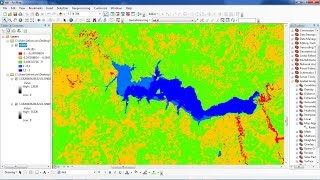
carlos.. the Gridcode field is automaticaly created by the raster to polygon tool
wow...
Actually NDVI ranges from -1 to +1. isn't it ? how this 1 - 100 values possible /
buenas tardes GERARDO FELIPE ESPINOZA PEREZ. al final del vídeo mostrabas los pixeles de acuerdo a sus valores, para llevarlo a plano y tenga una mejor presentación. vale decir se puede realizar una interpolacion luego ?
saludos
agradecería una cordial respuesta
atte: EDWIN PERCA CUTIPA
desearte lo mejor para ti.
After raster calculator what tool is you used?
Many thanks for the video ,how can I download images from CEBERS?I need a help, if you have a video on it you can share ,thank you!
thanks for the support
Hello, How can I find the current satellite images for NDVI
we can also use reclassify before raster to polygon, so we don't need to change the value from your previous processing
Hello Meike Erthalia
This video was made for a friend of mine that desired to convert each pixel to a polygon. I've changed the classified symbology just for a better visualization of the result.
@@gespinozpaerez how to reclassify the values in ndwi
How we can reclassify meike
what does times 0.5 twice for? and what does times 100 for?
is a way to stretch values from -1 and 1 for 0 and 100...
hi tksyour formula of raster NDVI multiplicatio is it empiric or published I didin't get how you index calculate?Tksin adJm
hello jean-marie mudry
Is not a cientific procedure.
Is just a linear regression made in Excel.
-1 = 0, 1= 100 and so on.
why do we need those gridcode?
hello neufal.. this procedure convert values from a -1 to 1 range to a 0 to 100 range...
I mean transform from 1to 100 rang to 1 to -1 range
Hello Elhadi Khalifa
Just ignore the procedure that multiply by 0.5 and sum 0.5...
@@gespinozpaerez it doesn't work... when you use Int tool it only show values 0 or 1.