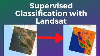
How to perform Supervised Image Classification & Accuracy Assessment in Google Earth Engine?

HTML-код
- Опубликовано: 26 авг 2024
- How to perform supervised Image Classification & Accuracy Assessment in Google Earth Engine?
Please Subscribe to My Channel for more Beginners Oriented Google Earth Engine Videos
Code Link: code.earthengi...
Drop a comment or mail me at : muddasirshah@outlook.com
Visit my website for more Google Earth Engine Scripts:
muddasirshah.com/
What is Image Classification in Remote Sensing?
gisgeography.c...
Recommended Tutorials to Watch before Image Classification:
How to sample an image (sample regions) in Google Earth Engine:
• How to sample a multi-...
or
• Sample Regions or Redu...
Pixel Area Calucation in Google Earth Engine
• Calculating Pixel Area...
How to Calculate Indices in Google Earth Engine?
• How to calculate Indic...
Alternative Key Phrases:
Supervised Image Classification in Google Earth Engine (GEE)
Supervised image classification in 10 easy steps
Supervised Image Classification using Random Forest Classifier in Google Earth Engine
Image Classification in Google Earth Engine
How to classify an image in Google Earth Engine
Supervised Classify Image
Classify an Image with Random Forest in Google Earth Engine
Classification Error Matrix in Google Earth Engine
Error Matrix in Google Earth Engine
Confusion matrix in Google Earth Engine
How to calculate overall accuracy in Google Earth Engine?
How to compute user accuracy in Google Earth Engine?
How to calculate producer accuracy in GEE?
How to calculate Kappa Value in Google Earth Engine?
Easy Way to Classify an Image in Google Earth Engine?
What are training samples in google earth engine?
What are validation samples in Google Earth Engine?
How to split data for image classification in Google Earth Engine?
Sample Regions in Google Earth Engine for Image Classification
How to perform classification accuracy assessment in GEE?
Classification Accuracy Assessment in Google Earth Engine
How to perform Sentinel-2 Image Classification in Google Earth Engine?
How to perform Landsat Image Classification in Google Earth Engine?
What are bandNames() in Google Earth Engine?
How to merge feature collections in Google Earth Engine?
Hash Tags:
#ImageClassification #GoogleEarthEngine #Sentinel-2 #RandomForest #RemoteSensing #GEE


You are a great teacher. All the best. GOD Bless you
Thank you so much 😊 means a lot.
Kindly make a video on how to do time series land use and land cover change detection using landsat
Awesome vido Bro,... congrat¡¡,.... I did something like this example but my training samples was polygons,... the training smples work well, but I've problmes whit de code about de Accuracy assesment,.. could you give some help, thanks on advance,...
Best reggards
Eduardo (e-mail friend)
thanks for tutorial
Thank u dude, very helpful
Thank you ^ ^
Thanks sir, but i can't access the code link. Please help me
Write an email ill share the link. Just with subject “classification script link” and I’ll respond
muddasirshah@outlook.com
Awesome. TY very much
You’re welcome 😇
Super (the Code link is broken though)😊.
Thank you, and it’s working fine. Please try opening the link with a proxy and let me know.
how do i know where the classification code comes in when performing damage assessment
Image classification for damage assessment, you sure?
I mean you can but there are other ways too
hi sir can u please tell me how to extract kappa coefficient from google earth engine
When the error matrix is generated using his method ConfusionMatrix.kappa() will return the value. It's displayed on console
I am getting zero for accuracy, error matrix and everything else. Don't know why when the code is the same
Hi Vanshika,
Please check your script thoroughly. Have you called the feature collection property name correctly? Have you made the feature colletions they way shown in tutorial?
Hi.thank you so much for your great and well detailed video.i have a question about accuracy assessment.
if i want to evaluate my classified image with another classified image as a reference to see how well my classes match on that classified reference image and give me a statistical output like these overal accuracy and like that how can i do that in envi or other softwares.
thank you.
That’s a really good question and honestly I don’t have answer for that. But from a data analyst perspective you would need to run some correlation test. It could be spatial correlation or simple linear correlation. The coefficient of determination will tell how close the data points are. But here’s the catch we do that in case of regression. Here we have classes not continuous data points (pixels) maybe if you could do something with zonal statistics of each class and compare the two.
Eg compute the area, mean median mode of pixels and statistically compare them. Also I don’t know how you will comprehend comparing two classified maps from different resolution images. Obviously the results are going to be different and perhaps you would interpolate / resample higher res data to lower res. Just remember you never resample from low res to high res but the opposite
Will discuss this with my teachers and let u know 🙂
@@MuddasirShah
thank you so much for your explanation.actually im a beginner in these subjects but i was heard about that zonal statistics i will try it thank you for your hint.and about the res difference as you mentioned my classified image is LC8 but the classified reference image is sen2.
@@majidhafezi9638 yes there’s a difference of 20 meters. Sentinel 2 has more fine resolution 10 meters whereas Landsat has 30 meters. You might need to resample 10 meters sentinel image to 30 meters and then compare.
I have an idea Majid. Why don’t you resample the 10 meters sentinel classified image to 30 meters. And then subtract the two maps using zonal statistics (class wise). That will tell the difference in terms of pixels which one has more or less. Make sure to do it class wise.
Subtract forest class of S2 from forest of L8.
There’s a tool in envi which helps you do that. You just have make sure both images have same resolution
ruclips.net/video/obC_KbO_MRE/видео.html
I can't open the code
code.earthengine.google.com/4c774858b4774ab6fa454820f185a038
Hello, can you upload the area calculation after supervised classification. I need to calculate the area of one particular land cover for example forest.
Yes you can. Just ingest the raster and apply the image pixel area method.
Is your image classified in Envi? If it’s a shapefile that will work also.
Here’s the code for calculation area of vectors
var study_area = ee.FeatureCollection(‘link of your ingested feature collection’);
var area = study_area.geometry().area()
var area_In_SqKM = ee.Number(area).divide(1e6).round()
print(stateAreaSqKm)
If the shape file has only one column in attribute table you might wanna go for filtering the particular landcover class value. The above method will give you area of entire shapefile / geometry.
var water = study_area.filter(ee.Filter.eq(‘class_name’,’water’));
Or if it’s a class value (integer) change the class name value from water to the value of class.
OK, I have done supervised classification and now I have 4 classes, which are cropland, bareground, trees and water. I now want to calculate area covered by all cropland region. When I calculate it all I get is the area I used during training. Am I making sense? How can I share my code with you for further help?
I also needed help when trying to display only one class I am interested in after the classification, let's say cropland region alone. Can you also help with that?
plzz provide in python
I don’t code in Python. There are tutorials of Sir Quishing Wu. I recommend his channel
Hello dear Admin, Please can I get the code of producer and user accuracy assessment in GEE from you and can I add you at WhatsApp please, I need a little bit your kind help with image classification? Your kindness will be highly appriciated
Email me please muddasirshah@outlook.com