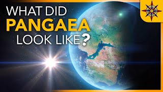
Very informative especially because it labels with modern day names but it should be larger and fully animated. Narration would be nice. This is another step in the right direction.
During baden (tertiary), 13 million years ago, there should be a sea in the area of Austria and Slovakia according to the info from local geopark. Do you have any explanation why this is not clear from this animation? Thank you
Fascinating. The fact that this is an animation based on thousands of geological analyses of rocks makes me think of all the space-based animations where flat-earthers say "Yes, but it can't be real because it's all CGI." :-) It would be awesome to time-travel and watch the Earth changing as sped-up as this. I had always wondered why the Rhine sped so directly south to the Med.
@Unique Pros Apparently you are as acquainted with the Rhine as the OP. Maybe you are suggesting it starts in the Netherlands and flows south / southeast?! Whatever the case I suggest you look at a map... Also, North and up are 2 different things, and the fact you seem to think gravity pulls water south is one the funniest things I've read all year. Our planet is NOT the same as the flat maps we use for our convenience.
@Unique Pros No, it isn't. Our planet is not even close to being aligned by its north-south axis. Plus it wobbles. And when we say in laymen terms (and in the context of our planet, not in general terms) that gravity is a force that pulls mass downward, that does not mean south, but inward, towards the center of the planet, or towards the ground if you will. This is why you're able to stand vertically anywhere on the planet, instead of leaning southward like a tree constantly battered by north winds. Also why despite your claims the immense mass of water that fills the oceans on the northern hemisphere is not flowing south. Fun fact: north is roughly left of me as I write this. And I'm standing, not leaning, not lying, standing. Also, my original comment simply points out the fact that OP doesn't even know where the Rhine flows to, which makes his comment nonsense. If you have something to add regarding that subject, be my guest. Otherwise, don't waste my time with laughable claims and references to simple concepts you don't have a grasp of. Have a nice day.
Everything here appears to be accurate as I cross-check it with Kennith J. Hsü 's book 'The Geology of Switzerland'. Specifically chapter 12 titled 'Geologic Evolution of Switzerland'. This animation has helped me gain some insight to the tectonic setting described in Hsü 's book. A hard thing to conceptualize with minimal figures. Send my gratitude to the videos creators!!!!
I was interested in this as a learning experience and expecting an explanation of the mechanics etc. Just some maps and graphics may be of interest to some of course, and I respect that.
Since the timeline for the broken and subducted tectonic plates is documented - by our ancestors - in historic records, since the forces that broke and subducted the tectonic plates is also documented - by our ancestors in historic records, to conjure up guessing games is to expose yourself as someone who doesn't care about the truth enough to simply study the reports in the historic documents. Since the timeline for Earth's expansion is also documented - by our ancestors - in historic records, we know the guessing games of pangaea, continental drift and continental collision are preposterous nonsense. Since the forces responsible for the massive water erosion across North America - and the British and Irish Islands - are also documented, along with the timeline, we know the Ice Ages are a theory that is proven to be false. If you would spend some time doing research, instead of listening to idiots pontificate about their insane detachment from reality, you would make some intelligent choices.


Mine stuck at 60 million years and did progress further...
The Mediterranean basin was a dry deep inland caynon some times
The Vardar ocean, around the transition from Jurassic to Cretaceous ... massive imapct?
Very informative especially because it labels with modern day names but it should be larger and fully animated. Narration would be nice. This is another step in the right direction.
During baden (tertiary), 13 million years ago, there should be a sea in the area of Austria and Slovakia according to the info from local geopark. Do you have any explanation why this is not clear from this animation? Thank you
Excellent! Thanks for posting
Ireland was once on 2 different plates, coming together 60 MYA. It shows here that that isn’t the case
Fascinating. The fact that this is an animation based on thousands of geological analyses of rocks makes me think of all the space-based animations where flat-earthers say "Yes, but it can't be real because it's all CGI." :-) It would be awesome to time-travel and watch the Earth changing as sped-up as this. I had always wondered why the Rhine sped so directly south to the Med.
flamencoprof Hard to understand what you mean by that, as the Rhine flows north and west and is at no point anywhere near the Mediterranean...
@Unique Pros May I ask why you're telling me this?
@Unique Pros Apparently you are as acquainted with the Rhine as the OP. Maybe you are suggesting it starts in the Netherlands and flows south / southeast?! Whatever the case I suggest you look at a map... Also, North and up are 2 different things, and the fact you seem to think gravity pulls water south is one the funniest things I've read all year. Our planet is NOT the same as the flat maps we use for our convenience.
@Unique Pros No, it isn't. Our planet is not even close to being aligned by its north-south axis. Plus it wobbles. And when we say in laymen terms (and in the context of our planet, not in general terms) that gravity is a force that pulls mass downward, that does not mean south, but inward, towards the center of the planet, or towards the ground if you will. This is why you're able to stand vertically anywhere on the planet, instead of leaning southward like a tree constantly battered by north winds. Also why despite your claims the immense mass of water that fills the oceans on the northern hemisphere is not flowing south. Fun fact: north is roughly left of me as I write this. And I'm standing, not leaning, not lying, standing.
Also, my original comment simply points out the fact that OP doesn't even know where the Rhine flows to, which makes his comment nonsense. If you have something to add regarding that subject, be my guest. Otherwise, don't waste my time with laughable claims and references to simple concepts you don't have a grasp of. Have a nice day.
Crimea was a Tethis(Vardar)archipelago, not always a landmass.
Thanks for sharing the knowledge.
It does not show parts that were under the sea or did not exist in the past. For example, only western Iberia existed around the Permian.
And Britain just sat there.
Would like to know the direction of the Bitish Isles given the African Plate bulldozing into southern Europe.
This is a gross oversimplification.
Earth hasn’t been around for billions or even millions of years, but only thousands.
Yeah according to ancient story book😂
Do you have any references available?
The team has changed since then, but I'll be looking for the information. Thank you for your interest! 👍
***** thank you, I love the compilation of research represented in this video.
Everything here appears to be accurate as I cross-check it with Kennith J. Hsü 's book 'The Geology of Switzerland'. Specifically chapter 12 titled 'Geologic Evolution of Switzerland'.
This animation has helped me gain some insight to the tectonic setting described in Hsü 's book. A hard thing to conceptualize with minimal figures.
Send my gratitude to the videos creators!!!!
Great sound track!
Peter Rafeiner Do you need to hear something in order to appreciate with your eyes?
I was interested in this as a learning experience and expecting an explanation of the mechanics etc. Just some maps and graphics may be of interest to some of course, and I respect that.
A rift!!!!!!!!!!!!!!!!!!!!!!!!!!!!!!!!!!!!!!!!!!!!!!!!!!!!!!!!!!!!!!!!!!!!!!!!!
Since the timeline for the broken and subducted tectonic plates is documented - by our ancestors - in historic records, since the forces that broke and subducted the tectonic plates is also documented - by our ancestors in historic records, to conjure up guessing games is to expose yourself as someone who doesn't care about the truth enough to simply study the reports in the historic documents.
Since the timeline for Earth's expansion is also documented - by our ancestors - in historic records, we know the guessing games of pangaea, continental drift and continental collision are preposterous nonsense.
Since the forces responsible for the massive water erosion across North America - and the British and Irish Islands - are also documented, along with the timeline, we know the Ice Ages are a theory that is proven to be false.
If you would spend some time doing research, instead of listening to idiots pontificate about their insane detachment from reality, you would make some intelligent choices.
Are You sure about that?
This is so wrong in so many ways
Αναστάσιος Τσέλιος tell us then
NO NO there was NO millions and millions of years .It took a few THOUSAND years !!.
Don't be such a creationist idiot. Face the truth!
Claudius Pereira no, it was millioms
Rubbish