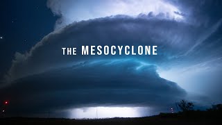
The BIGGEST severe weather outbreak sequence of 2024 is COMING! Daily chances for damaging winds, large hail, and tornadoes can be expected, from today through at least Thursday! Make sure to remain weather-aware across the Plains and Midwest this week.
Gonna be keeping an eye on the OHV storms, I know they don't have Western PA highlighted but I wouldn't be shocked if we get hit with some nasty storms here that day. Keep up the great forecasts!
Hi Hunter, thanks for another great forecast! Will the storms likely weaken before they reach NW Indiana (just southeast of Chicago)? What do you think our tornado risk will likely be? Thanks!
No problem! Thanks for watching. Storms should begin to weaken moving east into Northwest Indiana overnight Tuesday into Wednesday. But confidence remains low on exactly how strong and exactly how long the severe weather risk will last into Tuesday night. It's a very dynamic system and if a derecho develops on Tuesday, then it could persist further east than expected. I'll keep you updated.
Severe weather will be possible on Monday, Tuesday, and Wednesday in Springfield, Illinois. The greatest chance for severe weather will be on Tuesday in Springfield, Illinois.
Monday (5/20/24) - Isolated to scattered thunderstorms. One or two of those storms may become severe with damaging winds up to 60 mph and quarter-size hail. The tornado risk will be very low. Tuesday (5/21/24) - Possibly a brief round of thunderstorms (some strong to severe) during the morning hours. Then, a break with sunshine during the afternoon. A second round of thunderstorms is likely Tuesday evening into Tuesday overnight. Damaging to destructive winds, large hail, and a few tornadoes would be possible. The second round of storms and their intensity remains uncertain because if the morning storms stick around longer that may lead to lower energy for the second round later in the day. I'll keep you updated.
Low potential for a few severe storms on Monday and Tuesday. Damaging winds up to 60 mph and quarter-size hail would be the primary hazards from any severe storms that are able to develop those days.
Marginal risk severe weather on Monday, Tuesday, and likely even on Wednesday as well. Damaging winds to 60 mph and quarter-size hail would be the primary hazards from any severe storms that are able to develop. The tornado risk for Northeast Lower Michigan remains low all week.
Good question. It's been performing very well this year so far. I expect probably a Moderate risk upgrade across parts of Southwest Wisconsin, East-Central Iowa, Northeast Missouri, and perhaps Northwest Illinois either tomorrow morning or Tuesday morning. If that Moderate risk upgrade occurs, then I could see the Enhanced risk expanding into parts of Southeast Wisconsin. I'll keep you updated.
Difficult to say right now. There is a lot of severe weather potential this week. Severe weather in the Plains today will affect severe weather tomorrow, and severe weather tomorrow will affect severe weather on Tuesday, and so on. So it's rather uncertain but I'll keep you updated.
@@WeatherOnTheGoForecasts okay thank you. I hope and pray not. I don't have a tornado shelter neither does my family. We can't afford one and we don't have any public ones to go to either :/
Dear Heavenly Father, We come to you seeking your protection and mercy as severe weather approaches. Calm the storms, still the winds, and quiet the thunder. Protect us, our loved ones, and our communities from harm. Keep us safe from the dangers of the storm, and shelter us under your loving care. We pray for those who are vulnerable, especially the elderly, children, and those in poverty. Please keep them safe and provide for their needs. May your peace and calm be upon us, and may your grace sustain us through this challenging time. In Jesus' name, we pray. Amen! ✝️ Remember, God is our rock and our refuge in times of trouble. May He keep us all safe and secure!


The BIGGEST severe weather outbreak sequence of 2024 is COMING! Daily chances for damaging winds, large hail, and tornadoes can be expected, from today through at least Thursday! Make sure to remain weather-aware across the Plains and Midwest this week.
Thanks for the heads up on this
@@ElevaTOURSbyRainMaves Absolutely!
Cold AM - bright sunshine this morning! Holding off on planters! Our hare rabbits are back, deer changing their coat color! Thank you Hunter!
Thanks for watching!
Hope your weekend is good. Greg 😊.
Thank you! You too. Thanks for watching!
Excellent coverage. I really can't imagine how people you are keeping safe. Keep up the great work. Your parents did you right. Good work ethics.
Thank you so much!
Thank you, sir. Have a great weekend and be well. ❤ Stay safe everyone!
No problem! Thanks for watching. Enjoy your weekend.
Yup I’m dead in the severe weather on Tuesday
Garage beers and lightning
Gonna be keeping an eye on the OHV storms, I know they don't have Western PA highlighted but I wouldn't be shocked if we get hit with some nasty storms here that day. Keep up the great forecasts!
This is crazy I’m sure this will be a active hurricane season too
Hi hunter happy day to you buddy
Good morning! Thanks for watching.
Got an update for the Day 1 outlook. Now we have a Moderate Risk for both wind and hail at 45%. Still a Slight Risk for tornadoes at 5% though.
Hi Hunter, thanks for another great forecast! Will the storms likely weaken before they reach NW Indiana (just southeast of Chicago)? What do you think our tornado risk will likely be? Thanks!
No problem! Thanks for watching.
Storms should begin to weaken moving east into Northwest Indiana overnight Tuesday into Wednesday. But confidence remains low on exactly how strong and exactly how long the severe weather risk will last into Tuesday night. It's a very dynamic system and if a derecho develops on Tuesday, then it could persist further east than expected. I'll keep you updated.
How's Paducah Kentucky looking for this storm?
Slight Risk for severe weather on Wednesday. Still low confidence since Wednesday is still a few days away. I'll keep you updated.
There is a PDS Severe Thunderstorm watch for potential of widespread destructive winds and some tornadoes
A derecho is possible across the Central Plains today
Hunter is eastern Iowa gonna be under the gun on Tuesday?
Considering we're in the moderate risk I'd say yeah.
Keeping an eye with you. Tuesday should be a little bumpy for us in the Quad Cities.
I'm expecting probably a Moderate Risk upgrade for the Quad Cities region for Tuesday's severe weather (either tomorrow morning or Tuesday morning).
How’s Illinois gonna be like in spfld
Severe weather will be possible on Monday, Tuesday, and Wednesday in Springfield, Illinois. The greatest chance for severe weather will be on Tuesday in Springfield, Illinois.
How is Milwaukee WI looking please answer?
Monday (5/20/24) - Isolated to scattered thunderstorms. One or two of those storms may become severe with damaging winds up to 60 mph and quarter-size hail. The tornado risk will be very low.
Tuesday (5/21/24) - Possibly a brief round of thunderstorms (some strong to severe) during the morning hours. Then, a break with sunshine during the afternoon. A second round of thunderstorms is likely Tuesday evening into Tuesday overnight. Damaging to destructive winds, large hail, and a few tornadoes would be possible. The second round of storms and their intensity remains uncertain because if the morning storms stick around longer that may lead to lower energy for the second round later in the day.
I'll keep you updated.
@@WeatherOnTheGoForecasts Thank you for the information my friend! ✌️
Im in black river falls i think im done for
Do you see Erie Pennsylvania getting put in that slight risk Wednesday this week it’s a little west of Erie
Probably not
When will Minnesota get anything?
Maybe mid-to-late Summer.
@@WeatherOnTheGoForecasts aren’t i getting anything on Tuesday? Im near the twin cities.
@@GraceGoodrich-kf8sw Possibly heavy rain. The main severe weather outbreak will be to the south.
@@WeatherOnTheGoForecasts I’m in the slight risk
Any chance the risk for Tuesday can get decreased if we get enough rainfall and cloud cover tomorrow?
Maybe. But it’s a dynamic system so cloud cover might not matter as much.
Ann Arbor, Michigan this week good?
Low potential for a few severe storms on Monday and Tuesday. Damaging winds up to 60 mph and quarter-size hail would be the primary hazards from any severe storms that are able to develop those days.
Is Alpena Michigan still in the clear with the severe weather?
Marginal risk severe weather on Monday, Tuesday, and likely even on Wednesday as well. Damaging winds to 60 mph and quarter-size hail would be the primary hazards from any severe storms that are able to develop. The tornado risk for Northeast Lower Michigan remains low all week.
@@WeatherOnTheGoForecasts so we’re good from the tornadoes in my area correct?
@@Jordan92129 All severe thunderstorms are capable of producing tornadoes. But the tornado risk is very low.
@@WeatherOnTheGoForecasts Thanks hunter have a good day
@@Jordan92129 You too!
How high do you think the tornado risk in the enchanted risk will be?
Enhanced
Yes but how high of a chance?
@@WeatherOnTheGoForecasts
?
Hey, do you think that the csu-mlp model is overdoing it for se wisconsin? Im a bit concerned by the severity of the prediction
Good question. It's been performing very well this year so far. I expect probably a Moderate risk upgrade across parts of Southwest Wisconsin, East-Central Iowa, Northeast Missouri, and perhaps Northwest Illinois either tomorrow morning or Tuesday morning. If that Moderate risk upgrade occurs, then I could see the Enhanced risk expanding into parts of Southeast Wisconsin. I'll keep you updated.
@@WeatherOnTheGoForecasts Do you think the day 3 high risk is a bit extreme though?
You think Indiana could see strong tornados this week coming up? I am scared
Difficult to say right now. There is a lot of severe weather potential this week. Severe weather in the Plains today will affect severe weather tomorrow, and severe weather tomorrow will affect severe weather on Tuesday, and so on. So it's rather uncertain but I'll keep you updated.
@@WeatherOnTheGoForecasts okay thank you. I hope and pray not. I don't have a tornado shelter neither does my family. We can't afford one and we don't have any public ones to go to either :/
Space weather has consequences.
Happy my favorite day of the year!
Why is that so?
Dear Heavenly Father,
We come to you seeking your protection and mercy as severe weather approaches. Calm the storms, still the winds, and quiet the thunder.
Protect us, our loved ones, and our communities from harm. Keep us safe from the dangers of the storm, and shelter us under your loving care.
We pray for those who are vulnerable, especially the elderly, children, and those in poverty. Please keep them safe and provide for their needs.
May your peace and calm be upon us, and may your grace sustain us through this challenging time.
In Jesus' name, we pray. Amen! ✝️
Remember, God is our rock and our refuge in times of trouble. May He keep us all safe and secure!