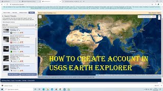
How to download satellite images from USGS || Lecture Number 10

HTML-код
- Опубликовано: 8 фев 2025
- In this video I've explained how to download satellite data i.e landsat data, sentinel data, SRTM data etc from the USGS websites (Earthexplorer & Glovis) and also adding those data in ArcGis. the data is available free for download.
earthexplorer....
DOWNLOADING LANDSAT IMAGES FROM USGS
POINTS TO NOTE:
1. Cloud cover of the image should preferably be either ZERO or 1%. Values upto 5 or at the most 10% can be accepted in case you find no image with zero or 1% cloud cover.
2. For images from 1972 to 1999, download LANDSAT 4-5 TM
For those between 1999-2003, download LANDSAT 7 ETM+ SLC ON
For 2003 to 2012, download BHUVAN LISS III images since Landsat 7 ETM + SLC OFF will give lining error.
For 2013 to present, download Landsat 8 OLS/TRS images from USGS.


Mashalah, Good Effort
Very Helpful work for me
May Allah bless you.
JazkAllah ✨
Good work bro, kindly upload all the work & process through which we can achieve freely from the earth explorer
JazkAllah ✨
Good
AOA Sir! Kindly ap bata sakthe hai k lithology rastar data of pakistan kaise download kre
Thanks sir
JazkAllah ✨
Bhai mera account nhi bna...kindly ap bta sakty hain kaisy bnaana?
Hy dear bro Good job
Thanks 🙏
Good job✌
Thanks 👍
Sir Ye site ab open nae ho rahe hai koye or site hai??????
@@MRGISOfficial The specified URL cannot be found.Ye lekha ata hai
Good 😊👍
Thanks 🙏
Mr.gis bhai mojhe polio k lei aik map chahei area Pakistan KPK Charsadds UC Battagram.
Please full tutorials of ERADAS
Okay
👏👏
Good boy
ETM+ keyse download karu
@@MRGISOfficialap jis file se image ko open Kiya, us file k name keya hai ?
@@MRGISOfficial nehi ....maine tumko Instagram per pucha hai....plz dekar bolo
@@MRGISOfficial MR GIS Official
Plzz es sy next video ka link bta dy
K next kaisy work krty ha
Or thank you sooo much bhot hi acha mathod ha ap ka
@@iramghafar7985 next video 4,5 han ....es sa next how to composite k nam sa ha.....
@@iramghafar7985 agr ap ko samj nie arhi to moju Whatsapp ya mail kr dy ma sab link send kr data hun