GPR-Slice Introduction

HTML-код
- Опубликовано: 15 сен 2024
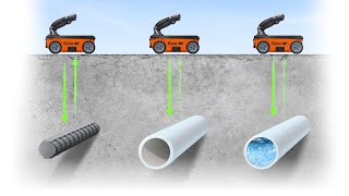
- GPR-SLICE is a comprehensive ground penetrating radar (GPR) imaging software designed for the creation of 2D/3D subsurface images for use in a variety of geotechnical, engineering, and archaeological applications.
Learn more about GPR-Slice software:
www.guidelineg...


Çok teşekkür ederim. Gayet açıklayıcı olmuş.
Hello how are you. Can I process data or space radar images such as LOS, Landsat, or others with thermal ranges that can penetrate the earth and convert them to gpr, analyze and display them with this program
How to install software
كيف يمكنني أن انزل البرنامج
leave my signal