
- Видео 181
- Просмотров 272 368
Best GIS Tutorials
Пакистан
Добавлен 6 окт 2016
All about Software Tutorial Videos like Erdas imagine, ArcMap, MapInfo, ILWIS and so on .. in this platform we provide all basics of software i-e how to georeference a map, how to digitize a scan map, How to extract study area map from satellite image, how to make layout for study area map how to use merge tool, how to use band composite tool, how to interpolate the data, how to use raster calculation tool, how to download image from google earth, how to download image from satellite. How to use clip tool, how to use IDW techniques, How to classify landuse/Landcover map and Entertainment's
Keep in touch with Us
#bestgistutorial
#gis #codeeditor #gee
#remotesensing #webGIS
#webDevelopment
#Googleearthengine
Subscribe our channel and don't forget to like share and comments
@Best GIS Tutorials
ruclips.net/channel/UCqpzWp7L5mFIDZ2_iHejoSQ
Keep in touch with Us
#bestgistutorial
#gis #codeeditor #gee
#remotesensing #webGIS
#webDevelopment
#Googleearthengine
Subscribe our channel and don't forget to like share and comments
@Best GIS Tutorials
ruclips.net/channel/UCqpzWp7L5mFIDZ2_iHejoSQ
Lecture 05/ How to Create Aspect Map in Google Earth Engine
Welcome to Best GIS Tutorials.
In This Lecture you will learn that how to create Aspect map in google earth engine. in this channel we teach you step by step about mapping in different software. after joining us you will be able to make maps for your research purpose and will easily analyze your research
#gis #googleearthengine #remotesensing #gee #codeeditor #engine
#bestgistutorials #dem #slope #terrain #elevation #slope #slopemower #aspect
#HowtocreateAspectMapinGoogleEarthEngine
Introduction to Google Earth Engine
ruclips.net/video/bHc5h62NfdM/видео.html
How To Import Shape file in Google earth engine
ruclips.net/video/QEgPQ2LY-pM/видео.html
How To Download Alos DEM with High resolution 12...
Просмотров: 716
Видео


GEE #04 / How To Create Slope Map Using Google Earth Engine for Absolute Beginner
Просмотров 7177 месяцев назад
Welcome to Best GIS Tutorials. In This Lecture you will learn that how to create slope map in google earth engine. in this channel we teach you step by step about mapping in different software. after joining us you will be able to make maps for your research purpose and will easily analyze your research #gis #googleearthengine #remotesensing #gee #codeeditor #engine #bestgistutorials #dem #slop...
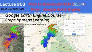
GEE 03# How To Download ALOS DEM 12.5m In Google Earth Engine
Просмотров 1,6 тыс.7 месяцев назад
Welcome to Best GIS Tutorials. In this Google Earth Engine tutorial, I will present how to download ALOS POLSAR Digital Elevation Model with 12.5m high resolution from Google Earth Engine . Downloading, processing and storing satellite data can be not download easily on other platforms. Google Earth Engine (GEE) is a cloud-computing platform for processing satellite imagery and other geospatial...

How to Georeference a Map in QGIS/Georeferencing with Accuracy for Absolute Beginner/Hind/Urdu
Просмотров 3678 месяцев назад
Welcome to Best GIS Tutorials. in this lecture you will learn about How to Geo refer a Map with 100% Accuracy in QGIS easy step to learn GIS software with us Best GIS Tutorials is platform to help those people who want to develop their Skill we provide all the basics of Geographic information System From Beginner to Advance level such is how to georeference a map, how to digitize a map, how to ...

GEE lecture 02 : How to Import/Upload Shape File To Google Earth Engine in Hindi/Urdu
Просмотров 5698 месяцев назад
Welcome to Best GIS Tutorials. In This Lecture you will able to work on Google Earth Engine from absolute beginnings. in this lecture we work on import or upload shape file to Google Earth Engine Lecture 01 Introduction To Google Earth Engine in Hindi/Urdu, Absolute Beginner's Guide to GEE ruclips.net/video/bHc5h62NfdM/видео.html Best GIS Tutorials is platform to help those people who want to d...

Introduction To Google Earth Engine in Hindi/Urdu, Absolute Beginner's Guide to GEE
Просмотров 6599 месяцев назад
Welcome to Best GIS Tutorials. hello Everyone This Is Absolute Beginner Google Earth Engine Course For All GIS and Remote Sensing Users Who Have No Idea about Coding. If You are Looking For GEE Course From Basics, So this Is the Best platform for You to learn Google Earth Engine In Friendly environment if You Like the Lectures then hit a like button and Stay with us for more informational lectu...

Lecture 1 # Introduction To QGIS in Urdu/ Hindi/ Absolute Beginner Guide
Просмотров 23410 месяцев назад
Welcome to Best GIS Tutorials. In This Video you will learn about QGIS from basic introduction. How to familiar yourself with QGIS interface and activation of different tools and how to install plugins from insource and outsource Download QGIS Link www.getintopc.com ArcGIS Basic Course 👇👇👇👇 ruclips.net/p/PLDYyg9pTDkUqVd6ow-vYCwXSsLjBkCdu_ Best GIS Tutorials is platform to help those people who ...

How to Download Tidal Data Freely For Any Country / Tide Data
Просмотров 1,7 тыс.Год назад
In this video, we'll show you how to download tidal data for any country for free using the Tidal Data Downloader. Tidal data is a valuable resource that can be used for a variety of purposes, such as coastal flooding, climate change research, and more. In this video, we'll show you how to easily download tidal data for any country using the Tidal Data Downloader, so that you can use this valua...

How to Download High Resolution (UHD 8K) Historical Satellite Images From Google Earth Pro
Просмотров 1 тыс.Год назад
Welcome to Best GIS Tutorials. In this lecture you will easily learn the how to download historical satellite image with high resolution for different time period like from 1945 to 2022 Using google earth pro Best GIS Tutorials is platform to help those people who want to develop their Skill we provide all the basics of Geographic information System From Beginner to Advance level such is how to...
How to Download and Install Tableau Software For Free
Просмотров 252Год назад
Welcome to Best GIS Tutorials. In Today Lecture you will Learn that how to download and install Tableau on Windows 10. Tableau is a Business Intelligence Tool owned by Tableau Software. Products include Tableau Desktop, Tableau Server, Tableau Download Link public.tableau.com/s/ Best GIS Tutorials is platform to help those people who want to develop their Skill we provide all the basics of Geog...
How to Download Global Earthquake Magnitude Data for Free
Просмотров 7302 года назад
Welcome to Best GIS Tutorials. In Today Lecture you will learn that How to Download Global Earthquake Magnitude Data for Free from USGS Earthquake catalog, Search Latest and past Earthquake Catalog data, ,It contain different Magnitude data in excel, csv, KML file format, Search Earthquake Catalog, Latest Earthquakes, USGS earthquake catalog, Recent earthquakes in the world, USGS earthquake Map...
How to Edit Legend, Grid and Scale Bar in GIS/ Give Perfect Layout to Map in GIS
Просмотров 4,3 тыс.2 года назад
Welcome to Best GIS Tutorials. Best GIS Tutorials is platform to help those people who want to develop their Skill we provide all the basics of Geographic information System From Beginner to Advance level such is how to georeference a map, how to digitize a map, how to download google earth image, how to download Satellite image for research, use of merge tool, how to make study area map, how t...
How to Download Microsoft Global Building FootPrint for Free
Просмотров 3,4 тыс.2 года назад
How to Download Microsoft Global Building FootPrint for Free
How to Download Shapefile Data GIS For Any Country
Просмотров 7502 года назад
How to Download Shapefile Data GIS For Any Country
How to Install ENVI Software 5.3 Version
Просмотров 21 тыс.2 года назад
How to Install ENVI Software 5.3 Version
How to Recover loss data in GIS/ mxd Loss Data Recover
Просмотров 4,4 тыс.2 года назад
How to Recover loss data in GIS/ mxd Loss Data Recover
How to Use Clip Tool For Raster Data And Vector Data in GIS
Просмотров 4512 года назад
How to Use Clip Tool For Raster Data And Vector Data in GIS
How to Use Merge Tool in GIS/ Merge Boundaries by 2 Method
Просмотров 1,1 тыс.2 года назад
How to Use Merge Tool in GIS/ Merge Boundaries by 2 Method
How to Use Union And Intersect Tool In GIS/ Union & Intersect
Просмотров 2,9 тыс.2 года назад
How to Use Union And Intersect Tool In GIS/ Union & Intersect
How to Find Latitude and Longitude of Any point in GIS
Просмотров 10 тыс.2 года назад
How to Find Latitude and Longitude of Any point in GIS
How to Calculate Stream Power Index in GIS Software
Просмотров 1,1 тыс.2 года назад
How to Calculate Stream Power Index in GIS Software
How to Use Dissolve Tool in GIS Software
Просмотров 1742 года назад
How to Use Dissolve Tool in GIS Software
How to Download Landsat 9 Images from USGS Earth Explorer
Просмотров 3,2 тыс.2 года назад
How to Download Landsat 9 Images from USGS Earth Explorer
How To Calculate Area of Land Using Google earth And Google Map
Просмотров 5 тыс.2 года назад
How To Calculate Area of Land Using Google earth And Google Map
How To Find Sediment Transport Index in GIS/STI
Просмотров 9332 года назад
How To Find Sediment Transport Index in GIS/STI
How To Make 3D Buildings Map in ArcGIS/Arc Scene 10.5
Просмотров 9 тыс.2 года назад
How To Make 3D Buildings Map in ArcGIS/Arc Scene 10.5
How to Convert Shapefile To Raster in ArcGIS/ArcMap
Просмотров 9592 года назад
How to Convert Shapefile To Raster in ArcGIS/ArcMap
How to Visualize Single Band Image in ILWIS Software
Просмотров 6152 года назад
How to Visualize Single Band Image in ILWIS Software
How to Import Latitude & Longitude Coordinates To Google Earth Pro
Просмотров 16 тыс.2 года назад
How to Import Latitude & Longitude Coordinates To Google Earth Pro
Thank you very much. Can you please send me the download link?
Can you please send the link?
Can you share the download link, please? thank you
getintopc website
My file download in Rar format what I do 😢
extract it from rar using rar
@@BestGISTutorials extract hi nhi ho rhi option hi nhi a rha extract ka
Super useful! Can you please share the link through google drive please ?
it can be easily download from getintopc
Thank you sooo much ☃️
🙏😍
halo thanks for the vidio.can i have link download for Envi please
download it from getintopc
Very nicely explained.
thanks
Do you have the link in order to download ENVI?
download it from get into pc
the drive link please
download it from getintopc
can i get the link please.
download it from getintopc website crake version is available
Hello, can you send me the download link? Pleaseee
download it from get into pc
Thabks for sharing! Do you have the download link or file? it's open source?
its open source
@@BestGISTutorials do you have the link?
Can you please share the file
download it from get into pc
send me Activation file only please
its creak version
can you share with me the installation files?
yes
Wow Detailed video Pls can you share the file
yes
tnq for ur useful video
thanks for ur valuable comment
I need the drive link, can u please send the link
sure
Assalam-o-Alaikum Sir, Sir without layout view mera matlab hain data view mein ham (Grid) Apply kar sakhta hain
grid index feature apply ho skti lkn wo special purpose k lye use Hoti like to scale a map in grid... Grid index feature is mostly use for cadastral mapping to clip massavi and make a mouza
W Salam
Monday.
Can you please send me the download link too?
Sure send me the mail
Sure send me the mail
Kindly share the link of hillshade, NDVI, NDWI,NDSI videos
Share your mail I will send the code
Share your mail I will send the code
Brother link please
Send mail 💌
Hi, can you pls send me the download link?
Surely
Can you please give me the download link?
Yes
@@BestGISTutorials@BestGISTutorials, when can I expect from you?
I need the drive link, can u please send the link
Send me ur Mail address
Can I get the file, plase
Sure drop your mail 💌
Mengapa arcgis 10.8 saya cannot be installed 😥 mohon petunjuk
Install 10.5
Hello sir, Can you please send me the download link please. Thankyou
Sure
How can i access the link?@@BestGISTutorials
Or can i have your mail so i can mail you?@@BestGISTutorials
@@BestGISTutorialsshould i drop my email or how sir? Sorry in advance
Drop ur Mail 💌 address
Thanks. Great work. I have a question. Can I draw the Drainage manually ?
You can collect inventory data from Google earth
can i get the link?
Sure
I need the file please
Drop ur mail
hey bro could you please send me the link ? thank you for the vide
Sure send me ur mail 💌
Sir my study area is come in 3 grid. In one grid temperature is -7 , 2nd grid show -04 and in 3rd grid temperature is -12. sir what i do in that situation , which one i pick
Use average of these all
@@BestGISTutorials Thanks sir
Thanks for the tutorial...On what basis you gave the raster value greater than 1200 for raster calculator ?
Based on area topography
This is a good lecture, however, the presenter started the presentation from the middle as we do not know he prepared the DEm and SHP files.. could you please post another video to that effect ?
It's so simple just add your study area shape file and DEM than clip it using extract by mask tool
Hello Sir, I am a new learner of GIS. if you have any online classes then plz inform me.
Go to playlist of basic gis classes and learn on my channel for free
Nice!! Can u share the file?
Sure drop your mail 💌 address
Hey can you share the download link
Sure
Please provide that file
Upload to drive
Hi! Can I get the download link? It's for my thesis. Thank you!
Done!
@@BestGISTutorials Hi, i cant find the link
Thank you very much. Can you please send me the download link?
Send ur mail
Hello can you share the download link with me? please
Sure share with you through drive
Hi, can you leave me the download link? thank you
Yes drop ur mail 💌
Can I get the file please??
Sure 😊
@@BestGISTutorials I tried to install from getintopc it ran at first but then an error said (AFcore.dll) error
@@BestGISTutorials How will you share the file Sir?
hi, kindly send link
Sure send ur mail 💌 i wil share the drive link
Please tell me about this
See the video in detail
In my arc gis hve no any option of 3d editor
Which version u r using
😮
❤️