
- Видео 107
- Просмотров 507 486
Md Arifur Rahman, PE, CFM, ENV SP
США
Добавлен 13 ноя 2011
"Diligite Lumen Sapientiae": Love the light of education. The purpose of this channel is to help undergraduate, master's, and Ph.D. students and professionals successfully complete their research and project work in water resources engineering and associated fields. Learning new skills is always fascinating and challenging to me; however, it is required to fulfill the demands of the present era. So..........
For Training, send a message to +16825537054 on WhatsApp or shoot an email to mdarifur.rahman@mavs.uta.edu
- Hydrologic Modeling by HEC-HMS, SWAT, TxRR
- Hydraulic and Morphological Modelling by HEC-RAS (1D, 2D)
- Reservoir Modelling by HEC-ResSim
- Hydrodynamic and Storm Surge Modeling Delft3D-FM, ADCIRC, and SCHISM
- 2D and 3D Compound Flood Modeling
- Mapping and Data Processing by ArcGIS, ArcGISPro, QGIS, Global Mapper, and Surfer
- Data processing and plotting by Python, MATLAB, R, Shell, and NCL Scripting
- Generation of Publication Quality Plots
HEC-RAS 2D: How To Setup Boundary Conditions For 2D Flood Model-T7
In this tutorial, I have explained how to set up boundary conditions for the HEC-RAS 2D flood model and run the simulation. The tutorial includes detailed instructions on defining inflow and outflow boundaries, configuring hydraulic structures, and applying the necessary parameters to ensure accurate model execution. By following these steps, you will be able to successfully simulate flood scenarios and analyze the resulting data for flood risk management and mitigation planning.
#How_To_Setup_HEC_RAS_2D_Flood_Model
#How_To_Create_Gridded_Precipitation
#Frequency_Storm
#Atlas_14_Frequency_Storm
#How_To_Setup_HEC_RAS_2D_Flood_Model
#How_To_Create_Gridded_Precipitation
#Frequency_Storm
#Atlas_14_Frequency_Storm
Просмотров: 306
Видео


HEC-RAS 2D: How To Refine Mesh For 2D Flood Modeling-T6
Просмотров 124Месяц назад
In this tutorial, I have demonstrated how to refine a 2D mesh for the HEC-RAS 2D flood model using stream and roadway shapefiles. The tutorial covers the steps to integrate these shapefiles into the model, ensuring that the mesh accurately captures the detailed geometry and features of streams and roadways. This refinement process enhances the precision of the flood model by providing a more ac...

HEC-RAS 2D: How To Create Mesh For 2D Flood Modeling-T5
Просмотров 155Месяц назад
In this tutorial, I have explained the process of creating a 2D mesh for the HEC-RAS 2D flood model. The tutorial covers the steps involved in setting up the computational grid, including defining the mesh boundaries, specifying the resolution, and adjusting the mesh to accurately represent the topography and hydrological features of the study area. By following this guide, you'll be able to ge...

HEC-RAS 2D: How to Create Infiltration Layer for 2D Flood Modeling -T4
Просмотров 242Месяц назад
In this tutorial, I have demonstrated how to create an infiltration layer using land use and soil data. This involves collecting and processing land use and soil datasets, classifying the data according to infiltration rates, and integrating these classifications into a spatial layer suitable for hydrologic modeling. I have also shown how to incorporate this infiltration layer into the HEC-RAS ...
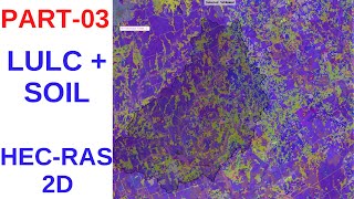
HEC-RAS 2D: How to Create LULC and Soil Layers for 2D Flood Modeling -T3
Просмотров 240Месяц назад
In this tutorial, I have demonstrated how to create an infiltration layer using land use and soil data. This involves collecting and processing land use and soil datasets, classifying the data according to infiltration rates, and integrating these classifications into a spatial layer suitable for hydrologic modeling. I have also shown how to incorporate this infiltration layer into the HEC-RAS ...

HEC-RAS 2D: How To Generate Gridded Frequency Storm Rainfall -T2
Просмотров 211Месяц назад
In this tutorial, I have demonstrated how to create gridded precipitation data as a .dss file using Python scripts. The process involves downloading and processing precipitation datasets, converting the data into the required grid format, and saving it in the .dss file format compatible with HEC-RAS. Additionally, I have shown how to integrate this gridded precipitation data into the HEC-RAS mo...

HEC-RAS 2D: Frequency Storm Flood Modeling -T1
Просмотров 204Месяц назад
In this tutorial, I have generated a 2D flood model using the HEC-RAS software, incorporating Atlas-14 frequency storms. The steps include setting up the computational mesh, defining boundary conditions, and calibrating the model. I have also demonstrated how to simulate various storm scenarios to assess flood extents and depths and how to analyze the results for flood risk management. This com...

How To Compute Curve Number Grid From Soil Class and LULC
Просмотров 11 тыс.2 года назад
In this tutorial, I have demonstrated how to generate Curve Number Grid from soil class, and land use and land cover dataset. I have demonstrated the tutorial in ArcGIS Pro; however, it is also possible to do the same in ArcMap. The soil data has been downloaded from SSURGO and LULC data has been downloaded from NLCD. SSURGO data: esri.maps.arcgis.com/apps/View/index.html?appid=cdc49bd63ea54dd2...

How To Validate HEC-HMS Model
Просмотров 6 тыс.2 года назад
In this tutorial, I have demonstrated how to validate a hydrologic model in HEC-HMS. For Training on HEC-HMS: Send message to 16825537054 on WhatsApp #How_To_Validate_HEC_HMS_Model #How_To_Setup_HEC_HMS_Model #HECHMSModelFromDEM #How_To_Calibrate_HEC_HMS_Model #RainfallRunoffModel
How To Calibrate HEC-HMS Model Using Automatic and Manual Techniques
Просмотров 11 тыс.2 года назад
In this tutorial, I have demonstrated how to calibrate a hydrologic model using the automatic and manual techniques in HEC-HMS. For Training on HEC-HMS: Send message to 16825537054 on WhatsApp #How_To_Calibrate_HEC_HMS_Model #How_To_Setup_HEC_HMS_Model #HECHMSModelFromDEM #RainfallRunoffModel
How To Clip NetCDF Dataset By Shapefile Using Python Script
Просмотров 17 тыс.2 года назад
In this tutorial, I have demonstrated how to clip multiple netcdf files by study area shapefile or country shapefile in python. Here I have completed the steps from downloading the data to clip and plot dataset. I downloaded the CHIRPS global rainfall data for demonstrating this tutorial. Link to download the rainfall data: data.chc.ucsb.edu/products/CHIRPS-2.0/global_daily/netcdf/p05/ For Trai...
HEC-DSSVue: How To Create DSS Data Set For H&H Modelling
Просмотров 9 тыс.2 года назад
In this tutorial, I have demonstrated how to create a .dss file, which is called Data Storage System. This dataset is compatible with HEC-HMS, HEC-RAS, HEC-ResSim, etc. Here I have used several raw files to create the data set. I have adopted manual entry, automatic entry of data and merging of several .dss file into one .dss file. HEC-DSSVue Download: www.hec.usace.army.mil/software/hec-dssvue...
ArcGIS T19: How To Calculate Automatically % Imperviousness From LULC (2/2)
Просмотров 1,2 тыс.2 года назад
In this tutorial, I have demonstrated how to calculate percentage Imperviousness automatically using model builder from Land Use and Land Cover dataset. The imperviousness has been calculated per subbasin and saved as excel files. You can use the python code to reclassify the LULC: def classify_landuse(gridcode): if gridcode 1: return "Water" elif gridcode 2: return "Developed" elif gridcode 4:...
ArcGIS T18: How To Calculate % Imperviousness From LULC (1/2)
Просмотров 4,1 тыс.2 года назад
In this tutorial, I have demonstrated how to calculate percentage Imperviousness from Land Use and Land Cover dataset. You can use the python code to reclassify as well: def classify_landuse(gridcode): if gridcode 1: return "Water" elif gridcode 2: return "Developed" elif gridcode 4: return "Mechanically Distributed Other Public Lands" elif gridcode 5: return "Mechanically Distributed Private" ...
HEC-ResSim T3: How To Setup Reservoir Model (3/3)
Просмотров 2,5 тыс.2 года назад
In this tutorial, I have demonstrated how to generate a Simulation module and run conditionfor modeling reservoirs using HEC-ResSim. I also run the model and visualize the results using GUI. HEC-ResSim download: www.hec.usace.army.mil/software/hec-ressim/downloads.aspx For Training on HEC-HMS: Send message to 16825537054 on WhatsApp #How_To_Setup_Reservoir_Model #HEC_ResSim #Reservoir_Operation...
HEC-ResSim T2: How To Setup Reservoir Model (2/3)
Просмотров 4,8 тыс.2 года назад
HEC-ResSim T2: How To Setup Reservoir Model (2/3)
HEC-ResSim T1: How To Setup Reservoir Model (1/3)
Просмотров 7 тыс.2 года назад
HEC-ResSim T1: How To Setup Reservoir Model (1/3)
SWAT T2: How To Setup a Hydrologic Model Using QSWAT
Просмотров 7 тыс.2 года назад
SWAT T2: How To Setup a Hydrologic Model Using QSWAT
SWAT T1: How To Install QSWAT and SWAT+ in QGIS
Просмотров 16 тыс.2 года назад
SWAT T1: How To Install QSWAT and SWAT in QGIS
How To Subset XMRG Precipitation For a Watershed and Make DSS File
Просмотров 5862 года назад
How To Subset XMRG Precipitation For a Watershed and Make DSS File
How To Overlay Shapefiles on XMRG Rainfall Data From DSS File Using GridUtil
Просмотров 3272 года назад
How To Overlay Shapefiles on XMRG Rainfall Data From DSS File Using GridUtil
How To Set Up HEC-RAS Model From Raster DEM Using HEC-GeoRAS
Просмотров 13 тыс.2 года назад
How To Set Up HEC-RAS Model From Raster DEM Using HEC-GeoRAS
How to Download Stage-IV Rainfall Data as NetCDF4 File and Make Time Series
Просмотров 1,7 тыс.2 года назад
How to Download Stage-IV Rainfall Data as NetCDF4 File and Make Time Series
How To Download and Make Time-Series From ERA5 (ECMWF) Dataset
Просмотров 24 тыс.2 года назад
How To Download and Make Time-Series From ERA5 (ECMWF) Dataset
HEC-RAS T4: How To Calculate Bridge Scour
Просмотров 7 тыс.2 года назад
HEC-RAS T4: How To Calculate Bridge Scour
HEC-RAS T3: How To Insert a Bridge Into the Model
Просмотров 8 тыс.2 года назад
HEC-RAS T3: How To Insert a Bridge Into the Model
HEC-RAS: How To Set Up Unsteady FLow Model
Просмотров 14 тыс.2 года назад
HEC-RAS: How To Set Up Unsteady FLow Model
HEC-RAS: How To Develop Alternatives For Floodplain Reduction
Просмотров 4,1 тыс.2 года назад
HEC-RAS: How To Develop Alternatives For Floodplain Reduction
ArcGIS T17: How To Calculate Curve Number From Soil Map
Просмотров 16 тыс.2 года назад
ArcGIS T17: How To Calculate Curve Number From Soil Map
ArcGIS T16: How To Delineate Watersheds Using Arc-Hydro Tools
Просмотров 4,2 тыс.2 года назад
ArcGIS T16: How To Delineate Watersheds Using Arc-Hydro Tools
Neouw Ive learned from you
Could you show flooding of the flood plain?
can you please provide all the files used here in any google drive link I am just starting out in this new software I need to do the exact same steps
Thank you for your wonderful tutorial! Could you please provide us the data again since all of the links you provided before are not working. Thank you again!
Thomas Eric Lopez Elizabeth Jackson Daniel
Thank you for the great tutorial. Could you please check the cross section link, it shows that the data was deleted.
Can this be done using QGIS?
Dear Sir, Thanks for your viedo , can you cooperate with me for making a detail hydrology & hydraulic study and analysis for an existing trapezoidal canal inside of Erbil City in northerner Iraq by some cost ,as we want to redesign the canal to protect an area of mentioned city from flood . Best Regards
Hi, thank you. You can send me message regarding this to my WhatsApp number @ +16825537054.
Sir, I started following your videos. could you please send me the link for survey data excel sheet. thanks
Hello. To predict a phenomenon, I considered 7 variables as input and downloaded the ERA5 data for 41 years in NC format. I want to use this data as input to LSTM model. I need to convert this data into an Excel file. With Python, I converted the ERA5 data into an Excel file, but the amount of data is too large, and I don’t know which data to consider to prepare the Excel file. Please advise. thanks.
how did you get 15.62 for high cord and -6 and 13.12 for the low cord?
Thank you so much. Would you please share the data files?
The data has been deleted, can you please reupload the data?
Dear Mr. Doctor,Can you share your ManningN_and_CN_lookup.xlsx for everyone?
Thank you for your viedo! It is very detailed, but I have a question for you, when I open the meteorological data with Gridded precipitation input to calculate, it always gets an error and can't do the calculation, do you know what the reason is? the error is always "forrtl: severe (64): input conversion error, unit -5, file Internal Formatted Read" ,could you help me? Thank you very much!
Thank you for posting the query. Without proper investigation, it's hard to say what's causing the error. It could be related to unit or other. You can send message to +16825537054 on WhatsApp.
@@MdArifurRahmahn Thank you for your reply.Would you like to give me your email address so I can send you a message if it's convenient for you, I'm sorry I don't have this app and it's difficult fo me to have this app.
@@MdArifurRahmahn Thanks for the reply, could you tell me your email address if it's convenient for you so that I can send a message to you, I don't have this app and it's difficult for me to have it.😀
Very Helpful. Thank you.
Hello Kindly assist. Am running QSWAT and this error is coming up.. forrtl: severe (64): input conversion error, unit 27, file C:\SWAT\swat_project\RIVER_DONGA_project_500\Scenarios\Defaul Image swat2012.exe t\TxtInOut\fig.fig
Thanks for the informative video. Is it possible to share the codes?
As this map was made using data sourced from 2000-2009 isn't it not valid anymore ?
glad.earthengine.app/view/global-land-cover-land-use-v1#lon=0;lat=0;zoom=3;
hi
can you make a tutorial for creating rainfall dss file for daily observed rainfall on multiple points in the watershed for 5 or 6 years
I logged into the website. Unfortunately, when trying to access the download pages, it gives error 500 and 400.
please, provide the code sir
thank you so much .
Thank you sir
Hello sir great tutorial can i get the cross sectional data its shows the data is deleted
It is nice video, I have learnt so many things. But, How I can Calibrate the model if I have more than 1 stream gauged data in the watershed? Please, tell me I have three stream gauging in the watershed and want to calibrate it all.
Thank you. The more the better. It's always recommended to calibrate the model at multiple locations. Sometimes, due to limited gauging stations, we calibrate at least at the outlet. You need to add a junction at each of the stations and generate watershed for that calibration point.
how can you know that %imperviousness is 30 for all basin?
You need to calculate it from the landuse data. Sometimes, % impervious is readily available to download, especially for USA.
When I import the GIS geomentry data in Hecras, my channel cross section is showing only straight lines, how to resolve that issue?
You can just draw the channel and bank lines in GIS and import into RASMapper and cut the XS. However, the latest version has all the functionality to do it without GIS.
sir how to get data
Which app is importat
Tanks very much
❤all hydrolic soft wer
Can you upload resampling video.i want to resample multiple.nc files ypto resoultion of 0.01 degree grid
Sir, please share the survey data since the dropbox link that you have provided shows that data is deleted from here.
Which playlists is this video under sir?
45 minute well spent 🫡🫡🫡 Thanks for this video
I have a calculated value which is either +1 or -1 in hourly time frame. I want to resample in 5M time frame but the same value should be populated in the entire hour on expansion of time. May kindly guide.
Sir, i am having error while computing unsteady flow analysis Its HDF5 error it says “all chunk dimensions must be less than 2^32” How to solve it
The File for practice is deleted from dropbox
DEM File is deleted
Thank you so much for the video
In model what value we consider for R2(square)
Please use indian or bangladeshi dialect. it is really iritating. 😮💨
Hello sir, i exported the DEM of my delineated watershed from ArcGIS to be used in HEC-HMS and imported the DEM into the HEC-HMS. the HEC-HMS will not accept the DEM bacause of " no coordinate system found problem". thank you sir.
Outstanding video . can you please share the script link in description box?
Dear sir, I have gotten a problem. I hve downloaded the QGIS and QSWAT but the QSWAT cant not open in QGIS when you check in the plugins. Infact it doesnt exist
Thank you for the great tutorial, is the third step available?
Hi! How can I get the Delft 3D FM GUI and license file free of charge?
You need to send the request to deltares, they will justify your need and send you the license if you deserve it. But explain the project you are working on using Delf3D-FM and show your need for the project.
Certainly! Here's a more detailed rephrasing: You undertook a conversion of units and meticulously discerned specific areas characterized by elevations falling within the 10 to 20 feet.