
- Видео 16
- Просмотров 62 858
Geospatial Lab (GeoL)
Добавлен 9 дек 2021
This platform was developed for GIS, Remote Sensing, Geo-sciences and Data Analysis related tutorial. To be the next level learner you will get all of assistance from GeoL. So, lets become a part of this community today!
ArcMap Mastery: The Ultimate Guide to Field Manipulation - Delete, Add, and Hide/Unhide Made Simple!
Dive into the world of ArcMap mastery with our quick and easy tutorial! 🚀 Learn the art of deleting, adding, and hiding/unhiding multiple fields effortlessly. Become a GIS Ninja as we guide you through essential tips and tricks to streamline your ArcMap experience. Whether you're a beginner or seasoned pro, this tutorial is your key to unlocking the full potential of field control. Watch now and elevate your ArcMap skills to new heights! 🌐🗺️ #gis #arcmap #field
Просмотров: 47
Видео


Step-by-Step: Excel to Google Earth Pro with KMZ - A Visual Delight!
Просмотров 2908 месяцев назад
🌐✨ Unlock the Power of GIS! Excel to Google Earth Pro Tutorial: Visualizing Spatial Data with KMZ Magic ✨🌐 Ready to elevate your data visualization game? Join us in this comprehensive tutorial where we guide you step-by-step through the process of transforming raw data into stunning visualizations using Google Earth Pro and ArcMap. 🚀 In this tutorial, you'll learn: Selecting the Primary Key: Un...
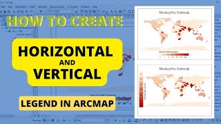
Legend in ArcGIS ┃ Add Vertical and Horizontal Legend┃ Edit Legend in ArcMap ┃ Map Making in GIS
Просмотров 2,1 тыс.Год назад
This tutorial will help you to learn all about horizontal and vertical legend. Happy Learning. 01:00 About Horizontal and Vertical Legend 00:50 Horizontal Legend 02:30 Vertical Legend #arcgis #arcmap #gis #rs #legend #mapping #geospatial

How to Joining Excel (CSV) file with Shape file in ArcMap ┃ Joining database with Attribute Table
Просмотров 7202 года назад
This tutorial will help you to learn the Joining process in ArcMap. Here we have used CSV file to join with Shp file. If you have any queries please do comment.

Calculate NDVI from Landsat 8 Image I Classify NDVI Range in ArcGIS
Просмотров 18 тыс.2 года назад
This tutorial will help you to learn all about NDVI. In first part you will get the basic of NDVI and the Bands importance for NDVI. Than you will learn how to extract NDVI from Landsat-8 satellite Image. Finally you will able to create a beatiful NDVI map layout with the proper ranges. Which will help you to use in your scientific study. If you have any question, don't hesitate to ask. Happy l...

How to Download Landsat Satellite Data from USGS I Satellite Images Download from Earth Explorer
Просмотров 7802 года назад
This video help you to download the satellite images from the websites. Go through this link to follow this tutorial. Thank you. earthexplorer.usgs.gov/

Digitizing in ArcMap Using Portable Server I Geo database Design and Project Area Mapping in ArcGIS
Просмотров 6912 года назад
This tutorial will help you to design a File Geo-database for your project data mapping. Here, you will learn everything about project area mapping. In first chapter, how to create File Geo-database, Feature Datasets, Feature Class & Domain. And than we will do a real project mapping using ArcMap. Where we will creating point, line and polygon features for our project. Finally we have export ou...

Create Fishnet or Grid Polygons in ArcGIS | Sampling Design for Inventory Study
Просмотров 9 тыс.2 года назад
This tutorial will help you to learn all about Fishnet and Sampling polygons or area design. Shape file, using in this tutorial attached in link. If you have any queries regarding this tutorial, you can do comment. Thank you. drive.google.com/drive/folders/1xRBtVyVPuWK0DRBEKpYmJ4j_NRrbUCDs?usp=sharing #Fishnet #ArcGIS

Geo-processing Tools in ArcMap ┆ Buffer_Clip_Merge_Intersect_Dissolve_Union in ArcGIS
Просмотров 3,4 тыс.2 года назад
This tutorial help you to learn Geo-processing tools of ArcMap. From buffer to dissolve all of tools included. Happy learning.
Vegetation Assessment Using MODIS data | NDVI in Google Earth Engine
Просмотров 1,4 тыс.2 года назад
This tutorial contains the vegetation changes in Sundarbans during 2011-2012 time period.
Geo referencing and Digitizing in ArcGIS I Google Earth Pro image Digitizing
Просмотров 20 тыс.2 года назад
This tutorial will help you to learn all about digitizing and georeferencing using Google Earth Pro and ArcGIS. GEP was used for downloaded Image and ArcGIS was used for digitizing and georeferencing. Happy Learning. 01:00 Learning Outcome 04:00 Download the Google Earth Image 07:20 Georeferencing the Downloaded Image 14:20 Digitizing the Georeferenced Image 18:00 Input the relevant Data in the...
Excel to Shape File in ArcGIS I Convert Excel to SHP
Просмотров 6 тыс.2 года назад
This tutorial will help you to convert your sample location (lat, long) from excel to shapefile. By converting format you can use your sample location point easily avoiding complex procedures. 00:00 Excel data to CSV format 01:00 Add data in ArcGIS 02:00 Convert Excel to Shapefile #ArcGIS; #Shapefile; #ExceltoArcGIS; #ExceltoShapefile
Study Area Mapping in ArcGIS | Import Excel Data in ArcGIS
Просмотров 6192 года назад
This tutorial will help you to learn 00:00 Convert the xlsx format to CSV format in Excel. 01:03 Import the sample location in ArcGIS. 02:20 Create a new shapefile from existing data. 06:05 Using guides in the Layout view. 11:10 Insert text, rectangular box, line, and formating these elements. 21:43 Export the map in JPEG format. So, let's start and follow to get the updated new tutorial. Downl...
How to Make a Study Area Map in ArcGIS 10.8 │ Study Area Mapping
Просмотров 8372 года назад
How to Make a Study Area Map in ArcGIS 10.8 │ Study Area Mapping
Hernandez Laura Taylor Frank Rodriguez Ronald
Schowalter Shores
Sir from where did u download the data?
Thanks so much
I wanted to know: where and in which type of project it is used?
your video is helpful ☺☺☺
Glad to hear that
Thank you for the video, can I ask you about something that's related to this topic? Thank You.
Yes,
Can you do one of how to query cadastral database?
Great video, well covered the whole topic.
Excelente video
Thank you
Informative
Thanks for your appreciation.
Tutorial is good but you should avoid bg music and improve your audio quality. Thanks.
try to improve on volume
thank you so much
its too much informative
thanks can you send us avideo of aerosol mapping using landsat8
how to connect with google map
Could you tell me how we can do this in Arc GIS PRO?
Have been facing the same problem in ArCgis Pro including how to apply common legends for multiple maps
please add volume!
but why you don't respect value max 0,42 and you change it and you don't change value min can you explain to me
Tutorial is Good. But you should improve your voice
I'm the real Geospatial
Interesting
how to make attribute table here?
this vedio highly supported to me. thank you.
Your contact number please
The geo referencing , sometime it doesn’t make straight
Zazwezwss was zeszww more tutorials
Zazwezwss was zeszww more tutorials
My research topic is : Monitoring Sal Forest Decline Through Remote Sensing Time Series Analysis. What can I do Sir?
You may use LULC/ NDVI to get the forest condition. For time series analysis you can use GEE.
Contact / WhatsApp number please
have you validate your classes?
Not yet
Please I would like to discuss with you.. can I get your a link
Hello Adetutu, You can discuss with me throughout this email. juvairhossan181050@gmail.com Happy Learning.
I have sent you a mail sir
Got it and replied. Please check.
Superb.. well done sir
Thank you, do follow for the update tutorials.
Highly informative. Much appreciated. The volume was exceptionally low though.
Thank you @Survey Nevis for your good words. We will trying to solve volume problems in our next tutorials.
Thank u sir for making this videos
If you have any asking regarding this tutorial, please do ask. Thank you.
Nice
Thank you, Felix. Happy learning with GeoL.
Keep them video tutorials coming...very useful tutorial
@@mondendamase5333 Your comment make us inspire. Follow and subscribe to get update from GeoL. Happy Learning,
Great work
Thank you Mr. Hasan. Happy Learning.
Nyc brother. Go ahead ❤..
good initiative
If you have any queries do comment, I'll get back to you. Thank you.
If you have any queries do comment, I'll get back to you. Thank you.