
- Видео 12
- Просмотров 319 735
TheContour
Филиппины
Добавлен 10 окт 2011
Hi, welcome to TheContour! The channel shows some of the basic operations in utilizing spatial tools such as Quantum GIS (QGIS) and R for environmental studies.
ExtractCoor - Automate longitude and latitude extraction from pdf files
Here is a simple python code that can help you automate longitude and latitude extraction from pdf files. github.com/csupsup/ExtractCoor
Просмотров: 1 050
Видео


QGIS Part8 - How to download digital elevation model (DEM)
Просмотров 22 тыс.4 года назад
This video shows how to download a high-resolution digital elevation model in QGIS using the SRTM downloader plugin. EARTHDATA Registration page: urs.earthdata.nasa.gov//users/new

QGIS Part7 - How to download high resolution satellite image from google
Просмотров 6 тыс.4 года назад
Use high-resolution satellite images from google as your basemap. Here's my tutorial on how to download it using QGIS. XYZ connection link: drive.google.com/file/d/1UGwjIp96B4Yy68hIKyPddY32tkjn6mmY/view?usp=sharing

QGIS Part6 - How to move vector features
Просмотров 29 тыс.4 года назад
This video shows you how to move vector features in QGIS, and use OpenStreetMap as reference. Download the sample vector file from this link: drive.google.com/drive/folders/1beNDbvvP4Od0nHRhqeWn9eFkApyr5sKm?usp=sharing

How to download data from GBIF using RStudio
Просмотров 5 тыс.4 года назад
This video shows you the steps on how to download species distribution data from GBIF using the "rgbif" package of R, and view it in QGIS. Download the code from this link: drive.google.com/drive/folders/1beNDbvvP4Od0nHRhqeWn9eFkApyr5sKm?usp=sharing

QGIS Part5b - How to georeference a topo map and digitize its feature
Просмотров 3,6 тыс.4 года назад
Here are the basic steps on how to georeference a topo map and digitize its feature in QGIS. If you need the data from this tutorial, please download it using the link below. drive.google.com/drive/folders/1beNDbvvP4Od0nHRhqeWn9eFkApyr5sKm?usp=sharing

QGIS Part5a - How to georeference a topo map and digitize its feature
Просмотров 8 тыс.4 года назад
Here are the basic steps on how to georeference a topo map and digitize its feature in QGIS. If you need the data from this tutorial, please download it using the link below. drive.google.com/drive/folders/1beNDbvvP4Od0nHRhqeWn9eFkApyr5sKm?usp=sharing
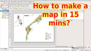
QGIS Part4 - How to create your first map in 15 mins
Просмотров 167 тыс.4 года назад
Do you need a map for your report or scientific paper? Here's my 15 minute video tutorial using QGIS. If you need the data from this tutorial, please download it using the link below. drive.google.com/drive/folders/1beNDbvvP4Od0nHRhqeWn9eFkApyr5sKm?usp=sharing

QGIS Part3 - How to import, export and customize raster data
Просмотров 22 тыс.4 года назад
Here are the basic steps on how to import and manipulate raster data in QGIS. If you need the data from this tutorial, please download it using the link below. drive.google.com/drive/folders/1beNDbvvP4Od0nHRhqeWn9eFkApyr5sKm?usp=sharing
QGIS Part1b - How to import gpx and coordinates encoded in spreadsheet
Просмотров 7 тыс.4 года назад
Here are the basic steps on how to use the Locus Map application to collect coordinates and import it in QGIS. The tutorial also shows the process on how to import coordinates encoded in spreadsheet. If you need the data from this tutorial, please download it using the link below. drive.google.com/drive/folders/1beNDbvvP4Od0nHRhqeWn9eFkApyr5sKm?usp=sharing
QGIS Part2 - How to extract, merge and clip vector data
Просмотров 35 тыс.4 года назад
Here are the basic steps on how to extract, merge and clip vector data in QGIS. If you need the data from this tutorial, you can download it using the link below. drive.google.com/drive/folders/1beNDbvvP4Od0nHRhqeWn9eFkApyr5sKm?usp=sharing
QGIS Part1a - How to import, export and view vector data
Просмотров 14 тыс.4 года назад
Here are the basic steps on how to import, export and view your vector data in QGIS. If you need the data from this tutorial, please download it using the link below. drive.google.com/drive/folders/1beNDbvvP4Od0nHRhqeWn9eFkApyr5sKm?usp=sharing
Hello Sir. Do you have a tutorial on how to make a heatmap for traffic counting?
Hello! I would like to ask where I could acquire shapefile data for the NCR region in the Philippines? The previous philgis website seems to not work anymore. Thanks so much!
Sir baka pwede makahingi ng copy ng mapa ng aurora province na with municplity and barangay salamat po. medyo mahirap gawin e hhe. thank you!
hi, thank you for creating videos po. More videos to come :) very helpful po sa mga Qgis learners :)
Sana maging madalas pag upload mo idol. Sulit lahat ng Videos mo. Thank you
More on QGIS mapping pa sana.
p̲r̲o̲m̲o̲s̲m̲ 💯
Hi ive been watching your videos for a awhile na po. Please make a video of watershed delineation and slope map, and hazard map. Thaaannkss..
Hi Apple, thanks for the suggestion! I might do a video on these topics in the near future. If you need help creating these maps, feel free to shoot an email.