
- Видео 7
- Просмотров 148 305
Quoc Dang
Великобритания
Добавлен 20 сен 2013
Custom Clipping in QGIS
Making a custom clipped or cropped selection in QGIS. Also featuring rectangle selections.
Просмотров: 31 126
Видео


QGIS to Blender GIS: Terrain model from contours
Просмотров 51 тыс.8 лет назад
How to take a contour shapefile .shp with real world elevation data and turn it into a surface model in blender. Blender GIS plug in: github.com/domlysz/BlenderGIS nd you'll need to install the georeferencer inside QGIS if you want a georeferenced texture map; QGIS - Plugins - Manage and Install Plugins. Search for 'Georeferencer GDAL' and tick that sucker
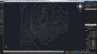
QGIS: exporting contours to DXF with height values
Просмотров 66 тыс.8 лет назад
This might be useful for anyone in who needs to go from analysis (GIS) to construction and CAD (landscape architecture, planning etc).


Grease Pencil, ideation
Просмотров 1058 лет назад
Blender grease pencil test. Didn't realise the pencil drew in 3D.

Test Video 1
Просмотров 888 лет назад
Mic test, one two one two I created this video with the RUclips Video Editor (ruclips.net/user/editor)
In case anyone is interested, the reverse process (DXF->SHP) can be done with Civil 3D using the MAPEXPORT command and specifying to the elevation attributes in the DATA tab. Greetings from Mexico.
¡Muchas gracias!
thanks
I dont get the option save as, I dont know if this is because its the new QGIS but I cant save it after that.
I have a large area of contours in a geodatabase and I am trying to only select a small portion of contours to export as DXF. Is there a way to only select contours within a particular area? So far, QGIS selects only those contours that are completely within the selection polygon. I want to select the contours that my polygon touches. Any help would be great.
Your tutorial was very helpful, I had bit of a trouble with it understanding and fixing the units
very helpful
Hi if is it the other way around like i have the DXF and i want to upload it to qgis?
sir how do we get contour text in cad from qgis
thanks
Extremely Helpful!!!!! Thanks
Great music man, chill and no effensive, really appretiate
It would be great if you could update this for 2021 now that QGIS has GRASS kinda built in. Thanks!
Thank you so much
money all day money all night ♥ Thx for the help
hey, After choosing for import vector with the Grass tool, you have to choose for a loaded layer. How do you make this layer? or Where you make this layer?
I keep getting "Finished with error". When I get to V to 3D.. and I don't get an output file??
I was struggling with this so much, finally got how to do it. Unfortunately when I click "View output" in 2D to 3D nothing happens and I'm stuck again. Anyone can help?
your USGS wrong
I keep coming back to this one, every time - two kung fu steps - blam! yes :) my brain is going
Dude, you saved me with it. Thank you very much
Why do you georeferencing and pick not directly by xyz tiles service a automatic google georeferenced image?
My Z is always 0. How to fix it?
I have the same problem. No height values when I import it into my other software. Did you find a fix?
@@svvine5803 No, i still have that problem.
Went to find GRASS in the plugins , its not listed.
hi, same problem, did you find it somehow?
same problem i cant find grass in the plugins
@@iancorrea8472 there is seperate app in the latest qgis
It helped me to download the old version 2.14
THANK YOU, this is exactly what i needed !
@Quoc Dang once I complete the "import loaded vector" command and my elevation values are gone in the new "contours_vector" layer which probably causes my QGIS to crash the 2d to 3d step.... I have tried both QGIS with GRASS 3.10 and 3.12. Both fail.... Any ideas how to fix this?
Quality commentary
I know this is an old post but were can i find tutorial from the begining to make contour lines from a specific site location and extract those curve to CAD. It is possible to extract existent building and roads from surroundings?
Thank's! But when I open the DXF in Autocad, all my curves are on Z=0 ... Do you know where it might come from?
I have the same problem. No height values when I import it into my other software. Did you find a fix?
I had that issue and figured out the fix. On the export to DXF there is Geometry options area. Expand Geometry area and change it from Automatic to Polygons, and then make sure the "Include Z-Dimension" box is checked. Worked for me.
@@robnewell9531 Whoa! That little step was the final piece of the puzzle I was looking for! Thank you for posting that!
@@robnewell9531 this solution saved the day. Thank you.
@@robnewell9531thanks for the info
Hi! what could it be the mistake if the poligon appears far away from the original shape layer? Thanks!
I installed blendergis but do not works and I cant see the option for shapefile or other gis format. I have the version 2.81a
Same
please, can you make please a tutorial on how to grab elevations from google earth /and contours from qgis/ into revit, your tutorial is very good but for me it's too complicated...PLEASE i'm trying to import elevations terrain into revit since 2 weeks everyday but revit doesn't no recognize any dwg or dxf, so please HELP me, i never seen in my life something so difficult...please sir help me or show me how to the simple way or a good way explained please, thank you
Excellent explanation!
My shapefile imports as just a meter wide but thousands of meters tall!
Can you please show how to compute volume from Google Earth into QGIS?
Yeah dropped in addons and nothing shows up
yoo Blender file isn't found
after the 2D -> 3D fanction has successfully finished i press "view output" but the layer wont appear, any ideas ?
I had the same issue
Any solutions?
BAD TEACHER
Awesome! Thank You!
Hi , I just realised i have a bit of a problem , when I go to convert 2d contour to 3d by attributes- when I look for which attribute to get the elevation data, I am only given 4 options when attribute table contains many more columns including the one i need named "elevation"
p.s. I just found out what my problem was - elevation column was classed as "string", to fix this I had to make new column and do function see this link - gis.stackexchange.com/questions/75021/convert-string-to-integer-in-qgis-tables/75032
very useful , cheers !!!!!!!
i got the dxf file out put but the contour limit size is very small in open cad.I think may it should be scaled multiple of thousands.some one could advise me?
Is this on scale? i would use it to make a racetrack for a game..
Thanks! it really helped me. I just have to add one trivial step in AutoCAD (applies to BricsCAD as well): When you export anything from QGIS (or ArcGIS) to DXF the units in DXF will be inches. This is ridiculous and the first thing in CAD is to change the units to meters. If you skip this and use the DXF file anwhere all the measures and thus also the CRS will be wrong since CAD programs think they are really inches which they never were. If you create a DXF from scratch it will be unitless and usually understood as millimeters.
this explains so much
do we change the units manually or through units tab? can you explain units a bit more please
@@moizzasaeed5132 I was speaking about drawing units. Although the AutoCAD I used was configured to ISO i.e. metric drawing units it will consider unitless DXFs having inch as drawing unit. I have not used any specific unit table.
@@moizzasaeed5132 Sorry, I misread your question. I' m not using units tab. Since I have originally learnt AutoCAD DOS version 9 in late 80's prefer commands and just enter "units" and select meters.
Nice tutorial
great tutorial, thanks! I am following all steps but when converting to 3d vectors the Column with height values field has only one option (cat) although the attribute table includes the elevation column. Any ideas?
did u find the answer ?
Thank you! I just needed a quick and simple tutorial and I was lucky enough to pick your video first. Windows version is slightly different on saving the clipped output file, but easy enough to figure out.
I'd also love it if you could show how to clip a raster (GeoPDF if possible) using a shape file in the same way...I'm having fits doing that...clipping vector with a shapefile worked perfectly.
You all probably dont give a shit but does anybody know a method to log back into an instagram account?? I stupidly forgot my account password. I would appreciate any help you can give me!
@Danny Joseph Instablaster =)
@Marc Kaden thanks so much for your reply. I found the site through google and I'm trying it out atm. Looks like it's gonna take a while so I will get back to you later when my account password hopefully is recovered.
@Marc Kaden It worked and I now got access to my account again. I am so happy! Thanks so much you really help me out !
Nice just what I was after to save me hours of reading documentation thanks goodness to youtube and people who share :")
Ok but the resolution is too low because is only a big tile from google earth (4800x2804) and when have big terrain is not good. Have the best way for bypass this step from google earth and make it from Qgis?
You are a national hero