
- Видео 16
- Просмотров 48 531
Nathan Lovin
Добавлен 27 авг 2015
Rstudio Github Quickstart Guide
This is a quickstart guide for connecting Rstudio to Github. Hopefully it will help getting you started on your journey using version control with your R projects.
Просмотров: 52
Видео


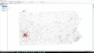
ArcGIS Districting Introduction -- Drawing Equal Population
Просмотров 2,3 тыс.6 лет назад
A quick intro to the ArcGIS Districting extension. Specifically, this looks at how to start drawing equal population districts. *NC Redistricting Data* www.dropbox.com/sh/lxez73g3ot7yb5c/AAAMsmBEfryEhUc2TcCezkgBa?dl=0

GVPT 372: Geoda Regression and Mapping Residuals
Просмотров 2,7 тыс.7 лет назад
Link to NC and FL donor data: www.dropbox.com/sh/j258itvr0avj31r/AADzt-ovA7q9iTY8iMdxtq2Va?dl=0

GVPT 392 -- Geoda Intro: Spatial Weights and LISA Cluster Maps
Просмотров 11 тыс.7 лет назад
This is a quick introduction to Geoda that should get you rolling for HW 11. Sorry the volume is so low.
GVPT 392 GIS Lab Chapter 8: Geocoding Data
Просмотров 1057 лет назад
This week, we learned about how to geocode data. This is a useful skill for getting address data attached to spatial data so we can put it all up on a map.

GVPT 392 GIS Lab Chapter 6: Geoprocessing Tools
Просмотров 2017 лет назад
Today, we learned about using the various geoprocessing tools to combine data.

GVPT 392 GIS Lab Chapter 5: Downloading and Joining Data from the Census
Просмотров 587 лет назад
Today we learned how to download maps/data from the census and join them.

GVPT 392 GIS Lab: Mean Center Intro
Просмотров 4267 лет назад
This is a quick intro to calculating the mean center of an object. Finding the directional distribution (SDE) is the exact same process.

GVPT 392 GIS Lab Chapter4: Combining Data from Different Sources
Просмотров 1137 лет назад
If you're unable to add spreadsheets to your table of contents, then you'll need to download the Microsoft Office System Drivers www.microsoft.com/en-us/download/details.aspx?id=23734
GVPT 392 GIS Lab Chapter 3: Map Layouts
Просмотров 1207 лет назад
I figured a way around the copy-paste bug we discovered in class and recorded a full lecture just now. This lab covers 3-2. 3-3-. and 3-4.
GVPT 392: LeFrak Lab Demo
Просмотров 437 лет назад
I went by LeFrak today to setup a demo for using the labs. The data is already on the lab computer under on Lab Data (L:) drive.
GVPT 392 GIS Lab Chapter 2: Introduction to the Visualization of Data with ArcMap
Просмотров 1117 лет назад
Here is the recording of today's class. We covered chapter two of the brown book.
Using ArcGIS on a Mac with VMware Fusion 8.5 (UMD GVPT 392)
Просмотров 18 тыс.7 лет назад
Windows 10 Download: goo.gl/s2Ws87 ArcGIS Download: goo.gl/syPoyG GIS Tutorial Data Download: goo.gl/byRRPk Finding VMware license code: ruclips.net/video/IFF26ZOyVy8/видео.html If you get an error when trying to authorize, follow this link: goo.gl/F81QjJ. Essentially, you need to go to the ArcGIS Student Edition webpage, create an account, and then add your authorization key to your account.
Stata Tutorial: Labeling, Recoding, and Describing our data
Просмотров 12 тыс.9 лет назад
This video covers everything you'll need for HW3, including how to call data into Stata, add labels to variables, recode variables, and create tables/graphs. 0:30 Calling data 2:12 Labeling data 6:43 Recoding variables 15:16 Recoding age example 22:14 Cross-tabs 31:10 Creating graphs
HW2 / Section Supplemental
Просмотров 1129 лет назад
This video goes over expectations for HW2 and gives examples.
How to add labels for polygons to give more context to clustering and hence making it more informative?
Dude you're Awesome!! I think you are the only one talked about this topic, many thanks 👍
Ummm... what about that fantastic wallpaper?? I came here for the tutorial, but I find myself wanting to look at the TNG wallpaper instead :)
Which textbook was used for this?
thank you~
덕분에 과제했습니다 고맙습니다
Hello Can we calculate p value from the Moran's I value?
Yes. Right click on the scatter plot, select Randomization, click on 999 Permutation. You'll get a new graph with p and z values on it. geodacenter.github.io/workbook/5a_global_auto/lab5a.html
Thankyou for the response
kindly someone helps me. how I can create a dummy variable for gender? I need urgent help .plz tell me the commands for creating dummy variables.
This is very easy
what if we don't go to Mireland?
link = expired
Can exactly arc gis work in Mac book without any trouble ???
Hello, loved your video. Very informative. One question, can this work in macbook air 2017?
i have the same question? :/
and me also i have the same question? :/
Really helpful video, thanks! Do you know where I might find districting data like this for other states (including the race/ethnicity and registered voters by party figures)? Or, if you compiled the NC_VTD shapefile data yourself, what was your process?
Sorry I'm just not getting to this -- I use a secondary email for this channel so I almost never see the alerts. A lot of states host their redistricting data online (North Carolina is particularly transparent in this case). Trying searches like "Maryland redistricting data," "Maryland VTD data," "Maryland GIS VTD shapefile," "Maryland voting precinct shapefile," etc. will sometimes result in getting the data you're looking for, but the data that are available vary widely from state to state. This is true for registration numbers -- a lot of states have this available at the precinct/VTD level, but a lot don't. If you can't find anything from the states themselves, you can always create a VTD/precinct shapefile yourself. The Census has VTD shapefiles for every state, so you can take a Census block shapefile (with demo data attached) and aggregate it up to the VTD/precinct level.* At the very least, it will contain basic demographic data for the Census (race, age, gender, etc.), but won't necessarily have the political data you're looking for. You can sometimes get the precinct level election data and merge it onto after you've aggregated up, but again the availability of this data varies. *To do this, you convert the block polygons to points using the Feature to Point tool in ArcMap and then do a spatial join with the VTD polygons. You do this to avoid any overlapping blocks and VTDs that might arise form resolution differences.
Hi Nathan, Links has expired, would you update the links, please?
This video is great, but sadly on the verge of being useless for those us without access to the data :(
Hi! Where can I get this data from?