
- Видео 45
- Просмотров 20 215
Eazy Geospatialz🌍
Нигерия
Добавлен 16 сен 2017
Channel to help you Grow Geospatially
Welcome to eazy geospatials🌍, one of the topnotch channel where you can find tactical #geospatial solutions.
I am here as one with wealth of knowledge in the industry and academic to share trending techniques to tackle major Geospatial problems of the profession with you.
If you want to explore the following application softwares among others #arcgis #autocadcivil3d #globalmapper etc. you're in the right place!
Don't cease to learn and share knowledge with us.
Join Our Whatsapp group and follow us on Facebook through the Address under the Links below to make your requests
Thank you❤️
Restore Missing Toolbars Quick fix solution in AutoCad || #autocadquickfix #cadtips
AutoCad Quick fix solution
How to restore missing toolbars menubar and others
If you're an autocad user and need to fix your missing menubar and others.
Don't worry. You can fix the problem and get your menubar and others in few steps as giving in this video tutorial.
Be sure to subscribe to this channel for more valuable tutorials on AutoCad tips, Quick fix solution and guides freely.
Join me on Social media
👥Public Facebook Group: profile.php?id=100092753202651
👷LinkedIn: www.linkedin.com/in/victor-nwosu-ab5532240?
📩Email: nwovic634@gmail.com
Other relevant tutorials below
ruclips.net/video/Lz5OE8x0FHc/видео.html
ruclips.net/video/6cLewZorVEE/видео.html
ruclips.net/video/-Fwdc9YohlE/в...
Просмотров: 64
Видео


Display Area of Parcel in Multiple Units in Autocad by Lisp || #autolisp for #areacalculation
Просмотров 325Месяц назад
In this comprehensive and easy-to-follow tutorial, I delve deep into the art of displaying #area of parcel in multiple units on AutoCad survey plans by #lisp . With this tutorial, you'll gain a thorough understanding of how to effectively utilize this feature to its fullest potential. Follow along as i explore the tool, techniques, and shortcuts to streamline your workflow, whenever you need to...

Generate Contour Map in AutoCad || Digital Terrain Model Full tutorial for beginners
Просмотров 316Месяц назад
This comprehensive tutorial on mastering #autocad , i will dive into the art of creating highly detailed #topographic #maps right from scratch. Whether you're a beginner or an experienced AutoCad user, this video is packed with valuable tips and techniques to help you excel in drafting topographic plans. Our step-by-step approach begins by familiarizing you with the basics of AutoCad and its va...

KML to SHAPEFILE || Digitizing Features like a pro #googleearth tutorial
Просмотров 208Месяц назад
In this comprehensive tutorial, we will guide you step-by-step on how to convert #kml google earth data to #shapefile ".shp" file. crucial process for accurate and precise design representation. #globalmapper is a powerful geospatial software that simplifies many GIS tasks. Learning how to convert and integrate geospatial data from one software to another enables efficient analysis and collabor...

HATCH Features in AutoCad Survey Drawings || Unlock HATCH tool || Detail like a Pro
Просмотров 3502 месяца назад
AutoCad #hatching tool is a crucial tool that allows you to visually detail features while working on your CAD designs. With our tutorial, you'll gain a thorough understanding of how to effectively utilize this tool to its fullest potential. Follow along as we explore various tools, techniques, and shortcuts to streamline your workflow. Whether you need annotate your designs, mastering the #aut...

KML to DWG autocad file by Lisp || Unlocking AutoCaD hidden features
Просмотров 1,6 тыс.2 месяца назад
In this comprehensive tutorial, we will guide you step-by-step on how to convert #kml google earth data to #dwg autocad file.crucial process for accurate and precise design representation. #autocad2021 is a powerful geospatial software that simplifies many CAD tasks, By learning how to convert and integrate geospatial data from one software to another enables efficient analysis and collaboratio...
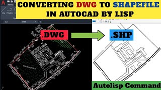
DWG to Esri SHAPEFILE in AutoCad by lisp || #autocad #autolisp
Просмотров 4502 месяца назад
In this comprehensive tutorial, we will guide you step-by-step on how to export survey drawings from autocad #dwg to #shapefile in AutoCad using #autolisp. AutoCad is a power software that simplifies many CAD tasks, including seamless integration of data from one software to another, enabling efficient analysis and collaboration with worldwide GIS professionals. Next, We will cover the necessar...

Converting Raster data to Shapefile in ArcGIS || #arcgistutorial for beginners
Просмотров 862 месяца назад
Welcome to this comprehensive guide on converting #raster to #shapefile in #arcgis In this informative video, we will explore the essential technique and strategy to seamlessly convert Raster data to Shapefile data using ArcGIS. Check out on this channel for other insightful tutorial where I will walk you through every step of the process, from understanding the fundamental concepts and princip...

How to Export Survey Data in AutoCAD Format From GNSS RTK logger || Tersus #gnssrtk tutorial
Просмотров 5962 месяца назад
The Tersus Gnss receivers data logger can efficiently export survey data directly in #autocad .dxf #dwg format for analyzing, plotting and processing in different CAD softwares. Here in this easy guide tutorial you will learn on how to export survey data directly to AutoCad for plotting without running script! Join me on Social media 👥Public Facebook Group: profile.php?id=100092753...
Dynamic Area Display on AutoCad by lisp || #autocad #autolisp
Просмотров 1,2 тыс.3 месяца назад
In this comprehensive and easy-to-follow tutorial, we delve deep into the art of mastering dynamic area display on AutoCad. Dynamic area display is a crucial feature that allows you to visually represent areas while working on your designs. With our tutorial, you'll gain a thorough understanding of how to effectively utilize this feature to its fullest potential. Follow along as we explore vari...
Georeferencing in AutoCad || AutoCAD Georeferencing for beginners
Просмотров 1543 месяца назад
Georeferencing is a type of coordinate transformation that binds a digital raster image or vector database that represents a geographic space (usually a scanned map or aerial photograph) to a spatial reference system, thus locating the digital data in the real world. This video tutorial gives a detail and informative guide to #georeferencing an imagery in #autocad easily. ruclips.net/video/igO6...
Creating Land Use Land Cover Map in ArcGIS: Complete Tutorial || #arcgistutorial
Просмотров 4893 месяца назад
Creating Land Use Land Cover Mapping in ArcGIS! In this Complete informative video, we will explore the essential techniques and strategies to accurately map and analyze land use and land cover data using ArcGIS. I will walk you through every step of the process, from understanding the fundamental concepts and principles to advanced mapping methodologies. Whether you are a beginner or experienc...
Activating Google Earth imagery in AutoCAD || Road Maps || Aerial Imagery #autocad #civil3d
Просмотров 6864 месяца назад
we will walk you through the simple process of activating #googlemaps within #autocad. By incorporating real-time map data into your AutoCAD designs, you'll gain a whole new level of accuracy and convenience. Whether you're an architect, engineer, or design enthusiast, this tutorial will provide you with invaluable insights on how to seamlessly integrate Google Maps into your AutoCAD workflow. ...
Convert DWG to KML || Transform Survey Drawings with Global Mapper localdatum to globaldatum
Просмотров 6474 месяца назад
This video tutorial displayed a crucial process for accurate and precise cartographic representation. You will know how to project survey drawings from a local datum to a global datum using globalmapper. Subscribe to this channel and turn on the notification bell for more valuable tutorial that unravels the complexities of transforming survey drawings without lisp! #cadtokml #projection #autoca...
Calculating Multiple Plots Area Automatically in AutoCAD || Mastering #autocad #civil3d
Просмотров 3794 месяца назад
Calculating Multiple Plots Area Automatically in AutoCAD || Mastering #autocad #civil3d
Automating Coordinate Display on Survey Drawings || #autocad tutorial
Просмотров 1,4 тыс.4 месяца назад
Automating Coordinate Display on Survey Drawings || #autocad tutorial
Creating Land Use Land Cover Map in ArcGIS: Comprehensive Guide || #arcgis tutorial
Просмотров 2334 месяца назад
Creating Land Use Land Cover Map in ArcGIS: Comprehensive Guide || #arcgis tutorial
Adding Grid Lines on Survey Drawings by lisp || AutoCad hidden features || #autocadgrids
Просмотров 3484 месяца назад
Adding Grid Lines on Survey Drawings by lisp || AutoCad hidden features || #autocadgrids
Creating 3D Fly-Through in Global Mapper || 3D Route Visualization || #globalmapper for beginners
Просмотров 1894 месяца назад
Creating 3D Fly-Through in Global Mapper || 3D Route Visualization || #globalmapper for beginners
NDVI using ArcGIS || Calculate and reclassifying || NDVI Complete video
Просмотров 1045 месяцев назад
NDVI using ArcGIS || Calculate and reclassifying || NDVI Complete video
Display Multiple Coordinates(XY) with Table Autolisp || #autocad #autolisp tips
Просмотров 9025 месяцев назад
Display Multiple Coordinates(XY) with Table Autolisp || #autocad #autolisp tips
Franson coordtrans v2.3 free download and install for PC || #fransoncoordtrans
Просмотров 3635 месяцев назад
Franson coordtrans v2.3 free download and install for PC || #fransoncoordtrans
Calculating NDVI using Global Mapper || #globalmapper Vs #arcgis Part1
Просмотров 2525 месяцев назад
Calculating NDVI using Global Mapper || #globalmapper Vs #arcgis Part1
Creating Path Profile From XYZ data using Global Mapper || #globalmapper for beginners
Просмотров 2965 месяцев назад
Creating Path Profile From XYZ data using Global Mapper || #globalmapper for beginners
How to Create Project on the Tersus #gnss Nuwa app || SurveyProject || Beginners guide
Просмотров 1756 месяцев назад
How to Create Project on the Tersus #gnss Nuwa app || SurveyProject || Beginners guide
How to download Landsat imagery free || Remote sensing Tutorial || Complete video
Просмотров 1686 месяцев назад
How to download Landsat imagery free || Remote sensing Tutorial || Complete video
How to Create Longitudinal Profile On AutoCAD || #autolisp #autocad #civil3d
Просмотров 5777 месяцев назад
How to Create Longitudinal Profile On AutoCAD || #autolisp #autocad #civil3d
How to import Coordinates from Excel into Tersus #gnss Data Logger || Setting Out || Complete video
Просмотров 5807 месяцев назад
How to import Coordinates from Excel into Tersus #gnss Data Logger || Setting Out || Complete video
How to Create Longitudinal Profile || #routesurvey || #autocadlongitudinalprofile
Просмотров 1,4 тыс.7 месяцев назад
How to Create Longitudinal Profile || #routesurvey || #autocadlongitudinalprofile
Extracting Multiple Coordinates from survey plans in AutoCAD || Converting notepad to Excel
Просмотров 2688 месяцев назад
Extracting Multiple Coordinates from survey plans in AutoCAD || Converting notepad to Excel
This is helpful. Buh I still find it hard to import on Autocad version of 2007. Any tips on how to do that?
Thanks for your feedback We would see on how to break the process down on 2007 and upload the video tutorial soon. Thanks
Can this work on phone?
Hi @tony Thanks for reaching out No, it can't work on mobile phones
Thank you sir Your videos are really helpful
Thanks for the feedback I'm Glad Regards!
Thanks, keep it up!
You are very good. I will like to have your contact for further training on this . thanks
Very nice. Thank you
Thanks very much, my surveyor. What an educating video. You are a blessing to young surveyors out there. Pls can you do a video on how to label / insert points ID on a layout in AutoCad, extract and arrange the coordinates in Excel. Thank you.
Thanks for the feedback For your request check out these videos below ruclips.net/video/AJ92hJ_SWKA/видео.html ruclips.net/video/3Xu57szUeKg/видео.html It will definitely be of great help Regards!
the colour not working ? yellow and after convert is white or byblock ?
Thanks for your feedback Yes,After concert it turns default color white However you can change color on AutoCad by going to"Properties" Regards!
Very helpful. Thank you!!!
You just nailed it my fellow analyst
Thank you for the feedback back I'm glad you found value surv Regards!❤️
Sir what if the intervals are not equal, how do i input
Hello there Thanks for the feedback Intervals must be equal Regards!
Can Autocad 2007 work for this too ?
Thanks for the feedback Try it out,it should work Regards!
Thank you sir for this video
hi, tnx for the lisp, but elevation grid is drawn +10 and -10 m of elevation, if we need more it goes off grid and becomes inaccurate. Can you help us again :)
Thanks for the feedback We will see to that soon
How do I change my Auto land desk to dark theme 🙏
Thanks for your feedback Go to settings to do that
That's very fast and accurate, please can this be applied in Autocad
No,it can't
Hi, thanks for the video but the points came in only as text and not as points. So I couldn't do much with them
Yes, that's ok ruclips.net/video/xqs8vPkHUCQ/видео.html Watch this above to see how to join the text as lines and point Regards!
Thank you for this explicit explanation❤ But please sir some of ur cursor pointing is not clear
@owobright3615 Thanks for your feedback Sorry about that,do well to utilize the audio instructions and follow the yellow cursor carefully We hope you get value at the end of the Tutorial Thank you ❤️
please share auto lisp command here as whatsapp link is expired thank you
@FunFrolic55 Thank you for your feedback Please check under the video description you will see the download link to lisp file there Click and download freely ❤️
Useful and understandable
Thank you ❤️
This video is so helpful… God continue to improve your knowledge
Amen Thank you my surveyor ❤️
❤
A question please, if you don't mind, first of all, your videos on arcgis is informative and easy to follow, thank you very much for that. please my question is it possible to know the percentage or amount of healthy vegetations and shrubs there is and if so can please make a video on it and same question for landuse landcover too?
Thank you for your feedback friend Yes it is possible We will work on your question and drop a video to guide you through soon
THANKYOU❤
My bro ,what about if I want to design irrigation layout ,shall I use same manner like this tutorial
Yes you can...
Usefull tutorial 🎉🎉
Please can you share this AutoCAD Lisp file on your WhatsApp group?
Thanks for the feedback Yes Ofcourse do well to make your request via the platform Don't forget to share and subscribe Thank you❤️
Pls how do I download global mapper
Thanks for your feedback Check under the channel description and join the WhatsApp Platform to make your requests Thank you❤️
"Promosm"
Thanks for the feedback back How may I be of help
Good job sir...let me try it
Thanks you're welcome ❤️
Thank you, sir.
You're welcome ❤ Do pass this solutions to others by sharing
Very solid content🤯, thanks
Thank you so much bossy!
cartel
Brother❤
Nice one
Please do drop suggestions on what our next video should be on. Thank you ❤
Nice one bro
Thank you we look forward to satisfying your quest for knowledge